(This is a guest contribution from Matt Hallas, Geospatial Practice Manager at DevPartners. Matt has spent more than a decade applying satellite data and GIS to food security, agriculture, and conservation challenges, including work with partners such as AGX and NASA Lifelines.)
Two systems are moving in opposite directions. Global development funding, once a somewhat predictable mesh supporting everything from vaccine delivery to food monitoring to local infrastructure, has contracted sharply. Meanwhile, pressure on global food systems is intensifying through climate stress, degraded soils, and erratic rainfall. Earth Observation (EO) sits at the intersection of these colliding trends, and in this environment it has become essential infrastructure: how we see what's happening when we cannot be there, how we predict what comes next, and how we hold ourselves accountable.
Global Official Development Assistance (ODA) from major donor countries fell 23.1% in 2025, the largest single-year contraction on record, driven largely by a 56.9% cut from the United States. Germany has become the largest bilateral donor for the first time in recent decades, while the UK, France, and Japan have also reduced contributions. Humanitarian assistance, the channel most directly tied to food aid, fell 35.8%. A further 5.8% decline in global ODA is projected for 2026.
USAID was officially dissolved on July 1, 2025. The organization managed over $35 billion in annual appropriations, roughly one-third of U.S. State and Foreign Operations appropriations (CRS IF10261). Funding in 2025 was substantially wound down prior to the dissolution, with 83% of its programs cancelled within months, and remaining operations were merged into the State Department following the formal closure of the agency. Among the initial casualties was FEWS NET, the Famine Early Warning Systems Network, which was suspended in January 2025.
FEWS NET is the gold standard of EO-enabled food security monitoring. For three decades it has delivered open-access, real-time analysis across Africa, Yemen, and South Asia, fusing satellite-derived rainfall, vegetation indices, crop calendars, conflict data, and ground reporting. Governments, NGOs, and the UN all rely on its monthly outlook to decide where assistance is needed. When FEWS NET went dark for five months, until its restoration in June 2025 under the State Department, the global response apparatus lost its primary early warning signal. The episode exposed a profound vulnerability: a global public good, built on decades of methodological rigor, was suddenly at risk.
Matt recently joined EarthDaily’s KC Kroll for a webinar exploring how commercial Earth Observation data can support agricultural resilience as government funding priorities shift.
As traditional donors retreat, other actors are attempting to fill pieces of the gap: philanthropic foundations, Gulf state governments, multilateral development banks, and smaller bilateral donors. Some notable commitments have emerged: the Gates Foundation announced $1.4 billion over four years for smallholder farmer climate adaptation in Sub-Saharan Africa and South Asia (Gates Foundation, COP30, November 2025), followed shortly by a $500 million, five-year strategic partnership with the Qatar Fund for Development (Gates Foundation & QFFD, December 2025).
The UN and the United States signed a $2-billion humanitarian funding agreement through OCHA in December 2025, welcome but far short of historical U.S. contributions. Some efforts show promise: new commitments to smallholder climate adaptation, public-private partnerships, AI-enabled advisory services.
But these initiatives are still new; their sustainability is unproven, and they operate at different scales than the systems they are replacing. The old system had coordination, reach, and long-term engagement in the hardest places. The emerging model is more fragmented, and funding cycles are shorter. Local institutional capacity, the foundation for sustainable food security improvements, is more precarious. Until the dust settles, uncertainty is the dominant feature of the food security funding landscape.
As funding contracts, food pressure rises. Africa is the only continent where hunger is increasing. Over 20% of Africa’s population is undernourished, and 58.9% faces moderate to severe food insecurity, more than double the global average. By 2030, the UN projects 512 million people will be chronically undernourished, with roughly 60% in Africa (SOFI 2025).
The drivers are environmental and structural. Ninety-five percent of African agriculture is rain-fed, meaning crop success depends almost entirely on rainfall timing and volume, factors increasingly unpredictable due to climate change. Across sub-Saharan Africa and South Asia, an estimated 500 million smallholder farmers depend on agriculture as their primary livelihood (IFAD, World Bank), the vast majority of them operating without insurance, irrigation, or financial reserves. When the rains fail, people go hungry. The IPCC projects African agricultural productivity could decline up to 20% by 2050 without adaptation.
The human toll is visible now. Sudan has experienced confirmed famine conditions: as of September 2025, El-Fasher and Kadugli were classified in IPC Phase 5, the worst level of acute food insecurity ever recorded by IPC in Sudan. Data from the IPC indicates that this month, May 2026, 19.5 million Sudanese (41% of the population) are projected in crisis or worse. South Sudan's situation is comparably dire: 7.8 million people (56%) face crisis or higher phases, and the number of people in the most severe Catastrophe category rose 160% from the previous estimate.
Food insecurity drives social unrest, forced migration, and conflict. When families cannot feed themselves, they move. When hope disappears, instability follows. The result is transnational: migration flows strain neighboring countries, regional tensions rise, and the global stability order is affected. Two recent cases illustrate this convergence and the critical role of EO.
When the Kakhovka Dam was destroyed in June of 2023, hundreds of thousands of hectares of irrigated cropland in southern Ukraine went dry. NASA Harvest tracked this loss in near-real time using Landsat and Planet imagery, providing documentary evidence of agricultural impact at scale across an active conflict zone where ground teams could not safely operate. The imagery made the loss visible, attributable, and quantifiable, none of which ground surveys could easily provide under occupation. Crucially, ongoing EO monitoring also helped refine early projections: the loss was severe, but satellite data showed that some areas recovered partial productivity over subsequent seasons, providing a more precise picture than initial assessments had suggested (NASA Harvest, nasaharvest.org). The imagery informed humanitarian response, damage documentation, and the evidence base for international accountability.
In 2025-2026, researchers at Yale University's Humanitarian Research Lab used high-resolution satellite imagery to document systematic attacks on agricultural communities around El-Fasher, Darfur: deliberate destruction of crop fields, irrigation systems, and settlements consistent with tactics aimed at denying food to civilian populations. With ground access impossible, satellite imagery became the only reliable way to document patterns and preserve evidence. The data makes atrocity undeniable, supporting international investigations and providing a record when ground truth cannot be directly observed.
As funding tightens and access constraints increase, EO becomes more important. It enables monitoring in conflict zones where ground teams cannot operate. It provides consistent measurement at scale: the same sensors, the same methods, comparable across continents.
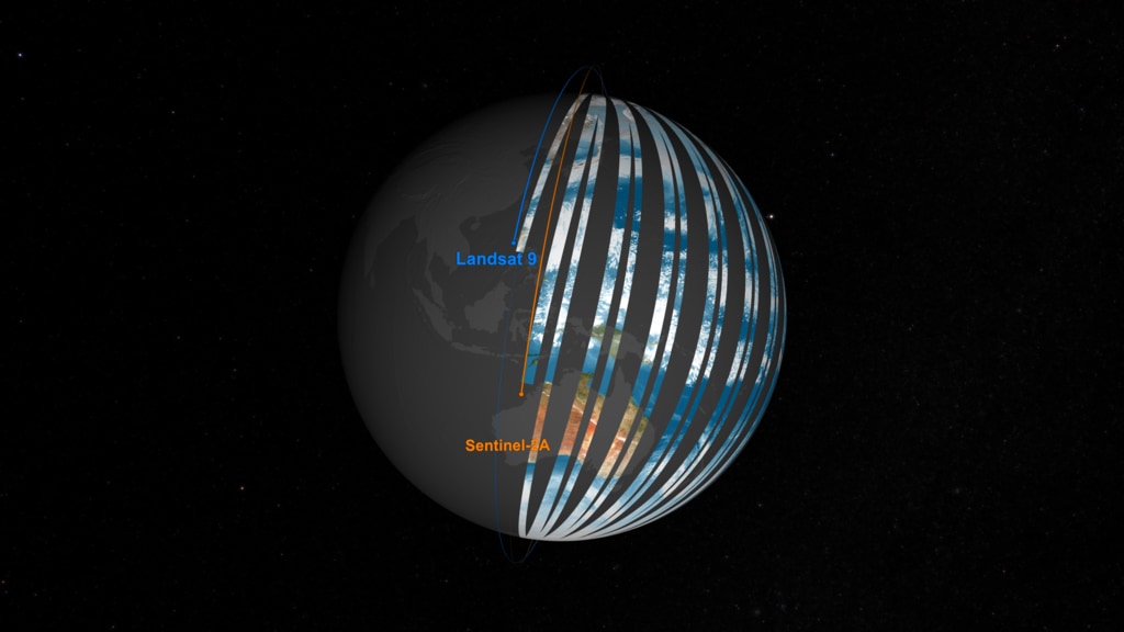
Digital Earth Africa's continental cropland map at 10-meter resolution, for instance, offers comparable data across 54 countries. EO underpins the early warning systems that determine where humanitarian assistance is needed — FEWS NET, WFP's HungerMap, IPC analyses. It enables rigorous impact attribution that increasingly skeptical funders demand.
And critically, it provides transparency: satellite imagery makes denial harder, preserves evidence, and offers communities a form of protection and voice when ground-level reporting fails. The Kakhovka destruction is visible. The El-Fasher patterns are documented. This visibility is not incidental, it is exactly what EO was designed for.
NASA's Scientific Visualization Studio.
The conversation around GeoAI has grown louder, and the promise is real: AI models trained on satellite imagery, weather data, and crop classifications can predict yields and guide adaptive management at unprecedented scale. Foundation models like Prithvi and Clay are advancing fast.
Earth Observation companies like EarthDaily are launching science-grade satellites that can match the calibration quality of federal assets including Landsat and Sentinel, but with higher resolution and revisit, enabling high-quality input data to geospatial workflows. But there is a critical gap between promise and achievement. These models need accurate, locally representative ground truth data. A yield prediction model trained on Iowa cropland will not reliably predict yields in northern Ghana. An AI system trained on commercial agriculture will not capture the complexity of smallholder farming in the Sahel.
The unsolved challenge is generating and maintaining this ground truth at the scale and locality where it is needed, and this is not a problem GeoAI can solve alone. It is a partnership problem, inseparable from a question of equity: whose data, whose interpretations, who benefits?
To meet the food security challenge at scale, we need a bigger tent. The technologies that endure are those designed collaboratively, tested locally, and owned by the communities they serve. This requires three commitments.
First, diverse voices in the room when systems are designed, not just technology vendors and Western researchers, but local agronomists, farmer organizations, and communities with lived experience of food insecurity.
Second, investment in local geospatial capacity as foundational infrastructure, not a nice-to-have. An AI model that predicts drought is only useful if the farmers in Sahel who depend on it had a seat at the design table and continue to provide the ground-level feedback that keeps it accurate and relevant over time.
Third, models grounded in locally representative data. Technology amplifies whatever assumptions are baked into it. If we want tools that serve small farmers and vulnerable populations, we have to design with them, not for them.
The future of global food security depends not just on what we can measure from space, but on who gets to help decide what we measure, how we interpret it, and what we do with the answers.
FUNDING LANDSCAPE
Congressional Research Service. "U.S. Agency for International Development (USAID): An Overview." IF10261, September 2025. https://www.congress.gov/crs-product/IF10261
OECD Development Assistance Committee. "A Historic Decline in Foreign Aid: Preliminary 2025 ODA Data." April 2026. https://www.oecd.org/en/data/insights/data-explainers/2026/04/a-historic-decline-in-foreign-aid-preliminary-2025-oda-data.html
Gates Foundation. "$1.4 Billion Climate Adaptation Commitment for Smallholder Farmers." COP30, November 2025. https://docs.gatesfoundation.org/documents/cop30_announcement_fact_sheet_2025.pdf
Gates Foundation & Qatar Fund for Development (QFFD). Strategic Partnership Announcement. December 2025. https://www.gatesfoundation.org/ideas/media-center/press-releases/2025/12/gates-foundation-qatar-milestone-global-partnership
FOOD SECURITY & NUTRITION
FAO, IFAD, UNICEF, WFP, WHO. "The State of Food Security and Nutrition in the World 2025 (SOFI 2025)." July 2025. https://www.fao.org/publications/fao-flagship-publications/the-state-of-food-security-and-nutrition-in-the-world/en
IFAD & World Bank. Smallholder farmer estimates in developing countries. Referenced in: Lowder, S.K., Skoet, J., Raney, T. "The Number, Size and Distribution of Farms, Smallholder Farms and Family Farms Worldwide." World Development, 2016. https://doi.org/10.1016/j.worlddev.2015.10.041
IPC Global Initiative. "Sudan: Acute Food Insecurity Situation, September 2025 and Projections for October 2025–May 2026." November 2025. https://www.ipcinfo.org/ipc-country-analysis/details-map/en/c/1159787/
IPC Global Initiative. "Sudan: Acute Food Insecurity Update." May 2026. As reported by Arab News, May 14, 2026. https://www.arabnews.com/node/2643600/middle-east . Official IPC report forthcoming at ipcinfo.org
IPC Global Initiative. "South Sudan: Acute Food Insecurity and Malnutrition Analysis, April–July 2026." April 28, 2026. https://www.ipcinfo.org/ipc-country-analysis/en/?country=SSD
IPCC. "Climate Change 2023: Impacts, Adaptation and Vulnerability." Contribution of Working Group II to the Sixth Assessment Report (AR6), Africa Chapter. 2023. https://www.ipcc.ch/report/ar6/wg2/
FEWS NET. "Food Security Outlook." February 2026 cycle. Famine Early Warning Systems Network. https://fews.net
EARTH OBSERVATION & CASE STUDIES
Chausse, C. et al. "The Impact of Systematic Razing of Agricultural Communities around El-Fasher: A Remote Sensing Study." Yale Humanitarian Research Lab, March 2026. https://humanitarianresearch.yale.edu/news/systematic-razing-agricultural-communities-around-el-fasher-remote-sensing-study
NASA Harvest. "Tracking Irrigation Loss in Southern Ukraine After the Kakhovka Dam Collapse." University of Maryland. https://nasaharvest.org/news/tracking-irrigation-loss-southern-ukraine-after-kakhovka-dam-collapse
Digital Earth Africa. "Continental Cropland Extent Map (10-meter resolution)." https://www.digitalearthafrica.org
NASA Scientific Visualization Studio. "Landsat with Sentinel — Global Coverage." Visualization by Kel Elkins, USRA. https://svs.gsfc.nasa.gov/4745 (Image 4 source; still frame direct download: https://svs.gsfc.nasa.gov/vis/a000000/a004700/a004745/landsat_w_sentinel_v2_ls8ls9sAsB_fade_08_60fps_4k_3240_print.jpg)