EarthDaily for Market Intelligence
We Deliver Expert-Informed Insights into Food Markets to Help You Make Better Decisions
Unlock Predictive Insights with Earth Observation and AI-Powered Analytics
Make Data-Driven Decisions with Confidence
Markets move fast, and uncertainty creates risk. We transform Earth Observation (EO) data into actionable insights, allowing businesses to anticipate trends, mitigate risks, and seize opportunities before the competition.
With predictive modeling, AI-driven analytics, and real-time data, you gain an information advantage—whether you're forecasting crop yields, optimizing procurement, or hedging against price volatility.

What Sets Us Apart?
Earth Observation Data with Unmatched Precision
Access daily, high-resolution satellite imagery combined with proprietary analytics to monitor global commodities, supply chains, and weather patterns in real time.
Predictive Modeling for Market Intelligence
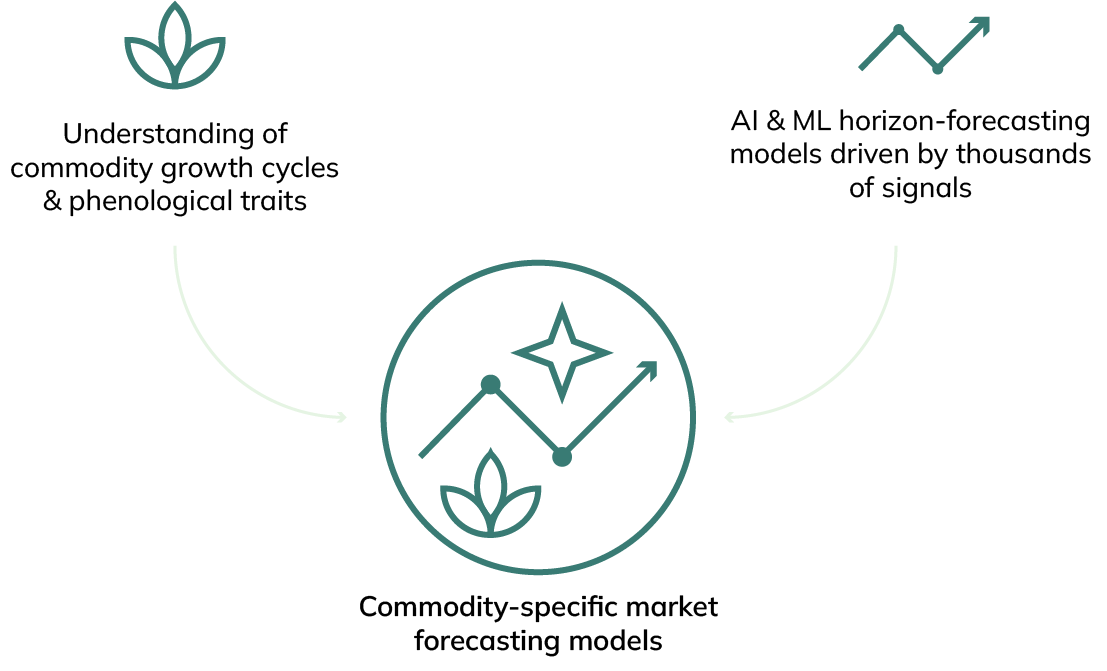
Harness advanced AI and machine learning to transform vast datasets into forward-looking market insights. Our predictive analytics model future outcomes with unmatched accuracy.
AI-Powered Market Insights
Our intelligent modeling continuously refines itself, using historical trends and current market conditions to detect patterns, predict disruptions, and enhance strategic planning.
Industry-Specific Solutions
Tailored insights for commodity traders, food and beverage companies, and procurement teams—helping optimize pricing, inventory management, and risk strategies.
Instant Access to Critical Market Signals
Leverage early-warning indicators to stay ahead of market shifts, manage supply chain risks, and capitalize on opportunities in real time.

Turn Market Volatility into Strategic Advantage
Hedgewise: Precision Risk Management with Predictive Intelligence
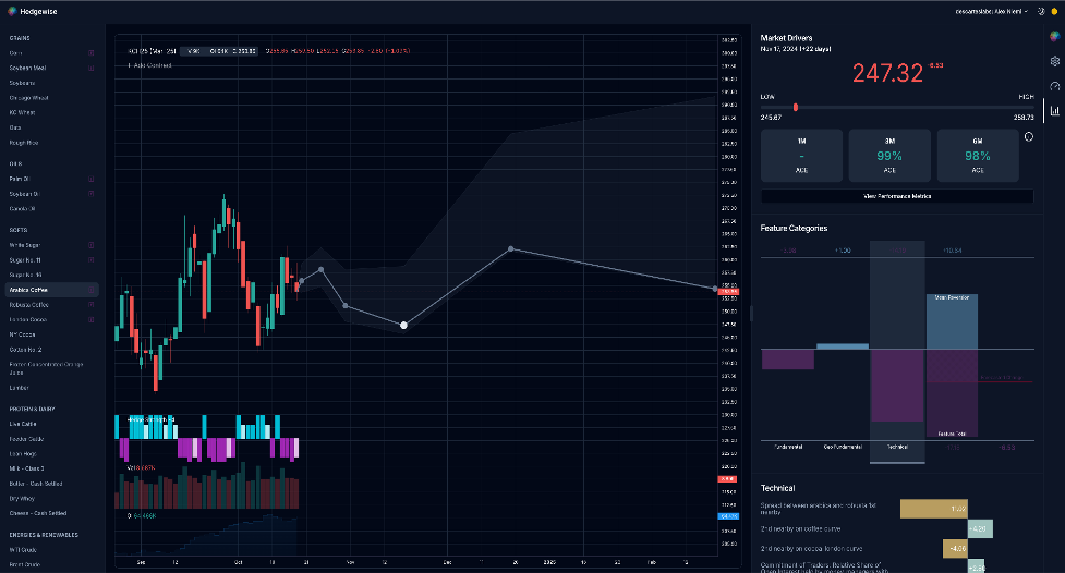
Hedgewise is an advanced risk management platform, designed for procurement teams. By integrating Earth Observation data, predictive analytics, and economic modeling, Hedgewise helps businesses reduce exposure and optimize hedging strategies.
Ready to Elevate Your Market Intelligence?
See Predictive Market Intelligence in Action
Why Choose Hedgewise
- Predictive Analytics that Enable your Hedging Strategy – AI-powered forecasting enables you to hedge with confidence and reduce price exposure.
- Comprehensive Commodity Intelligence – Evaluate historical trends, forward-looking projections, and dynamic market data for precise decision-making.
- Real-Time Risk Assessment – Continuously updated data ensures you always have the latest insights all in one place.
- Data-Driven Insights into Market Drivers – Understand future supply and demand shifts before they impact pricing.
- Seamless Integration – Connect Hedgewise directly into your existing risk management and procurement workflows.
Hedgewise empowers businesses to move from reactive risk management to proactive decision-making, ensuring resilience in unpredictable markets.

- Forecast price fluctuations with AI-driven market intelligence
- Reduce volatility risks with satellite-powered predictive models
- Gain early insight into crop yields and supply chain disruptions
- Secure reliable sourcing with real-time supply chain visibility
- Monitor sustainability and environmental impact using Earth Observation data
- Optimize procurement with predictive demand planning and risk assessments
- Strengthen supplier negotiations with data-backed market forecasts
- Reduce operational risks with continuous monitoring and early warnings
- Improve ESG compliance with verified, satellite-based insights
EarthDaily Constellation: Data Layers to Enhance Predictive Modeling
The upcoming EarthDaily Constellation will enhance our current offerings for our customers. Specifically, spectral bands aimed at information regarding vegetative health and monitoring will give us unprecedented insights into agriculture commodity supply and supply risk.


Transform Your Market Strategy with Predictive Intelligence
Data-driven decisions drive profitability and reduce risk with Hedgewise— delivering the intelligence you need to stay ahead.