EarthDaily Constellation
EarthDaily Constellation Data: AI-Ready for Unmatched Insights
The Next Era of Earth Observation
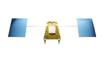
With 10 satellites capturing daily, scientific-grade imagery, this data is optimized for advanced analytics, machine learning, and AI applications—making it a critical resource for industries that demand real-time insights and predictive capabilities.
Science-Quality Data, AI-Ready Data
Our data is pre-processed, standardized, and structured to feed directly into machine learning models and automated analytics workflows. Traditional Earth Observation data requires significant manual intervention—EarthDaily eliminates that bottleneck by providing Analysis Ready Data (ARD), which is optimized for immediate use in AI pipelines.
Key Features
- Pre-Processed for Immediate Use: No need for complex normalization or calibration.
- Consistent Daily Imaging: Ensures uniformity in data over time, crucial for training reliable AI models.
- High Spectral and Spatial Resolution: 22 spectral bands and 5-meter resolution enhance model accuracy across a wide range of applications.
- Low Latency: Receive data within hours of collection, supporting near real-time decision-making.
Why Choose EarthDaily Data?
Consistency
Daily, consistent data acquisition, at the same time and from thesame angle, unblocks programmatic analysis, predictive Al, and event triggers, delivering timely data at scale.
Accuracy
Market-leading signal-to-noise ratios, global artifact-free mosaicking, and advanced cloud-masking provide precise data, powering more accurate Al-driven decisions.
Completeness
Our spectral diversity and global coverage enables coincident monitoring of a broad range of parameters and regions for a comprehensive and cohesive solution.
Interoperability
Low latency, compatibility with well-known missions, and standardized formats streamlines integration and adoption, letting your team solve business challenges faster.
Pioneer Program
Unlock AI-Ready Earth Observation Data
Early Evaluation Access to EarthDaily’s Next-Generation, AI-Ready Imagery.
Be among the first to tap into EarthDaily’s Constellation AI-Ready data -
Empower your software, tools and applications with unparalleled insights .
Spectral Bands for AI-Driven Use Cases
Comprehensive Spectral Diversity for AI Applications
EarthDaily Constellation’s 22-band spectral range provides a rich dataset for AI-driven analytics. From visible and near-infrared to shortwave and thermal infrared, this data enables deep analysis across multiple dimensions.
Visible Spectrum (RGB)
Urban change detection, vegetation cover analysis.
Near-Infrared (NIR)
Plant health, water body analysis, soil moisture monitoring.
Shortwave Infrared (SWIR)
Snow and ice detection, soil characterization.
Thermal Infrared (TIR)
Surface temperature analysis, wildfire detection, methane monitoring.
EarthDaily's Constellation Data Products
From Satellite to Strategy: Scalable, Smart EO Data
EarthDaily delivers a suite of high-performance Earth Observation products designed to meet the demands of today’s most advanced users—from scientists and data teams to industry operators and mission-critical decision-makers. Whether you're building custom algorithms, scaling AI models, or driving real-time operational insight, our data products give you the precision, speed, and control to act with confidence.
AI-Ready EO Data for Scalable Analytics
Daily Clarity for a Changing World
Clarity at Sea, Insight at Scale
Raw Precision for Research and Innovation
AiRD
AI-Ready EO Data for Scalable Analytics
Atlas
Daily Clarity for a Changing World
Maritime
Clarity at Sea, Insight at Scale
Science
Raw Precision for Research and Innovation
Capabilities
Core Vegetation
Monitor vegetation status (vigor, phenology, diseases), yield potential and productivity of crops, detect the changes
Advanced Vegetation
Monitor events such as flowering and diseases detection. Improved biophysical variables monitoring.
Soil Content
Soil composition and health. Monitor carbon content and soil degradation. Help making decisions around soil management practices.
Atmosphere
Enhance data quality and usability by correcting atmosphere effects, water vapor, aerosol, cloud haze. Ensuring actionable and measurable insights.
Water
Monitor plants water stress and availability of water resources. Help manage irrigations strategies when combined with weather information.
Spectral Bands
Visible
Near Infrared
Shortwave Infrared
Thermal Infrared
Highlights

High-Quality Data Without the Noise
The EarthDaily Constellation will provide a continuous stream of science-quality, analytics-ready data that has been processed by the EarthPipeline Ground Segment-As-a-Service to remove noise and tailored to meet the specific needs of customer APIs.

Daily Global Coverage
The EarthDaily Constellation’s fleet of satellites will enable coverage of nearly 100% of the world’s landmasses and maritime regions, collected at the same time every day, from the same angle. No tasking needed, empowering both historical analysis and forward-looking predictive modeling.

Ever-Expanding Historical Archive
Effective change detection requires not just the most up-to-date information, but the ability to discern change relative to an earlier point in time. EarthDaily Analytics is building a data-robust, ever-expanding historical archive with the potential to revolutionize humanity’s collective understanding of our planet in the present, the past, and the future.
The EarthDaily Constellation Powers AI and Machine Learning
The EarthDaily Constellation data is more than just imagery—it’s the foundation for scalable, AI-powered solutions. By delivering Analysis Ready Data (ARD) optimized for integration into AI pipelines, EarthDaily makes it easy for organizations to build advanced models, automate insights, and scale decision-making processes.
Improving Model Accuracy
with High-Quality Inputs
AI models rely on clean, consistent data. EarthDaily Constellation’s scientific-grade data—free from mosaicking artifacts and with superior signal-to-noise ratios—enhances the accuracy and reliability of AI-driven predictions.

Early detection of plant stress using spectral analysis and predictive AI models.

Continuous thermal monitoring feeds real-time wildfire tracking systems.
Event-Based Triggers
for Near Real-Time Alerts
The Constellation enables the development of automated event detection, to alert when changes occur in key metrics like temperature, vegetation health, or methane levels. These triggers improve response times and reduce operational risks.

Detect structural changes, new construction, or damage in urban environments.

Track illegal deforestation or changes in protected areas to comply with regulations.
Seamless Integration into ML Pipelines
EarthDaily data is designed for cloud-native, API-first integration, making it easy to scale analytics workflows. With compatibility across platforms like AWS and popular data science tools, organizations can develop custom AI solutions without the usual friction of Earth Observation data preprocessing.

Transform Your Analytics with AI-Ready Data
The future of Earth Observation is here. Prepare for the 2025 launch of EarthDaily Constellation
and unlock the power of AI-driven insights with high-quality, consistent data at scale.
Contact us today to learn how EarthDaily can transform your operations with AI-ready data and advanced analytics.

