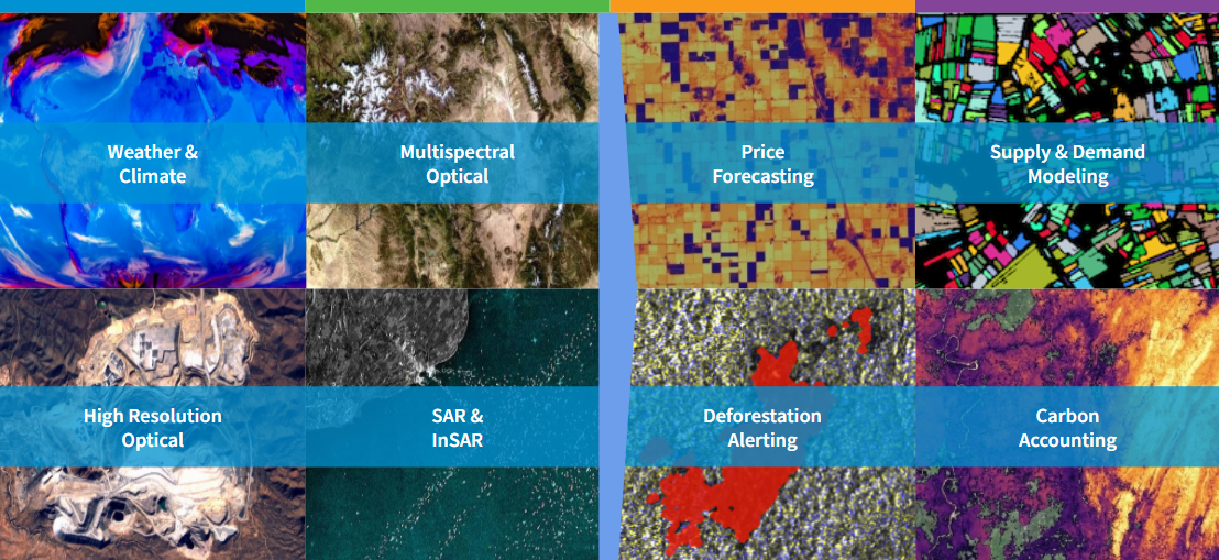
EarthDaily is proud to announce our release of two open datasets covering aboveground biomass (AGBD), tree height (CH) and cover (CC) for forests globally, as well as a derived forest mask. The benchmark global datasets (2023) are freely available alongside our recent paper in Remote Sensing and marks the most recently updated and most accurate data openly available.
Forests of the world store up to 500 petagrams (Pg) of carbon in their aboveground biomass, acting as a major carbon sink and playing a vital role in the stability of global ecosystems. Regular measurement of carbon is critical for scientific research and the development of carbon markets but has been largely limited to small scale projects with irregular updates due to a lack of ground-based assessments. Our recent work aims to address gaps and provide a framework for globally-consistently but locally tuned carbon monitoring.
View data sample

Figure 1: Global maps of aboveground biomass, canopy height and cover in a composite view.
Our approach
The modeling approach unifies the prediction of aboveground biomass (AGBD), canopy height (CH), canopy cover (CC), and their respective uncertainties into a single model. The model is trained on over one million globally distributed training samples consisting of 14 million image scenes from Sentinel-1 and Sentinel-2 and 67 million individual LiDAR ground truth points from the Global Ecosystem Dynamics Investigation (GEDI) instrument.
Despite the global coverage and billions of point measurements by the GEDI instrument, only a small fraction of the land surface has been scanned by LiDAR at high (<= 10 m) resolution, offering estimates for the vertical profiles of trees. It is therefore vital to develop models which can fill in the gap through additional data sources, such as remote sensing imagery, while learning from the many point measurements provided by GEDI.
Our approach consists of fusing multiple data sources such as Sentinel-1, Sentinel-2, Digital Elevation Model (DEM) from the Shuttle Radar Topography Mission (SRTM) and geographic location for a complimentary and rich set of input information. We built a custom AI model which processes the stack of input imagery and generates continuous maps of AGBD, CH and CC. It is trained on millions of globally distributed samples and ground truth gathered from the GEDI Level-2A/B as well as Level-4 dataset using a weakly supervised approach. Our model is globally deployable and able to estimate all three prediction variables at once. Due to the inherent uncertainty of the GEDI ground truth, our model also estimates the standard error for each of the variables. This is a critical improvement and necessary to enable downstream uncertainty quantification for carbon monitoring applications.
How accurate is our model?
On top of training the model on vast amounts of data covering diverse ecosystems, we also conducted extensive performance evaluations on a held-out test dataset (see Figure 2) as well as third-party datasets providing on-the-ground measurements. We achieve a mean absolute error (MAE) of 26.1 Mg/ha (3.7 m, 9.9%) for AGBD (CH, CC), significantly outperforming previously published state-of-the-art approaches.

Figure 2: Model performance against a held-out test dataset for AGBD (left), CH (middle) and CH (right) demonstrating a new state-of-the-art results.
The practicality of the model is demonstrated by validating its predictions against data samples collected with high precision and/or on the ground, offering an independent data source. The model shows reasonable agreement with these third-party datasets across a wide range of AGBD and CH values. Because local measurements involve extensive human labor and are not readily available at scale in the public domain, this approach is used to generate consistent, global-scale estimates of forest carbon, which can fill gaps where local solutions are not available, serve as a tip-and-cue mechanism to prioritize ground studies, and facilitate comparative studies where consistent methodology is required. In addition, we demonstrate the feasibility of fine-tuning the model on local conditions due to its multi-head architecture allowing the prediction of relative height (RH) metrics required by local allometric equations.
Open data access
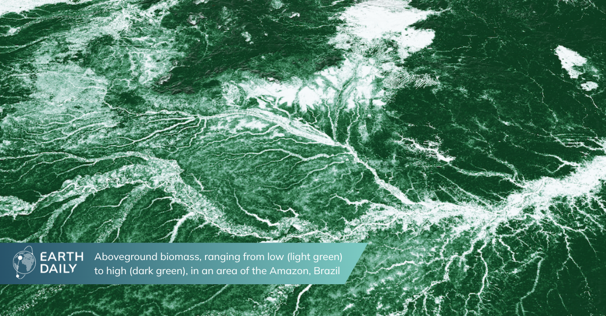
EarthDaily is committed to providing intelligence and insight that help mitigating the impacts of climate change and believe that it is of utmost importance to give open access to the datasets generated as output of our model to the academic and research community. We hope to contribute critical data to the community to push ongoing efforts. We therefore released the global maps of AGBD, CH and CC for the year 2023 at 10 m resolution, amounting to a total of 5 TB of data, and can be accessed through the Zenodo repository.
In Figure 3 we provide a few samples of the models output at different locations around the world. They cover a range of ecosystems, and the model can accurately estimate a wide range of values of AGBD, CH and CC. Even in challenging environments where the optical input composite is imperfect due to cloud remnants, the model performs well due to the fusion of multiple input sources.


The open data can be integrated into any geospatial analysis platform which supports GeoTIFF format. The animation below shows the dataset within the EarthDaily platform. It demonstrates the spatial extent as well as the high resolution and quality of maps available globally even in challenging areas where cloud coverage is high.
Figure 4: Our global datasets are accessible through the EarthDaily platform as demonstrated in this animation
Applications
Given the versatile capabilities of the model, a variety of use cases are imaginable which use one or a combination of multiple output channels. While traditional approaches often rely on task specific models, our unified approach provides common variables often used in these sub-tasks. Below we illustrate two use cases which make use of this capability.
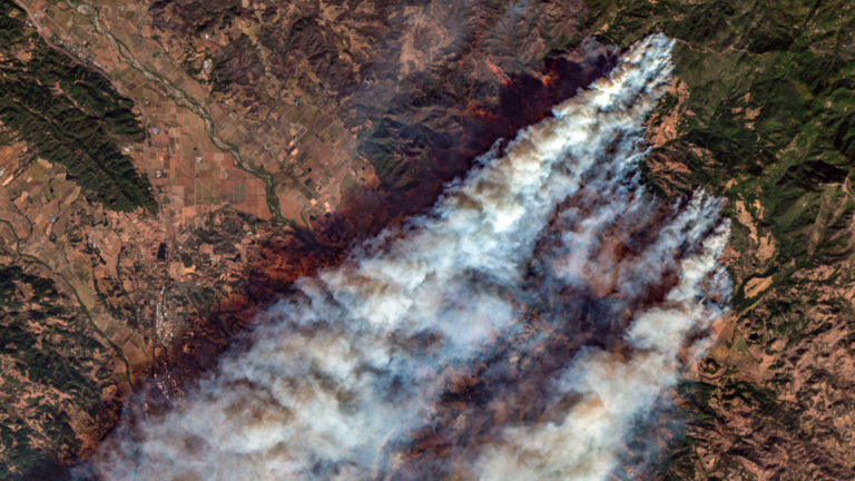
Carbon loss
Our model can be used for forest classification (CH and CC variables), deforestation detection (change in forest class), and association with carbon loss (AGBD variable). Here we ran a simple analysis measuring AGBD every year from 2017 to 2024 over an area that was affected by the 2021 Bootleg Fire in Oregon. The images below show the area before the fire (2020) as well as after the fires in 2022 during the summer. The impact of the fires is clearly visible in the loss of vegetation. From our model's aboveground biomass estimates in each year within the highlighted polygon, we measure a drop from 2.6 Mt (averaged from 2017 to 2020) to 0.87 Mt (averaged from 2022 to 2024) corresponding to a loss of 1.73 Mt of biomass or 0.81 Mt of Carbon as illustrated in Figure 5.

Figure 5: Tracking changes in biomass due to forest loss events illustrated by the 2021 Bootleg Fire in Oregon.
Global forest mask
While the exact conditions for classifying forest may vary regionally, at global scale a widely used definition relies on canopy height and canopy cover both of which our model is capable of predicting. This enables us to generate global forest masks from the model outputs based on the condition
forest = [(CH – CH_sd) > 5m] & [(CC – CC_sd) > 10%]
as illustrated in Figure 6.

Figure 6: Illustration of deriving the forest mask layer from the models estimate of CH, CC and their uncertainties.
We subtract one standard deviation from the source variables as estimated by our model in order to compensate for a slight over-estimation at low values of CH and CC, resulting in a more conservative classification of forest. We used the global model deployment to generate a forest mask for 2023 and made the data publicly available on Zenodo. Figure 7 shows a down-sampled version of this dataset. We also provide an interactive visualization of the dataset.

Figure 7: Global forest mask derived from the models outputs for the year 2023.
The ability to create updated forest masks at global scale is important to accurately track deforestation at high temporal resolution, and our model adds a crucial aspect to fulfilling this challenging task.
Explore Further
Our deep learning model can estimate aboveground biomass, canopy height, canopy cover and their respective uncertainties all at once anywhere on earth which makes deployment at scale very efficient and opens the door to numerous applications for the environmental sciences.
We have made two global datasets at 10m resolution for the year 2023 available through public repositories for research and academic use under the Creative Commons Attribution Non Commercial 4.0 International license. Advanced users can also explore the data alongside other open datasets on the EarthPlatform by creating a free account. If you are a commercial business or want to utilize the Earth Daily platform and API for convenient access to the data layers and custom model deployments, please contact us.
Paper: Read it here
Biomass, canopy height and cover dataset: Download | View data samples
Forest mask dataset: Download | View data samples