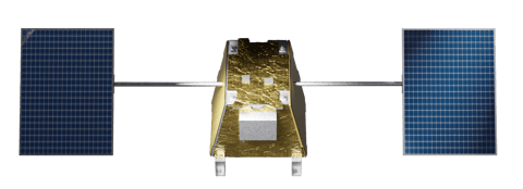
EarthDaily Constellation
EarthDaily Constellation: Daily Global Insights at Scale
Revolutionizing Earth Observation with Advanced Analytics
The EarthDaily Constellation isn't just a fleet of satellites—it's a powerful analytics engine. Our daily, high-quality data feeds directly into EarthDaily's platform, delivering actionable insights faster than ever before.
Using advanced machine learning and AI, we transform scientific-grade imagery into valuable intelligence for a wide range of industries.
How Constellation Data Supercharges Analytics
Enhanced Predictive Modeling
Daily, standardized data feeds reduce noise and improve accuracy in predictive AI models. Use this data to forecast agricultural yields, detect methane emissions, and assess environmental risks with confidence.
Faster Response with Event Alerts
The combination of daily data and AI-driven event detection allows users to monitor and respond to real-world events, such as natural disasters or crop stress, within hours.
Seamless, Scalable Integration
With cloud-native APIs and plug-and-play compatibility, integrating EarthDaily data into existing systems has never been easier. This supports large-scale ML pipelines and real-time analytics without bottlenecks.
Robust Change Detection
Monitor changes in infrastructure, natural resources, and environmental conditions with unparalleled accuracy, allowing for early intervention and better resource planning.
From Images to Insights: The Power of an End-to-End Geospatial Management System
EarthDaily’s full spectrum geospatial solution provides customers with a complete geospatial system: from normalized, science-ready data, through to robust processing and data engineering capabilities, all the way to downstream, industry-curated analytics.
At our core is the powerful data from the EarthDaily Constellation, which will feed into our downstream products to arm our customers with better insights, providing them with a real competitive advantage. The Constellation’s imaging capabilities span across a wide spectral range, beyond that of any currently available commercial offering, calibrated to serve the specific needs of customers across diverse business verticals and EO applications.
Our Earth Observation & Engineering Tools
EarthPipeline
Transform downlinked satellite imagery into analysis-ready data.
EarthPlatform
Access and integrate EarthDaily Constellation data.
EarthMosaics
Cloud-free, temporally coherent mosaics to power analysis.
EarthOne
Powerfully engineered enterprise-grade geoprocessing platform.
Discover the Real-World Impact of Downstream Analytics
Downstream analytics provide industry with vertical-specific applications to help them break through the noise and rapidly derive valuable intelligence from EO data. Learn more about the industries our data and analytics serve:

Preparing for the Future
The EarthDaily Constellation is the foundation of the future of geospatial analytics. By providing consistent, high-quality data every day, it enables users to transcend traditional Earth Observation and fully leverage the power of data-driven insights.
As we approach the 2025 launch, prepare to enhance your analytics workflows with EarthDaily’s comprehensive, scalable data and tools—making the complex simple and the unseen visible.
Contact us today to learn how EarthDaily can transform your operations with data-driven insights.