Crop ID Know What's Growing—Months Before Anyone Else
Crop ID delivers AI-powered crop classification at national scale, identifying what's planted and where during the active growing season. Move from reactive market intelligence to proactive decision-making—with crop maps delivered 6–12 months before official government releases.
The Complete Crop Classification
Purpose-built for agricultural intelligence, Crop ID provides commodity traders, AgTech platforms, insurers, and food corporates with accurate, timely crop maps that reveal planting patterns while the season unfolds. No field surveys required—satellite-powered intelligence at continental scale.
In-Season Intelligence, Not Post-Harvest Reports Traditional crop data arrives months after harvest, when market opportunities have passed. Crop ID delivers classification during the growing season, enabling proactive sourcing decisions, early supply signals, and competitive positioning while others wait for official statistics.
AI-Driven Classification at Scale Advanced machine learning models combine optical and SAR satellite imagery with weather data to accurately classify crops across millions of hectares. Our models achieve industry-leading accuracy for major row crops in each covered region.
Built on 35+ Years of Agricultural Expertise Developed by EarthDaily, with over three decades of experience in satellite-based agricultural analytics, Crop ID leverages proven methodologies refined across 50+ countries to deliver reliable crop intelligence you can act on with confidence.
Why Choose Crop ID for Crop Intelligence
Receive crop classification maps 6–12 months before government agricultural agencies publish their statistics. Act on planting shifts, acreage changes, and supply signals while competitors rely on lagging reports.
National-Scale Coverage:
Monitor entire agricultural regions—not just sample areas. Crop ID delivers wall-to-wall classification across key growing regions in the United States, Brazil, France, and Germany.
Cost-Efficient at Scale:
Eliminate expensive field surveys, manual sampling, and ground-truth collection programs. Achieve comprehensive crop visibility at a fraction of traditional intelligence-gathering costs.
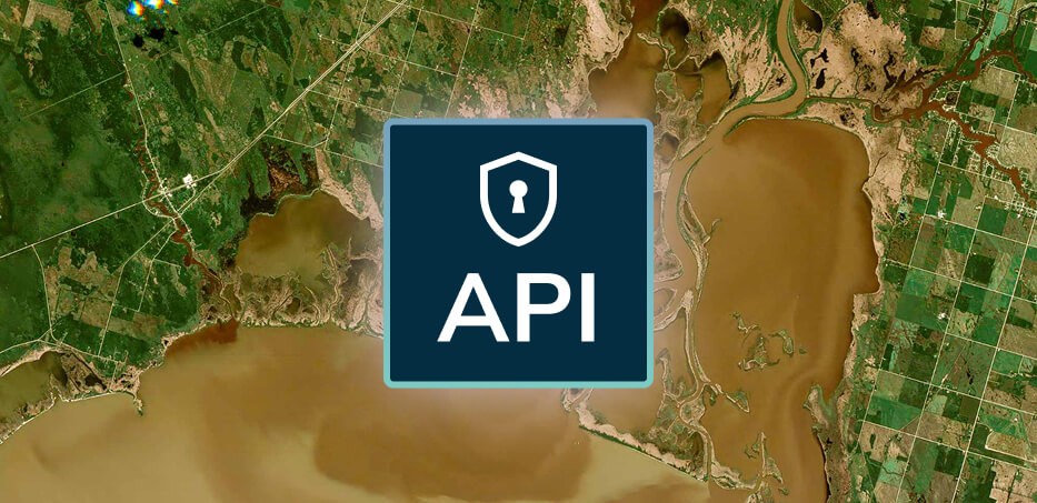
Seamless API Integration:
Access crop masks and field-level classification through STAC-compliant APIs designed for enterprise workflows. Integrate directly into trading systems, agronomic platforms, and risk models.
Crop ID's classification engine combines multi-source satellite data with sophisticated machine learning to deliver accurate crop identification throughout the growing season.
Validated Against Ground Truth Models are calibrated and validated using authoritative reference data including USDA Cropland Data Layer, European CAP declarations, and regional agricultural statistics.
Weather-Informed Models Crop development patterns vary with growing conditions. Our models incorporate weather data to account for regional variations in planting dates, growth rates, and phenological timing.
Temporal Pattern Recognition Advanced algorithms analyze crop growth curves across the season, distinguishing crops by their unique spectral and temporal signatures as they progress through growth stages.
Continuous Model Updates Classification maps are updated throughout the growing season as additional satellite observations become available, improving accuracy and capturing late-season changes.
Multi-Sensor Data Fusion Optical imagery from Sentinel-2 and Landsat captures spectral signatures, while SAR data provides weather-independent observations. This fusion ensures reliable classification even in persistently cloudy regions.
Seamless Integration with Your Workflows
STAC-Compliant Crop Masks: Query spatially and temporally indexed crop layers through standardized STAC APIs, delivering GeoTIFF outputs ready for GIS analysis
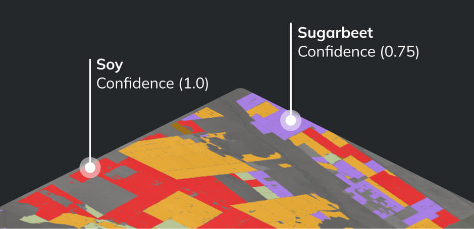
Field-Level API: Retrieve crop type predictions for specific field geometries, enabling precise integration with field-based systems
Crop Rotation History: Access multi-year classification data to analyze planting patterns, rotation practices, and year-over-year changes
Automated Field Boundaries: Combine Crop ID with EarthDaily's automated field boundary detection for complete field intelligence
Cloud-Native Delivery: Stream crop classification data directly into analytics pipelines without download bottlenecks
Coverage & Availability
Regional Coverage
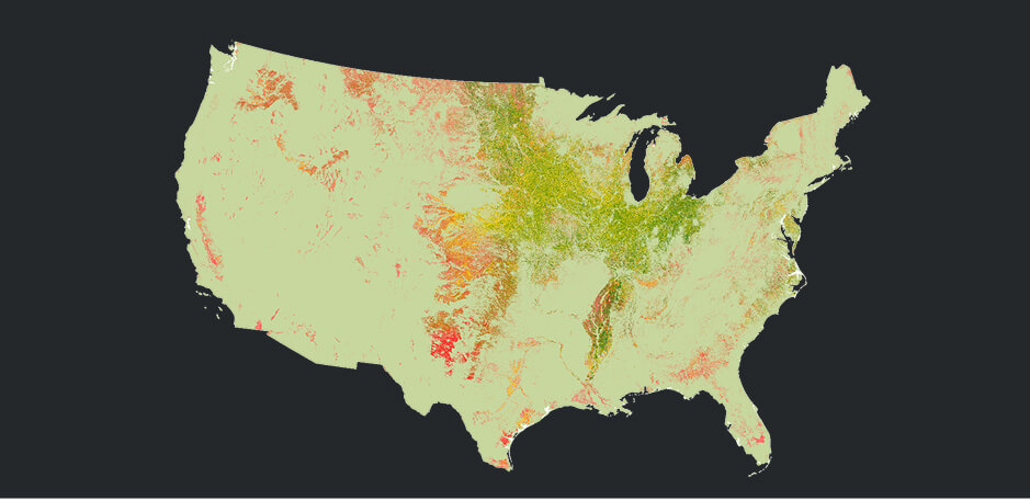
United States
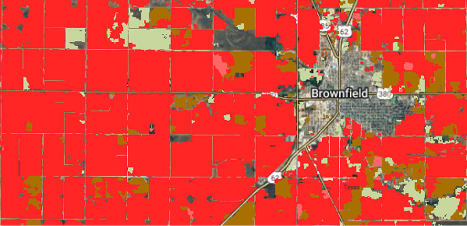
Coverage Area: Major agricultural regions including the Corn Belt, Great Plains, and Cotton Belt
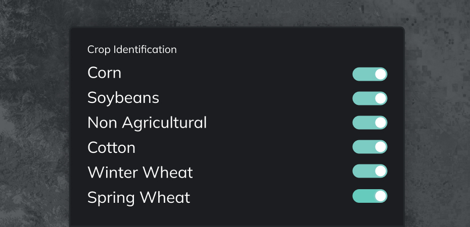
Key Crops: Corn, Soybean, Wheat, Cotton
Growing Season: Spring planting through fall harvest
Crop ID achieves industry-leading accuracy for major row crops in each covered region. Our models are validated against authoritative reference data and deliver F1-scores that meet or exceed published academic benchmarks for satellite-based crop classification. Accuracy varies by crop and region—contact us for detailed performance metrics for your specific use case.
When are crop maps available during the season?
Classification maps are generated and updated throughout the growing season as satellite observations accumulate. Initial maps become available early in the season and improve in accuracy as the crop canopy develops. This enables actionable intelligence 6–12 months before official government agencies release their statistics.
What's the difference between crop mask layers and field-level API?
Crop mask layers (via STAC API) provide wall-to-wall raster classification across entire regions—ideal for broad market analysis and supply estimation. The field-level API returns crop type for specific field geometries you provide—ideal for portfolio management, compliance verification, and field-specific applications.
Can I access historical crop data for rotation analysis?
Yes. Crop ID provides multi-year classification archives enabling crop rotation analysis, historical trend assessment, and year-over-year change detection. The /cropmasks/years endpoint specifically supports querying which years a particular crop was present in a given field.
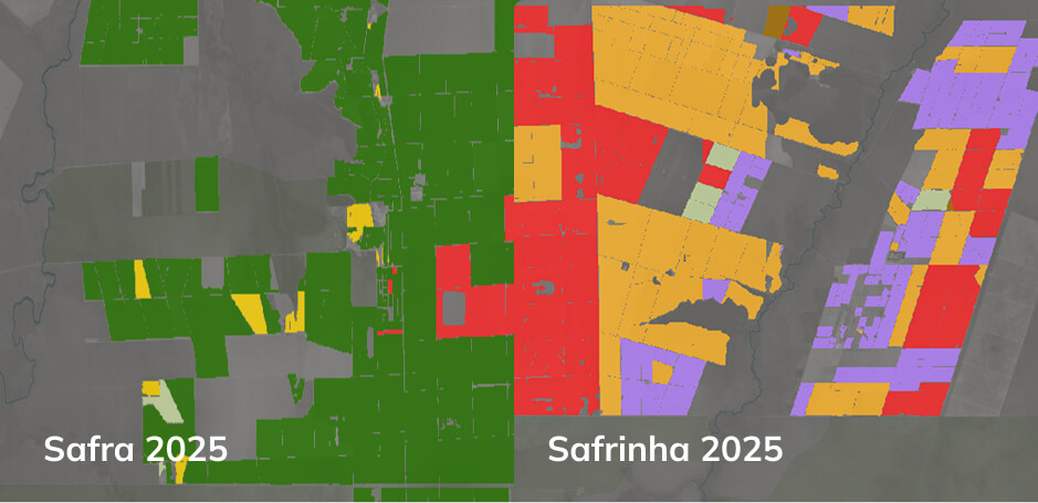
How does Crop ID handle double-cropping regions?
In regions with multiple growing seasons (such as Brazil's safrinha corn), Crop ID tracks both first and second season crops separately. This enables accurate monitoring of double-cropping systems common in tropical and subtropical agriculture.
What public datasets are included?
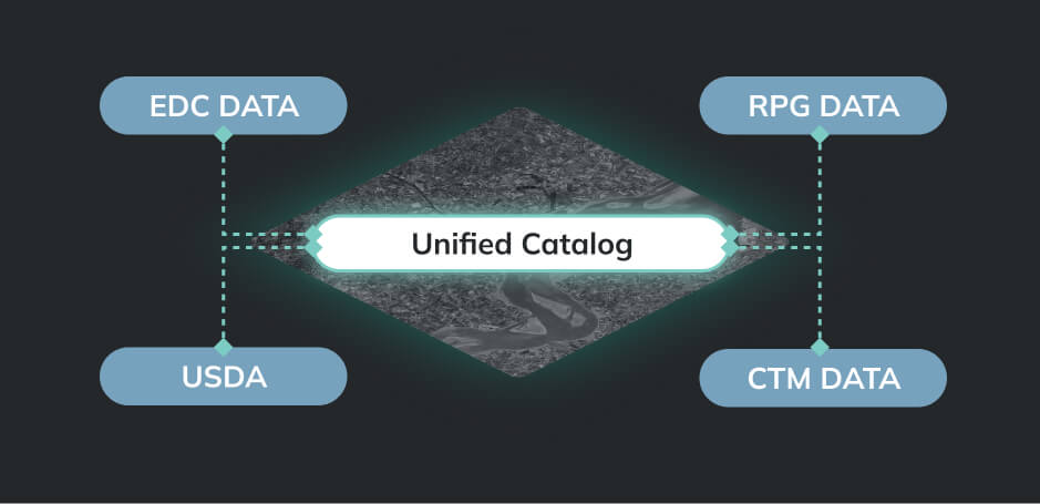
The Crop ID catalog integrates EarthDaily's proprietary in-season classifications with referenced public datasets including USDA Cropland Data Layer (CDL), French Registre Parcellaire Graphique (RPG), and German Crop Type Map (CTM). This unified access simplifies historical analysis and validation workflows.
How do I get started with Crop ID?
Contact EarthDaily Agro to schedule a demo and discuss your specific requirements. Sample data is available to evaluate classification quality for your regions of interest. API access includes interactive Swagger documentation for rapid integration.
Can additional countries or crops be added?
Yes. While Crop ID currently covers the US, Brazil, France, and Germany, additional regions and crops can be supported based on customer requirements. Contact us to discuss your expansion needs.
How is Crop ID priced?
Crop ID is available through flexible subscription models based on geographic coverage, delivery method, and access requirements. Contact EarthDaily Agro for pricing tailored to your use case.
Experience In-Season Crop Intelligence
Transform your agricultural intelligence with crop classification that arrives months before official statistics. Discover how Crop ID delivers competitive advantage:
Schedule a demo to see Crop ID integrated with your workflows
Review API documentation via interactive Swagger interface
Discuss coverage expansion for your priority regions and crops
Ready to know what's growing before anyone else? Contact EarthDaily to access in-season crop classification that transforms how you monitor, analyze, and act on agricultural markets.