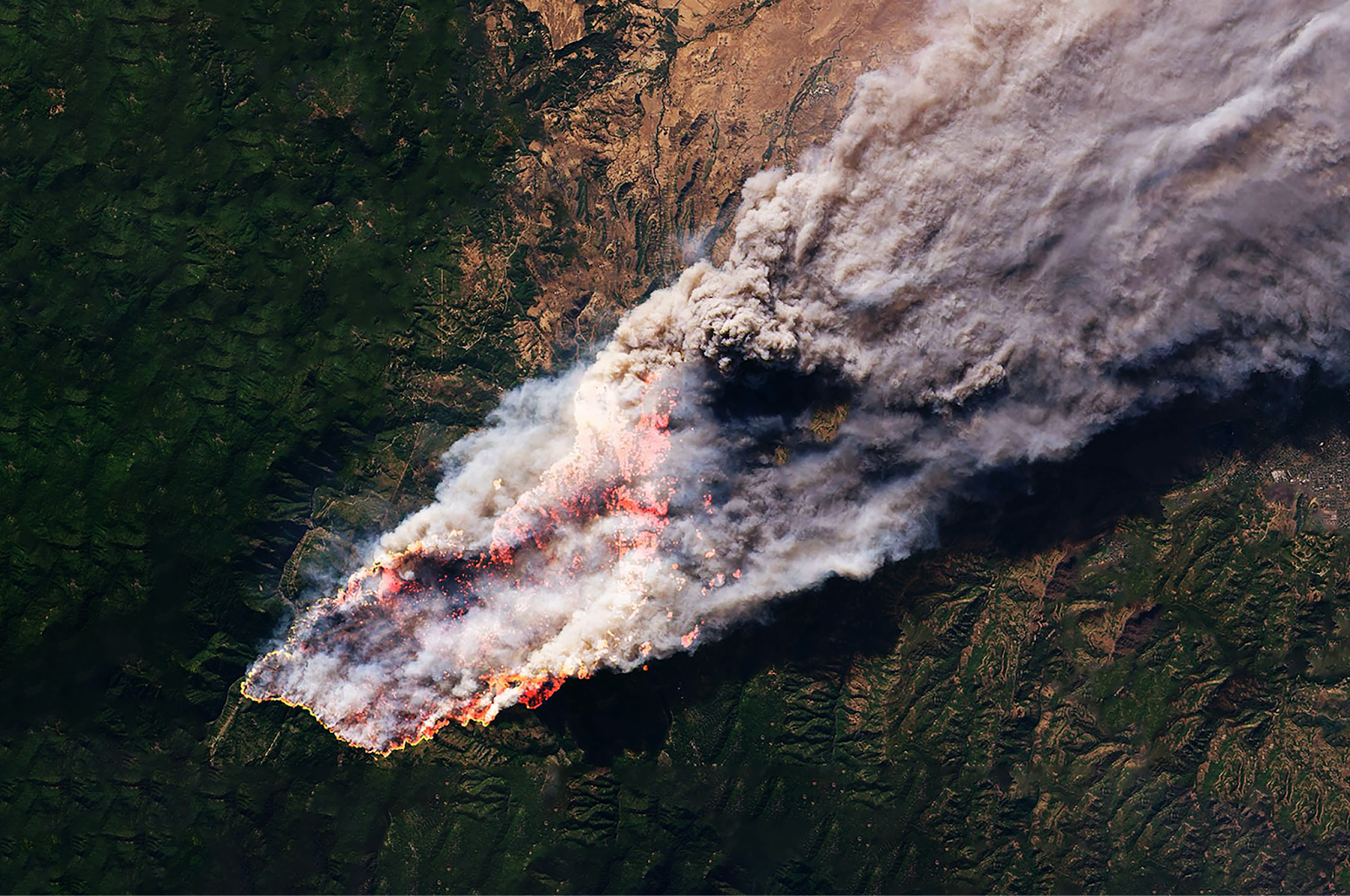
From the wind-whipped canyons of California to the dense boreal forests of British Columbia and Quebec, wildfires are no longer rare or seasonal. They’ve become constant threats reshaping landscapes, endangering communities, and disrupting entire economies across North America. The fires are faster, hotter, and more unpredictable than ever before. To meet this new reality, we need more than historical data and reactive planning. We need sharper foresight, better tools, and data that moves as fast as the threat.
The EarthDaily Constellation: A New Chapter in Wildfire Monitoring
In 2025, EarthDaily launched something that changed the game. The EarthDaily Constellation delivers a level of visibility we've never had before: daily, scientifically calibrated Earth Observation imagery that gives us a consistent, high-resolution view of the entire planet. For wildfire intelligence, that means up-to-the-minute insight into the environmental conditions that drive ignition, spread, and severity. It's not just about seeing what’s happening, it's about understanding it deeply and acting quickly.
Why Traditional Fire Models Can’t Keep Up
Today’s wildfire risk isn’t static. Fuel moisture can shift by the hour. Wind patterns can change in minutes. Fires don’t follow historical boundaries anymore, and traditional models just can’t keep up. Static maps, old vegetation layers, and historic fire perimeters fall short when lives, forests, and infrastructure are on the line. EarthDaily’s daily data closes that gap and brings wildfire intelligence into the now.
Earth Observation That Keeps Pace with Fire
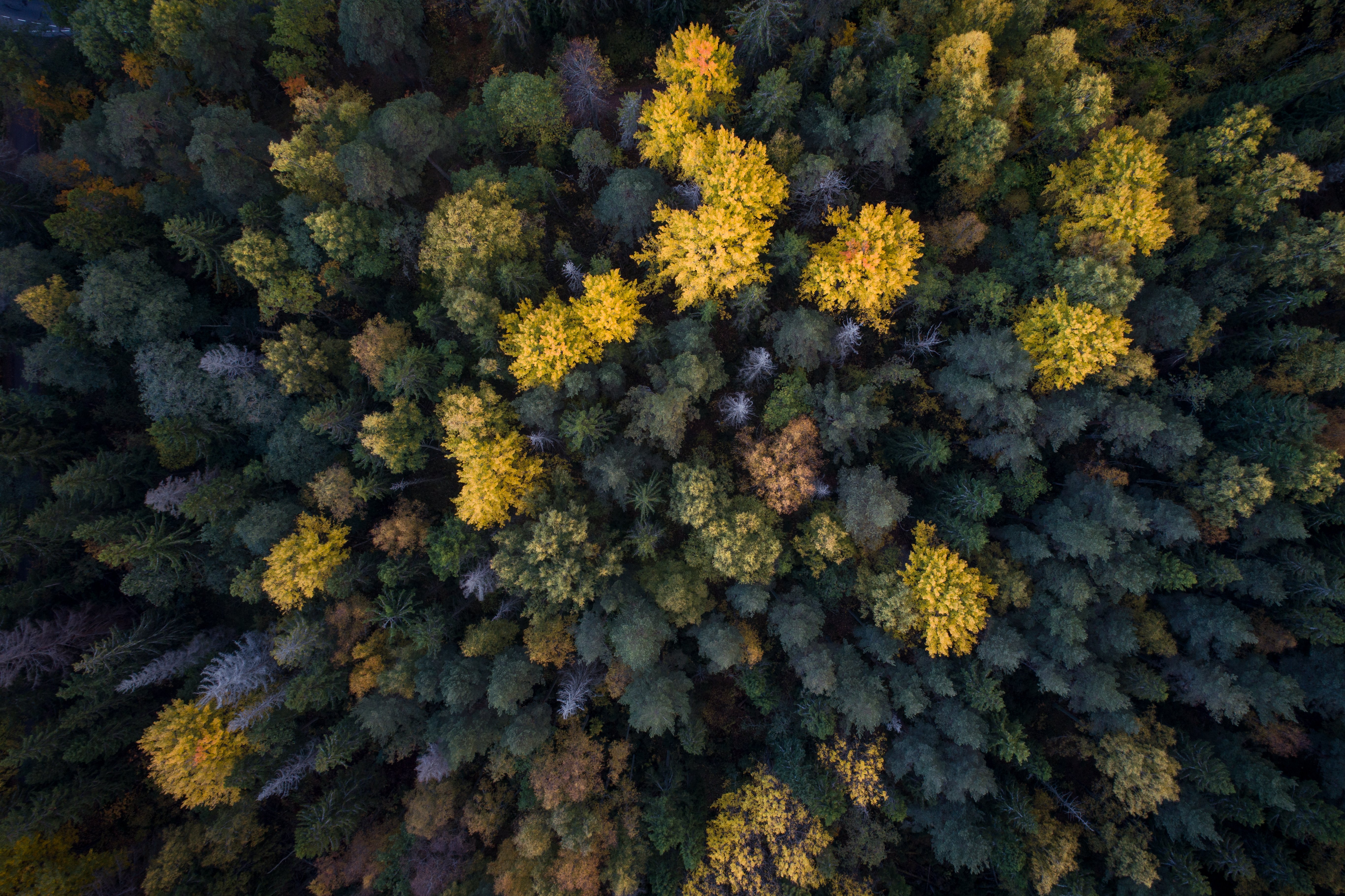
Every day, the EarthDaily Constellation captures high-resolution imagery and environmental indicators that help detect and model wildfire risk in near real time. It tracks how dry the vegetation is through indices like NDVI and NDWI, offering early signals about where a fire might spark or how fast it could spread. It monitors surface temperature and radiative energy to identify hotspots, even through smoke. It models terrain-driven fire acceleration by analyzing elevation data and topography. And with synthetic aperture radar, EarthDaily can see through clouds and thick smoke when optical imagery fails.
When a fire does occur, EarthDaily data helps assess its severity, map the burn scar, and track how the landscape recovers over time.
The Fire Seasons That Prove the Need
Over the last few years, we’ve seen exactly why this kind of intelligence is so urgently needed. In the U.S., California’s Smith River Complex Fire and the 2025 urban blazes in Altadena and Pacific Palisades tore through populated areas with incredible speed. Barring major shifts in conditions, 2025 is expected to rank among the heaviest wildfire seasons on record. Canada has already surpassed the typical full-season total of ~2.95 million hectares by mid‑June, with nearly 3.9 million hectares burned to date.
Fires in Alberta, the Northwest Territories, and North Carolina showed how fast conditions can shift and
how exposed we are when we don’t have a real-time view of risk.
Turning Risk into Readiness
EarthDaily’s wildfire insights are designed for people who need to act. For insurers, the data supports near real-time exposure scoring, dynamic event monitoring, and quick, accurate recovery assessments after the flames are out. For governments and emergency response teams, it helps identify high-risk zones, improve evacuation planning, and support fuel management based on current conditions—not outdated maps. For forestry and environmental leaders, it delivers a clear picture of forest health, carbon loss, and the pace of post-fire recovery.
SkyForest: The Intelligence Behind the Imagery
At the heart of this capability is SkyForest—EarthDaily’s advanced platform built specifically for forestry, utility and wildfire applications. SkyForest takes in all that satellite imagery and turns it into decision-ready intelligence. It can identify stressed vegetation before it becomes dangerous fuel. It can classify tree species, fuel type, fuel hazard to help prioritize risk mitigation at scale. It supports damage detection after fire events, and it models fuel buildup to guide where prescribed burns or other mitigation measures should happen. SkyForest takes what was once invisible and makes it clear, timely, and actionable.
A Smarter Approach to Fire Strategy
Responding to wildfires isn’t just about putting them out. It’s about understanding what makes them start, how they move, and what happens after they’re gone. EarthDaily’s approach reflects this broader, smarter strategy. By integrating daily Earth Observation with ecological baselines, fuel accumulation tracking, long-term recovery monitoring, we can build more resilient landscapes and communities.
The climate is changing. Fire behavior is changing. That means our tools, and our mindset. have to change too. With the EarthDaily Constellation providing daily insight from space, starting in 2026, and SkyForest delivering the analytics that turn that data into action, we’re entering a new era of wildfire intelligence.
From California to Quebec, from the Carolinas to British Columbia, we can now track, predict, and prepare for wildfire risk with more precision than ever before.
This isn’t just a better way to see the Earth.
It’s a better way to protect it.

.png)