
CHRIS RAMPERSAD, Vice President of Engineering at EarthDaily Analytics – working to make Earth Observation impactful to the environment, community and our future.
Introducing EarthMosaicsTM Alpha Release – On-Demand Custom Analytics Ready Mosaics
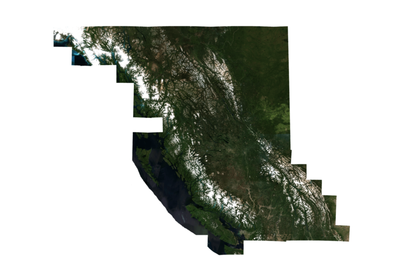
Today we’re excited to showcase the Alpha release of our revolutionary new EarthMosaicsTM service! Now, for the first time, you can select any Area of Interest (AOI) and time range available within the Sentinel-2 data catalog and use EarthMosaicsTM to generate full resolution geometrically and radiometrically corrected Analytics Ready Mosaics for your use case. As part of this release, we are providing two free mosaics of British Columbia, Canada (an area of about one million square kilometers) available to try here.
Why EarthMosaicsTM?
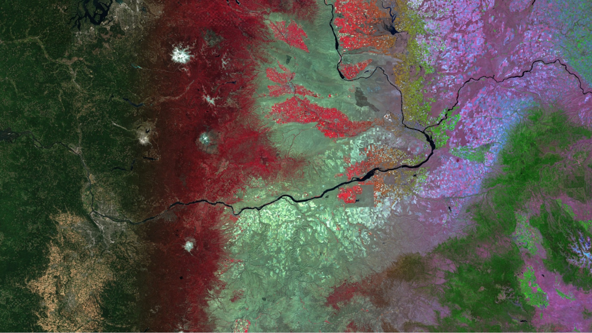
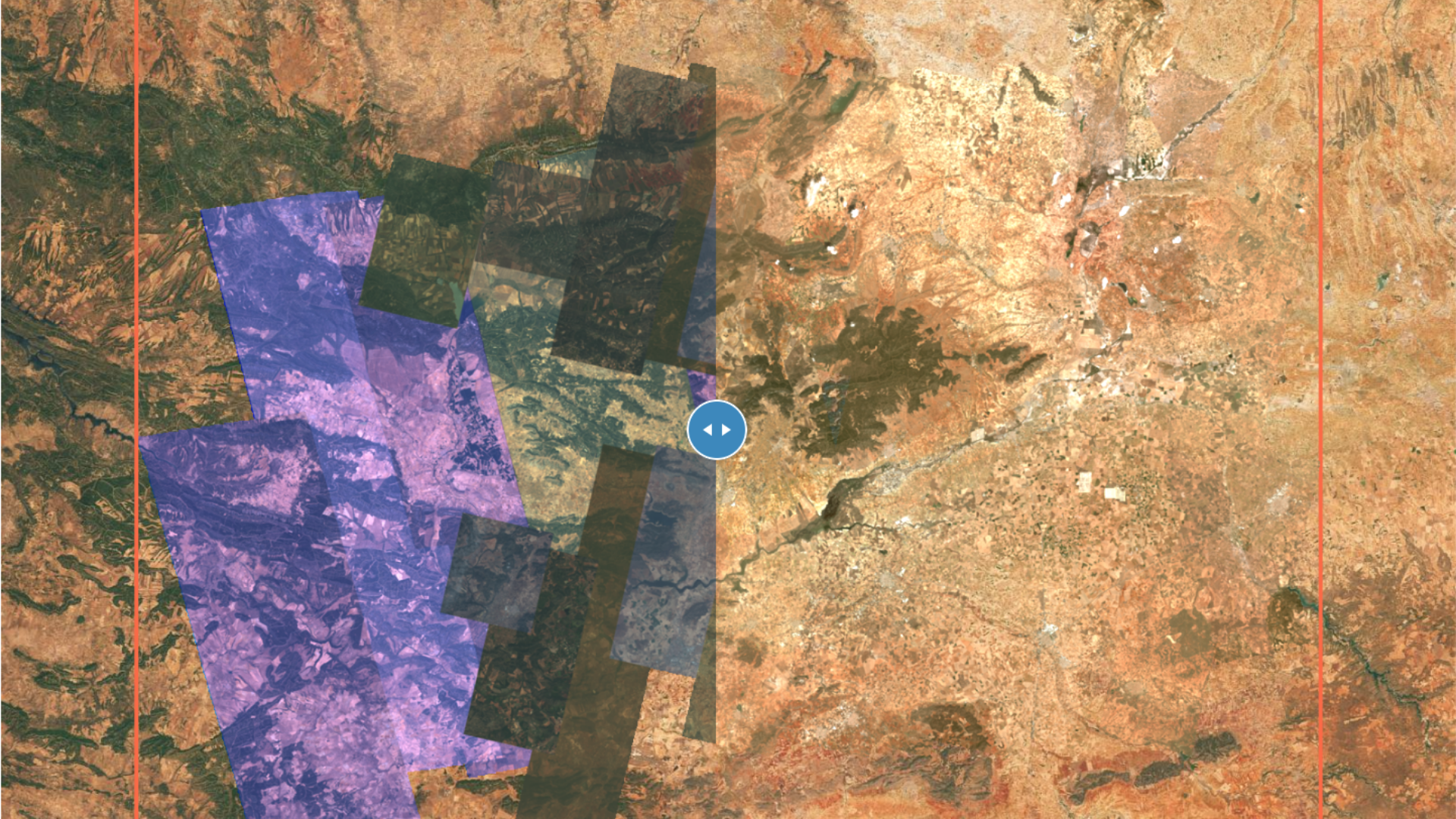
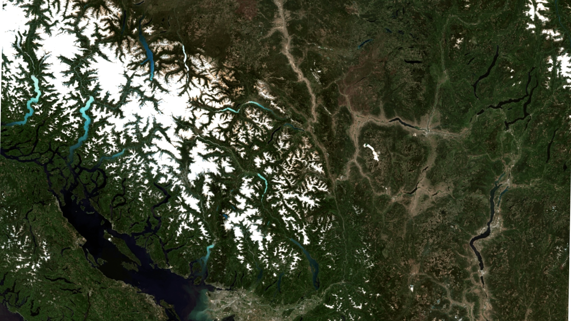
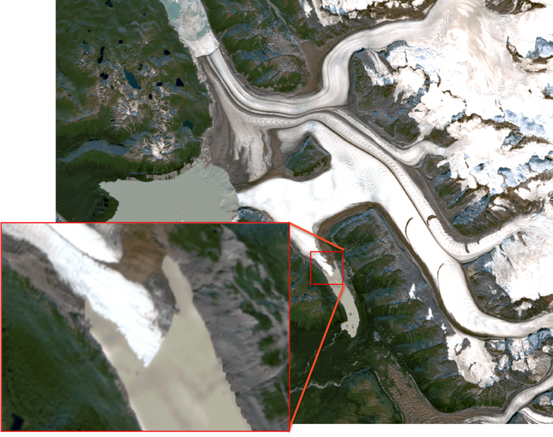
Monitoring the changing Earth is more critical now than ever before. With the record-breaking heat waves, deadly fires, and devastating droughts, EarthMosaicsTM provides a key tool to help monitor and mitigate climate change by allowing users to see a clear view of the Earth without clouds and atmospheric effects enabling a better understanding of the environment. To see how these mosaics can be used, take a look below at the area around the Grand Plateau Glacier. These types of changes in glacial melt can easily be monitored over broad areas to help us better analyze and model the impact of climate change.
2018
2020
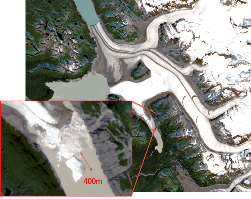
Large ice breakup observed near the Grand Plateau Glacier between the years 2018 and 2020. The Grand Plateau Glacier has been undergoing significant glacial melt over several decades.
Every application has different requirements and EarthMosaicsTM lets you customize mosaics to meet your individual needs. The key features of EarthMosaicsTM include:
- On-Demand creation of Sentinel-2 mosaics with a specified AOI and time range
- Geometric refinement of every Sentinel-2 image to ensure seamless and accurate location supporting large scale change detection
- Radiometric balancing to correct for subtle imbalances in the different scenes
- Cloud/shadow removal to provide a clear view of the Earth
Our team at EarthDaily Analytics is busy building new and innovative EarthMosaicsTM capabilities every day with the generous support from Microsoft and Canada’s Digital Technology Supercluster’s Satellite-based Environmental Analytics project and our partners Hatfield Consultants, BGC Engineering, BC Parks Foundation, and University of Victoria. We look forward to sharing additional features in the near future as we approach General Availability for the EarthMosaicsTM service. In the meantime, feel free to check out our newly released sample mosaics of British Columbia or learn more about our technology here!
Stay tuned for the next installment of our EarthMosaicsTM blog where Will Parkinson (Technical Product Manager) will demonstrate some insightful applications you can do with Analytics Ready Mosaics!
About EarthDaily Analytics
EarthDaily Analytics (EDA) is a Canadian company with headquarters in Vancouver, British Columbia, providing evidence-based, actionable insights for addressing some of the world’s greatest challenges, from sustainable agriculture and disaster management to climate change monitoring and forestry protection, among many others.