.jpg?width=289&height=168&name=Data%20Use%20cases%20(1).jpg)

Market Insights Overview: Descartes Labs' advanced geospatial insights uses quantitative models for ...
Market Insights Overview: Descartes Labs' advanced geospatial insights uses quantitative models for ...
Descartes Labs was pleased to join The Sustainability Consortium (TSC) members at the TSC Summit 202...

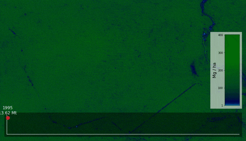
Improving trading and procurement performance with geospatial data and machine learning A recent rep...