.jpg?width=289&height=168&name=Data%20Use%20cases%20(1).jpg)

2026 is off to a powerful start at EarthDaily!
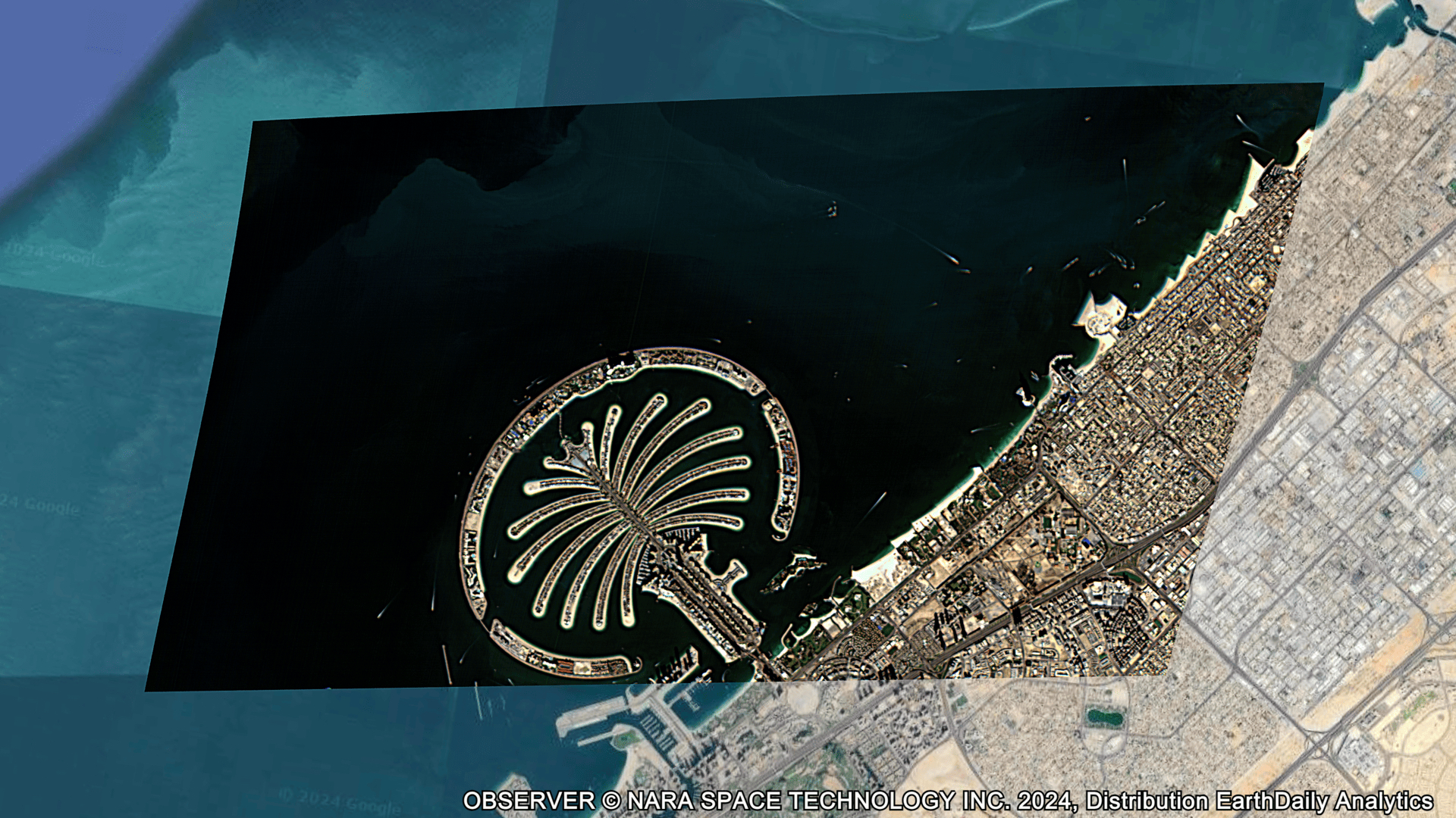
We are today releasing the early images from our first satellite, EarthDaily Constellation 1 (EDC-01). This marks a major milestone in the deployment of our next-generation, science-grade Earth observation system.
Since launch:
- Imaging operations have steadily scaled.
- Visible and near-infrared commissioning has progressed.
- Shortwave infrared and thermal validation continues.
- The full system has been exercised end-to-end in space.
Over months of sustained operation, the architecture stabilized within defined performance margins. Those margins have now been met in orbit and the stack performed as designed.
“From the beginning, our objective was not simply to launch satellites, but to build a change detection system that performs at operational scale. Validating that system in orbit before constellation expansion was essential. With this milestone achieved, we are ready for what comes next,” said Don Osborne, CEO, EarthDaily.


The first satellite’s early deployment in June 2025 allowed us to validate the full technology stack – spacecraft systems, calibration workflows, and processing infrastructure – before scaling the constellation.
With six additional satellites scheduled for launch in May, and the rest available for launch later this year, we will enter commercial operations in August 2026, with operational data availability beginning in September.
Each EarthDaily spacecraft carries 16 independent imaging assemblies operating across 22 spectral bands, spanning visible, near-infrared, shortwave infrared, and thermal wavelengths.
The system is purpose-built for broad-area change detection, delivering globally consistent, AI-ready data designed to support governments and enterprises in monitoring assets, managing risk, and predicting outcomes at scale.
The early images released today mark the transition from design and validation to operational scale.