Our customers and partners include leaders and innovators across the public and private sectors, including long-established and instantly familiar names, up-and-coming firms at the cutting edge of their fields, and numerous companies that have realized the tangible value of having a better, more contextualized, and more up-to-date understanding of the world around them.
As we count down until the scheduled launches of the EarthDaily Constellation (“EDC”), we are shining a spotlight on some of those who recognize the benefit of working with EarthDaily Analytics in unlocking the game-changing power of Earth Observation Built for AI Everywhere Everyday.
Partner Spotlight:
EarthDaily Analytics, is proud to announce the establishment of a strategic partnership with iGeosys. Integrated Geosys Development Inc (“iGeosys”), a premier geospatial solutions provider in the Asia-Pacific (APAC) region. Based in Manila, Philippines, iGeosys specializes in drone-based LiDAR mapping, topographic and orthophoto map production, and geographic information systems (GIS) solutions, providing critical insights and practical data in support of key civic and private sector functions spanning from power infrastructure assessment and maintenance to foresty to defense intelligence and beyond. This partnership strengthens and expands the already-extensive range of services by incorporating EDA’s advanced Earth observation data and analytics.
Expanding Geospatial Capabilities
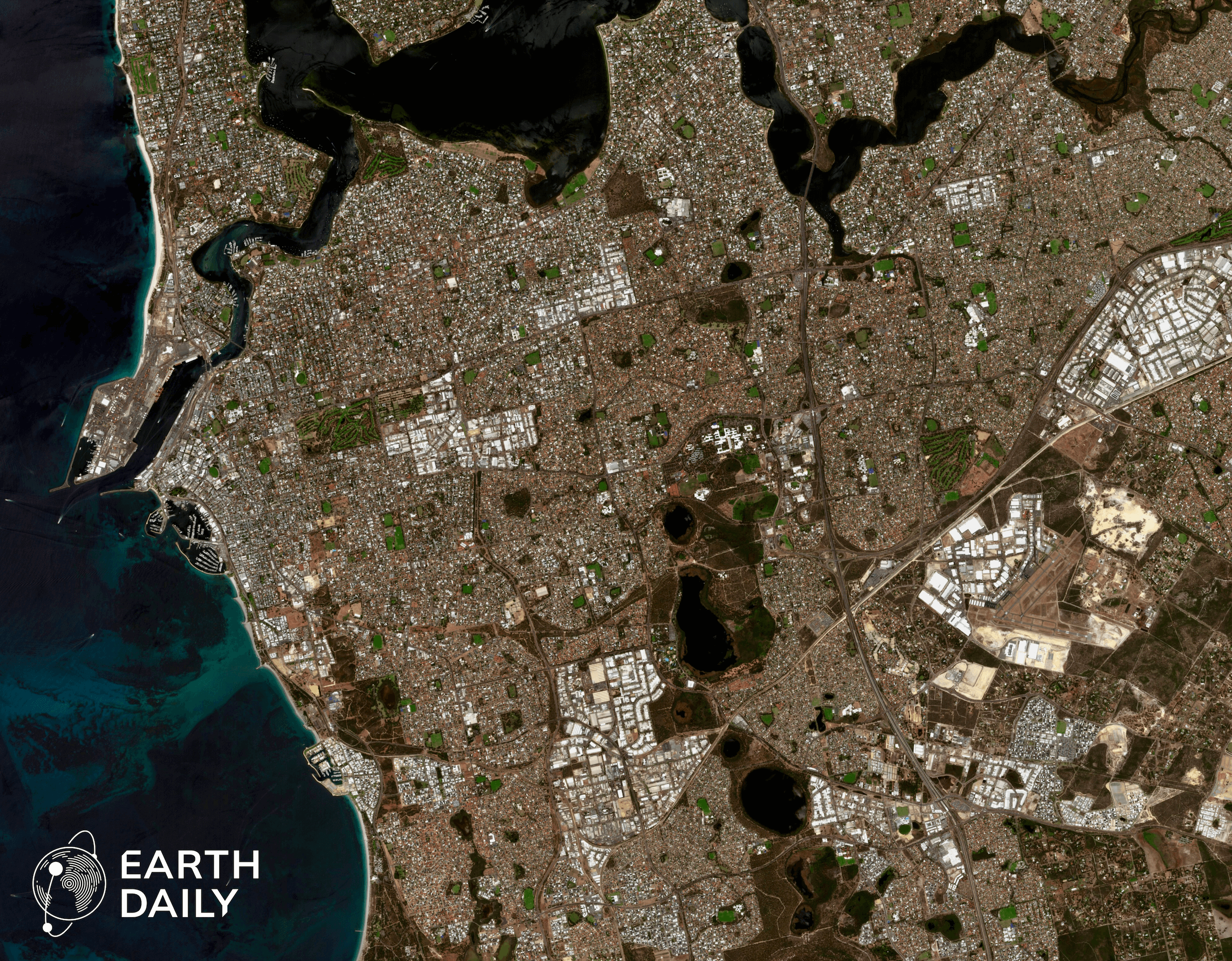
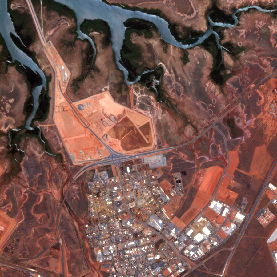
iGeosys serves a diverse clientele spanning industries across the private and public sectors, including the National Mapping & Resource Information Authority (NAMRIA), National Grid Corporation, DMCI Power, National Irrigation Administration, PhilRice, Manila Water, and Semirara Mining & Power Corporation. The Partnership will enable iGeosys to replace its current satellite data providers with EarthDaily’s state-of-the-art EarthDaily Constellation (EDC) data. This transition aims to enhance services in key areas such as natural resource management, coastal monitoring, environmental assessment and protection, agriculture intelligence and optimization, and disaster prevention and remediation.
Enhanced Services and Offerings
Srin Patnaik, of EarthDaily Analytics, commented, “This Partnership marks a significant milestone in expanding our footprint in the APAC region in collaboration with an established regional leader in downstream geospatial solutions. By leveraging our EDC data, iGeosys can offer unparalleled quality in scalable analytics purpose-built for use in AI, driving innovative, insightful, and highly efficient solutions for their clients in the civil government, defense, and enterprise sectors.”
Sandhel Matugas, CEO of iGeosys, stated, “We are excited to integrate EarthDaily’s advanced imaging capabilities into our service portfolio. The credibility and commitment of EarthDaily in delivering high-quality data were key factors in our decision to move forward with this Partnership, with the clear understanding that optimal end results are dependent upon optimal data inputs. We believe this collaboration will unlock new application areas and significantly benefit our clients.”
Commitment and Future Prospects
As part of the agreement, iGeosys will purchase EDC data products at commercial prices with a guaranteed partner discount under a yearly Minimum Annual Commitment (MAC). This collaboration underscores iGeosys’s commitment to providing cutting-edge geospatial solutions and reinforces EarthDaily’s position as a trusted provider of high-quality Earth observation data.
About EarthDaily Analytics:
EarthDaily Analytics (EDA), headquartered in Vancouver, Canada, is a vertically integrated provider of Earth Observation data, analytics, and solutions. Utilizing a unique combination of proven space technologies, ground-breaking AI applications, and cutting-edge big data tools, EDA provides value-added, actionable insights to decision makers and risk managers across the public and private sectors on a global basis. Building on a 35-year track record of leadership and innovation in the commercial application of Earth Observation technology, EDA is moving the state of the Change Detection industry forward with the 2025 launch of the EarthDaily Constellation. Supported by best-in-class project partners including Loft Orbital, Airbus, ABB, and SpaceX, the EarthDaily Constellation will provide spectrally robust, analytics-ready data covering nearly 100% of the world’s landmasses and maritime regions, collected at the same time every day. Pairing the unmatched data collection of the EarthDaily Constellation with EarthPipeline, the world’s first fully managed, endlessly scalable ground segment pipeline-as-a-service, EarthDaily Analytics is bringing the world’s most advanced change detection system to bear on the biggest challenges facing businesses, governments, and humanity as a whole.
For more information on the EarthDaily Constellation built for AI as well as EDA’s game-changing Change Detection offering, visit our website:
About Integrated Geosys Development Inc:
Integrated Geosys Development Inc (iGeosys) is a leading geospatial solutions provider based in Manila, Philippines. iGeosys offers a comprehensive range of services, including drone-based LiDAR mapping, topographic and orthophoto map production, and GIS solutions, serving clients in civil government, defense, and enterprise sectors.
For more information, visit https://www.igeosysdev.com