EarthDaily Ignites a New Era in Earth Observation with Landmark Satellite Launch
EarthDaily launches first satellite, marking a major step in deploying next-gen Earth Observation and AI-ready broad area change detection system.

Successful Launch of First Satellite Marks Critical Milestone in Deployment of Next Generation Earth...

From the wind-whipped canyons of California to the dense boreal forests of British Columbia and Queb...

Members of EarthDaily and Antarctica Capital at the 2025 Fast Company's Most Innovative Companies Su...
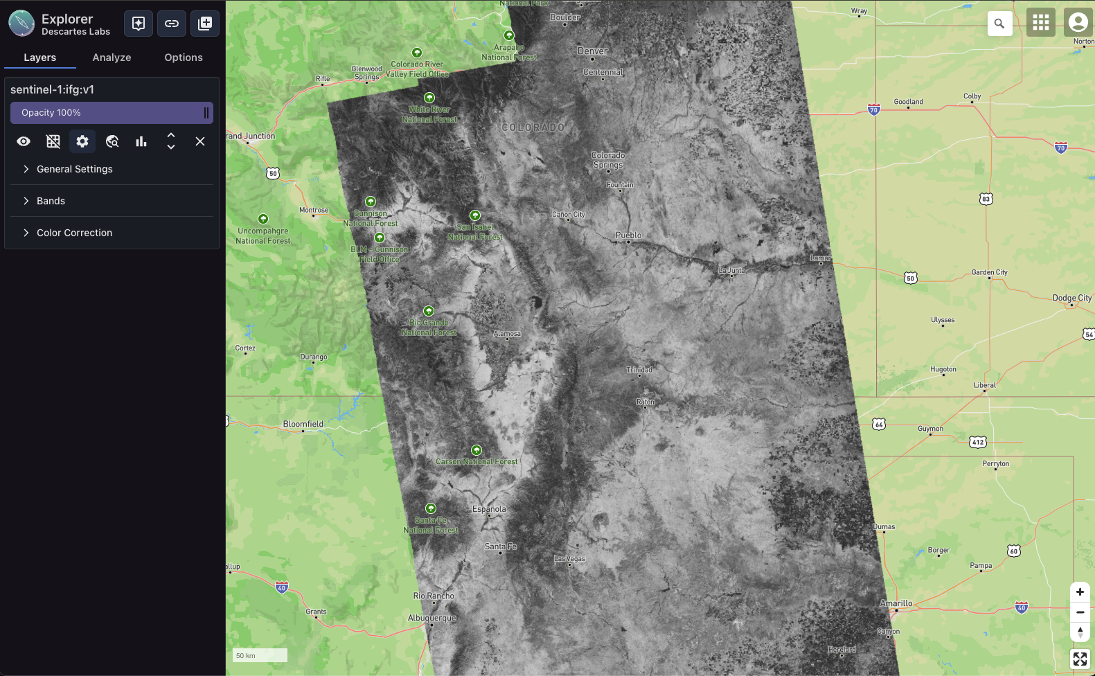
Over the last few years, NASA’s Jet Propulsion Laboratory (JPL) has been advancing its SAR-based cap...

EarthDaily Constellation Unlocks the Power of Broad-Area Change Detection to Deliver Unmatched Value...

Pioneering geospatial data science earns EarthDaily a Top 10 spot in the Data Science category along...

Acquisition embeds cutting-edge wildfire and forestry analytics into EarthDaily’s comprehensive Eart...

Author: Andre Veneziani Climate change is fundamentally reshaping the insurance industry. The increa...

Recently our VP of Business Development, Sahiba Sachdeva, sat down with Martin Veitch of Mining Jour...

Acquisition strengthens EDA’s core geospatial AI capabilities and provides immediate access to multi...

October 11, 2024 EarthDaily Analytics (EDA) is thrilled to be part of a significant milestone in the...