

.png?width=1620&height=1260&name=EarthDaily%20Change%20Detection%20mobile%20(1).png "EarthDaily Change Detection mobile (1)")


Data & Imagery
Platform & Processing
Vertical Market Solutions
Agriculture Environment Insurance Logistics Mining & EnergyA new era of change detection through earth observation has begun.
A new era of change detection through earth observation has begun.
Track the Constellation.
10-Satellite Sun-Synchronous Orbit
NORAD: 00000
Satellite description.
1 / 10
Satellites Launched
Integrate with our data.
Understand change detection at scale.
Experience the most complete, AI-ready Earth Observation datasets on the market, designed to streamline analysis and unlock faster insights. Backed by years of expertise in advanced modeling, we power predictive analytics at scale. With global, high-fidelity coverage, you can focus on decisions that move your organization forward, instead of dealing with the hassle of fragmented data.
We capture and downlink raw satellite data through a purpose-built constellation and ground system. This data is not usable on its own and exists solely to feed downstream processing.
We process, calibrate, and quality-control raw data to produce scientifically accurate image data products. This is where customers access, manage, and analyze data at scale with our platform or their own.
We turn daily, global imagery into actionable intelligence through advanced AI models and applications, powering decisions for governments and enterprises.
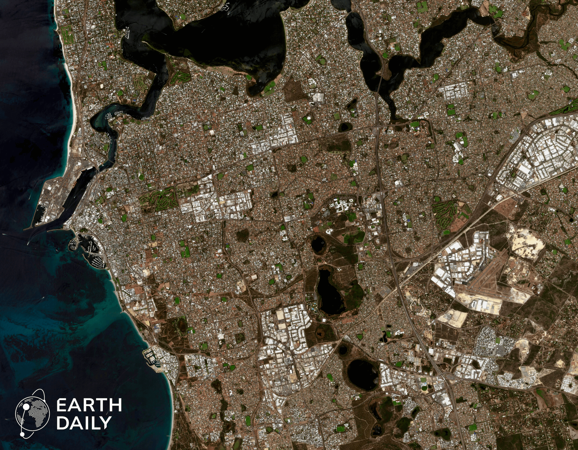
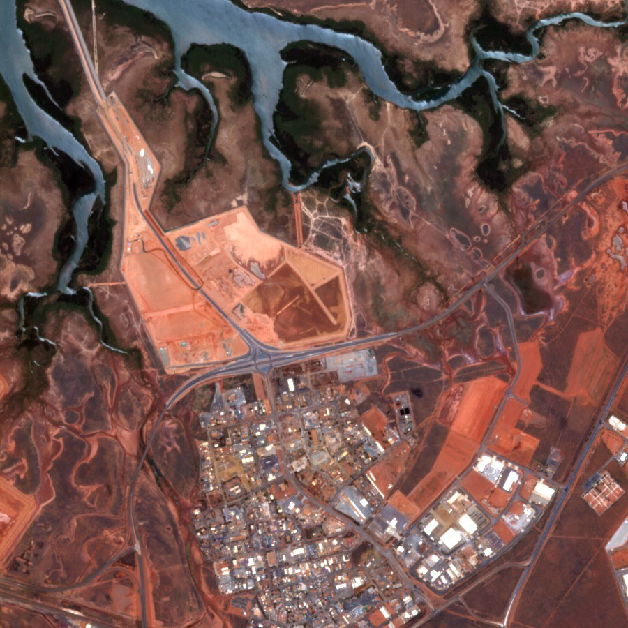
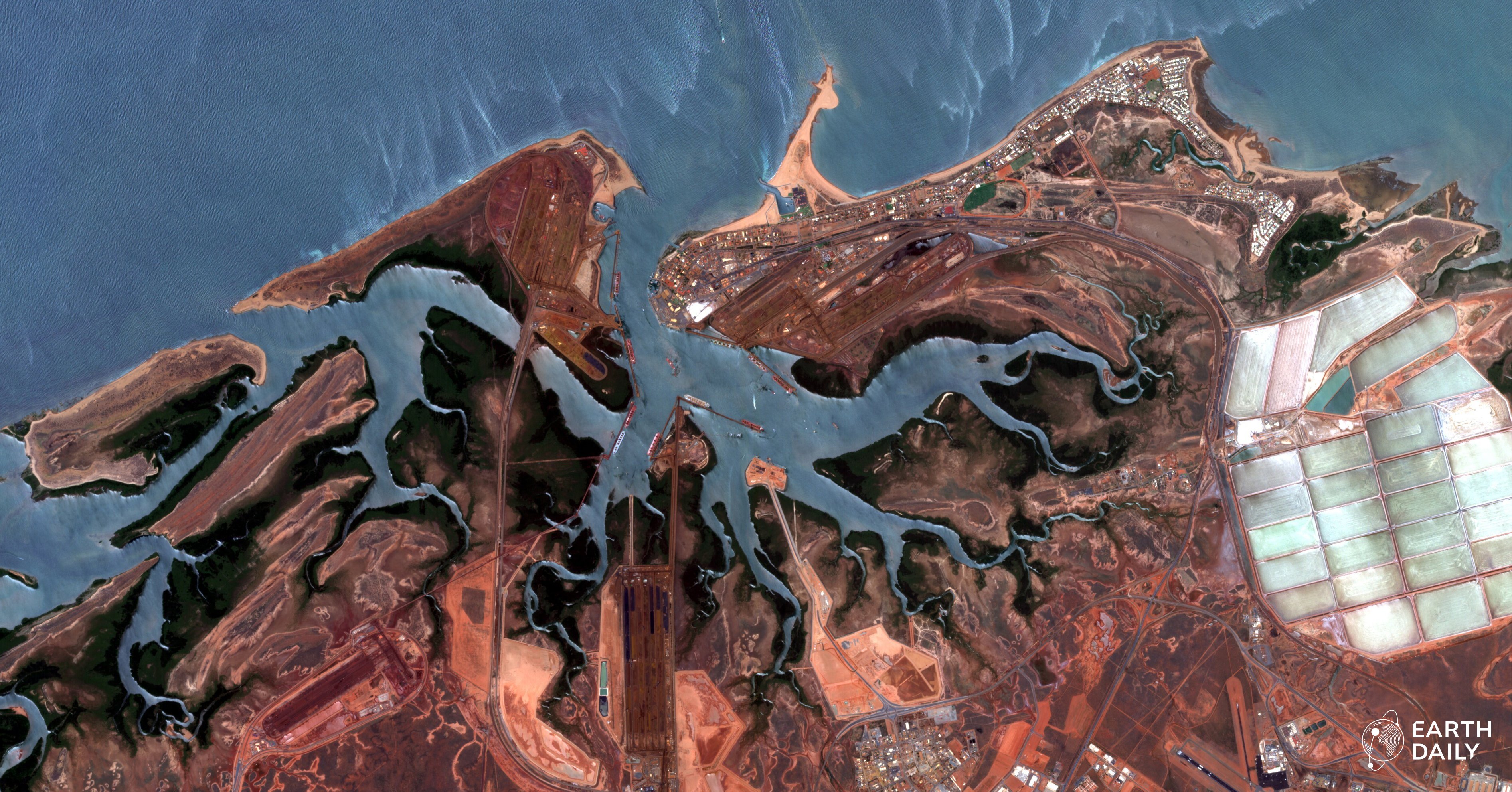
As seen by EDC-01
An industrial port complex along the red coastline of Western Australia’s Pilbara region, centered on Port Hedland — one of the world’s largest bulk export ports —
with ship channels, heavy mineral handling infrastructure, and adjacent salt evaporation ponds visible inland.
Boost yields, monitor crop health, and cut costs with AI-powered crop intelligence driven by advanced Earth Observation data.
Discover and secure with AI-powered resource management for mineral discovery, site condition monitoring, and operational safety insights.
Predict and protect your assets with geospatially-derived risk analysis, property monitoring, and climate impact assessment.
Act with precision with critical intelligence for infrastructure, security, and emergency response.
EarthDaily's platform combines rapid satellite imagery with AI,
enabling organizations to predict, monitor, and respond with unprecedented speed.
EarthDaily has been awarded a €480,000 grant by the French government under the FASEP (Fonds d'Études et d'Aide au...
Read More
How is artisanal and small-scale mining (ASM) defined? This article explains the regulatory spectrum of ASM, including...
Read More
Transforming Earth observation imagery into stable, analysis-ready data requires consistent calibration, cloud masking,...
Read More
EarthDaily announced that Don Osborne, President and Chief Executive Officer, and Sai Chu, Chief Financial Officer,...
Read More
Daily global monitoring is changing the rules of the intelligence cycle. Learn how consistent, calibrated observation...
Read More
EarthDaily has announced that its data products have achieved CEOS Analysis Ready compliance, a globally recognized...
Read More
Maintaining scientific accuracy in Earth observation requires continuous calibration, validation, and processing...
Read More
Artisanal and small-scale mining employs 40–45 million people worldwide. This article explains why ASM remains...
Read More
This article examines the structural limitations of current Earth observation systems and how the requirement for...
Read More
EarthDaily’s 16-imager architecture transforms wide-swath imagery into stable, science-grade data. Learn how...
Read More
Early images from EarthDaily Constellation 1 (EDC-01) showcase science-grade, AI-ready multispectral data validated in...
Read More
EarthDaily Territory Insights delivers early-season territory intelligence for agricultural retailers to plan earlier,...
Read More