

Engineering Behind EarthDaily: Building a Global Data Infrastructure for Earth ObservationEarthDaily was engineered around 16 coordinated imaging assemblies per spacecraft, forming a unified 22-band measurement architecture with a very wide swath while maintaining high quality. That level of ambition requires a different level of engineering discipline than a single-sensor mission, including maintaining calibration, stability, and measurement integrity across a highly complex system. This is part of a four-part series adapted from a feature first published in SpaceNews: Engineering Behind EarthDaily: Solving for Global Daily Coverage, Scientific Quality, and High-Spectral Diversity.
Broad-area change detection only matters if the measurement behind it is stable. In Earth observation, frequency without calibration creates volatility, and imagery without consistency erodes trust over time. EarthDaily was designed around a simple principle: global daily coverage must be paired with scientific rigor, spectral depth, and long-term measurement integrity. What follows is the engineering discipline required to make that standard a reality.
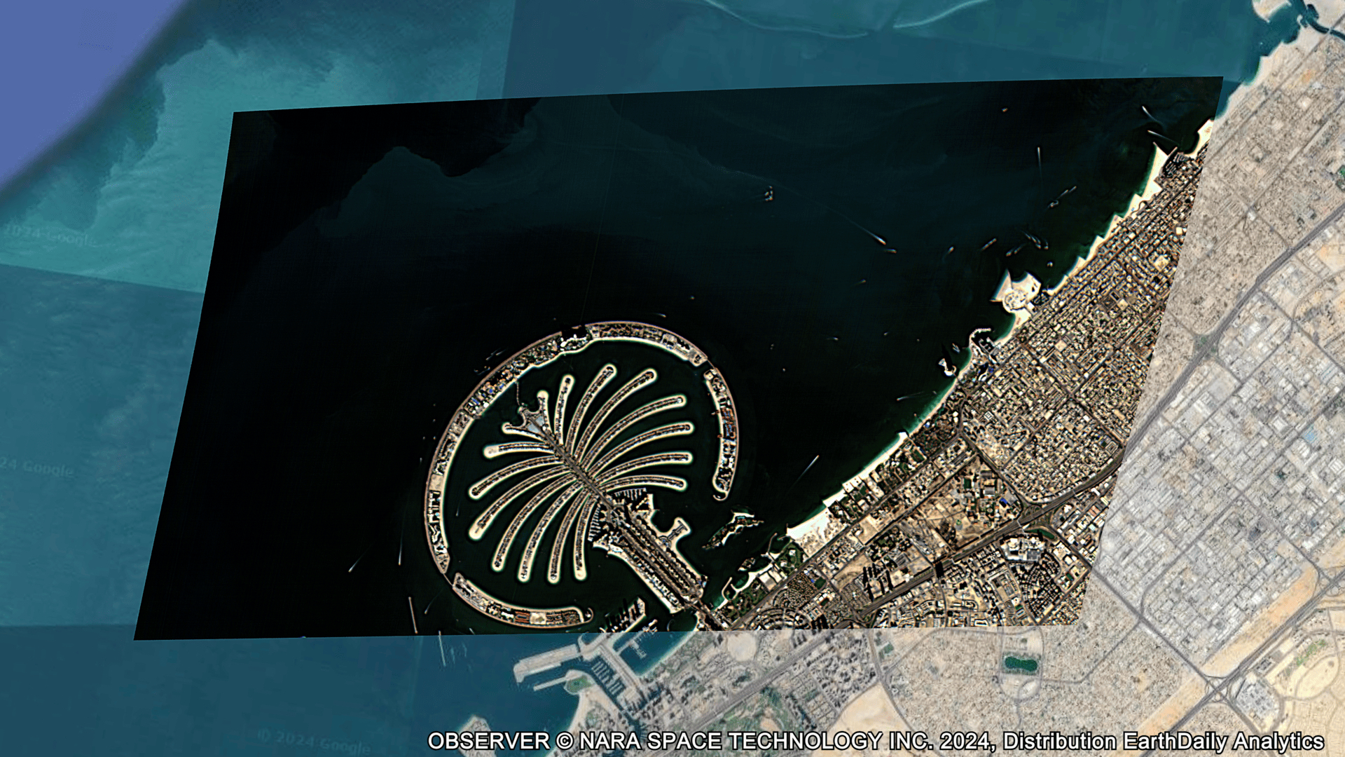
EarthDaily released early images from the EarthDaily Constellation on February 19, 2026, marking the beginning of the system’s transition from engineering to operational data delivery.
From conception to first launch in 2025, EarthDaily made a deliberate choice to invest the time required to build a mission people can trust, not just one that they can see.
Most commercial optical satellites are built around a single or limited number of primary imaging assemblies: a small number of optical paths delivering multispectral or hyperspectral data through a unified instrument.
Our architecture required solving for sixteen imagers per spacecraft. This allows maintaining a consistent imaging geometry and consistent operating environment for the imagers which is important to maintain high data quality.

EarthDaily spacecraft design with 16 imagers providing 22 spectral bands and 240 km swath with5m GSD in the VNIR bands on a high reliability, high performance bus. The EDC-01 Satellite is shown in the Falcon-9 Launch Vehicle during preparation for the launch that occurred in June 2025
Each satellite integrates sixteen independent imaging assemblies operating in coordination. Sixteen focal planes. Sixteen alignment geometries. Sixteen thermal profiles. Sixteen radiometric responses operating under constant motion and changing illumination.
That architecture enables achieving the wide swath per satellite and limiting the number of satellites to 10 for the constellation to achieve global daily coverage where each must have very high pointing control and stability performance and precise orbit control performance. It also multiplies calibration complexity, particularly in thermal bands where performance must be continuously characterized to maintain measurement integrity.
Sixteen optical instruments do not behave identically. Thermal shifts, detector variability, and atmospheric effects introduce small differences that must be observed, modeled, and constrained until the system performs as a single coherent measurement system.
Across the planned ten-spacecraft constellation, that complexity scales to 160 coordinated imaging assemblies — effectively 160 single-instruments aligned into one integrated measurement system.
On the ground, those streams are aligned, calibrated, and harmonized into a single unified dataset.
Rigorous laboratory testing can only reveal so much. The true test comes on orbit, when hardware is pushed to its limits and external variables come into play.
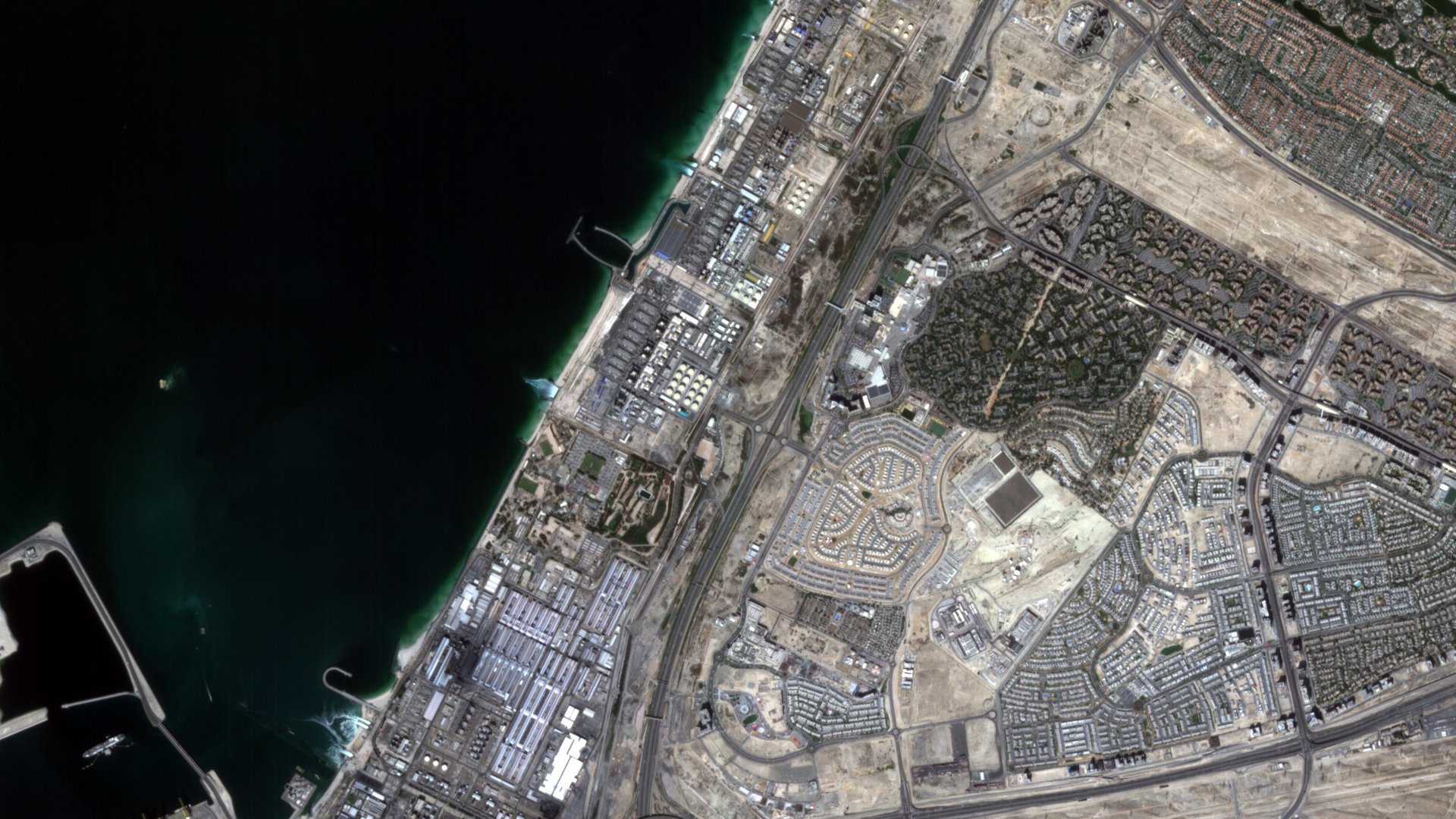
To explore early imagery from the EarthDaily Constellation, download this PDF.
More in this series: