Modern ag platforms depend on timely, reliable crop intelligence but building and maintaining a satellite analytics stack is complex, costly, and resource-intensive. EarthDaily removes that burden. By managing the full pipeline from data acquisition and processing to quality control and delivery. The result is lower total cost of ownership, faster time to market, and confidence in the delivery of data and analysis that go beyond what free or public sources provide.
Earth Observation for Smarter, More Profitable Farming
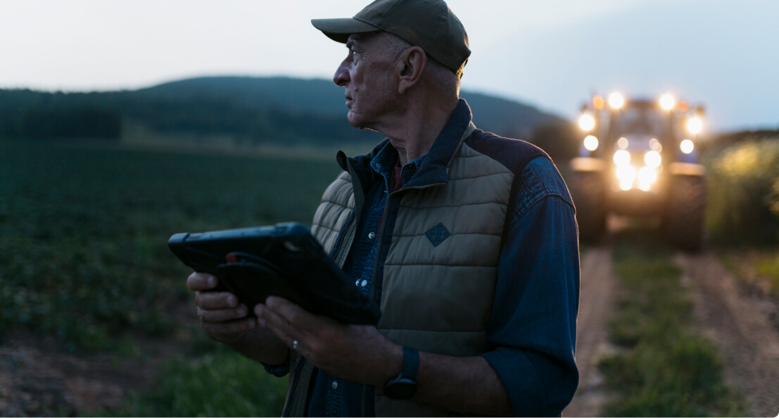
In modern farming’s competitive and unpredictable market, access to reliable, real-time intelligence is no longer optional, it’s essential. Satellite-driven analytics are vital for optimizing operations and ensuring sustainable growth.
Proactive Field Monitoring
High-resolution crop monitoring for real-time yield tracking,
Optimized Input Use
Reduce waste, lower costs, and improve sustainability
Informed Decision-Making
Strengthen grower relationships with data-backed recommendations
Advanced satellite-driven Analytics for Precision Agriculture
Dynamic Change Detection
Temporal Analysis: Monitors fields over time to detect subtle crop condition changes, enabling early intervention.
Anomaly Detection: Identifies unexpected vegetation index variations that may signal pest infestations, disease outbreaks, or water stress.
Technical Specifications
Data Acquisition: EarthDaily Agro processes data from a constellation of Earth observation satellites, ensuring high temporal and spatial resolution.
Data Processing: Utilizing cloud-based platforms, the system processes over 10 terabytes of data daily, transforming raw inputs into analysis-ready formats.
Integration Capabilities: Seamlessly integrates with existing farm management systems through robust APIs, enabling customized analytics and reporting.
Yield Trend Benchmarking
Historical Data Integration: Leverages over 30 years of satellite imagery to compare current crop performance against past seasons, supporting trend analysis and forecasting.
Regional Performance Comparison: Benchmarks fields against regional data to identify improvement areas and implement best practices.
Comprehensive Vegetation Indices
Normalized Difference Vegetation Index (NDVI): Assesses plant health by measuring the difference between near-infrared and red light reflection, offering insights into biomass and chlorophyll concentration.
Enhanced Vegetation Index (EVI): Improves sensitivity in high-biomass regions, reducing atmospheric influences and providing a clearer picture of canopy structure.
Leaf Area Index (LAI): Measures total leaf area relative to ground area, aiding in photosynthetic capacity assessments and crop growth predictions.
EarthDaily lets you skip the heavy data processing and get straight to actionable crop intelligence, so you can focus on decisions, not data wrangling.
Use Case: Precision Ag Providers: Scaling Sustainable Solutions for Growers
Challenge
Precision Ag providers face a talent gap in agronomists skilled in managing variable rate application maps and other precision agriculture application workflows. Limited expertise made it difficult to scale services efficiently.
Solution
By integrating EarthDaily’s geospatial platform, the operator gains real-time visibility into crop performance, data-driven production assessments. Leveraging comparative field performance assessments, advanced vegetation indices, and yield modeling, the company achieves more precise applications, stronger grower returns, and improved sustainability — all while scaling efficiently without adding agronomist headcount.
Outcome:
Streamlined Map Development – Reduced the time and expertise required to create precision variable rate application maps for nitrogen or other products.
Expanded Service Capacity – Hired more applicators instead of agronomists, increasing the number of growers they could serve.
Use Case: Input Manufacturers: Turning Field Trials into Actionable Insights
Challenge: A major input manufacturer had a massive database of field trials and test plots but lacked the tools to translate that data into actionable insights for sales teams and customers.
Solution: By partnering with EarthDaily, they developed a customized mapping and monitoring solution, integrating:
Satellite Imagery based field monitoring – Delivering real-time crop insights to sales teams and customers.
Precision application maps – Optimizing input placement based on historical and in-season performance.
Proprietary Data Integration – Cross-referencing in-house research with live field analytics.
Outcome: The company provided its sales force with a cutting-edge agronomic decision-making tools, enabling retail grain marketers and originators access to precise, data-backed recommendations. This strengthened customer retention and reinforced its industry leadership.
Advanced Analytics for Smarter Decision-Making EarthDaily’s Agriculture intelligence platform delivers:
Comprehensive Weather Analytics
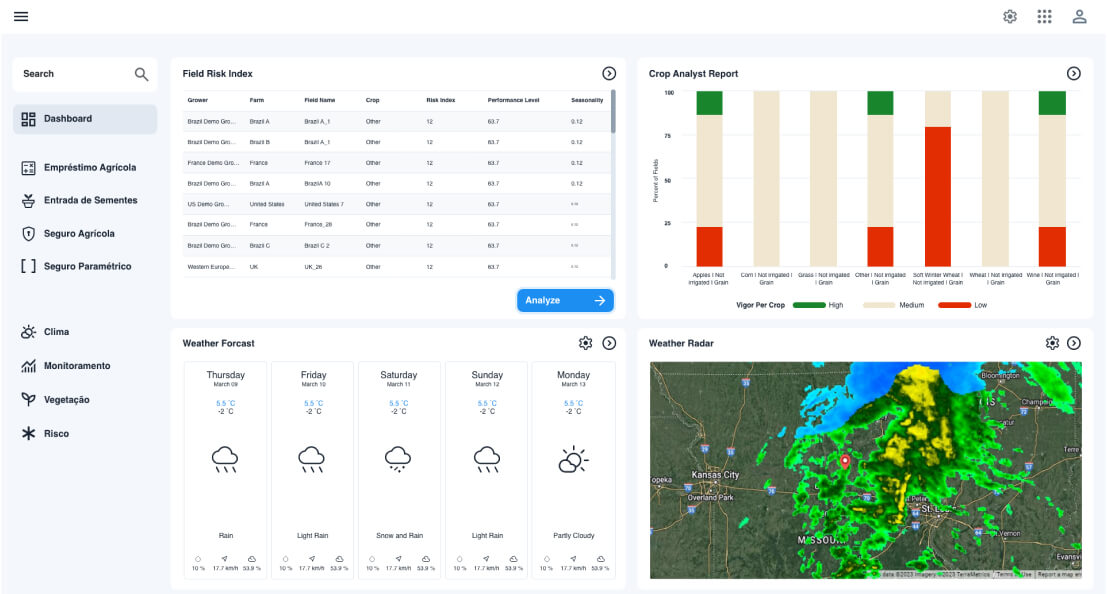
Access precipitation, temperature, soil moisture, GDD, ETP,wind speed, humidity, and solar radiation data at field level, with historical archives and forecasts.
Vegetation Index Monitoring
Track crop health using NDVI, LAI, EVI, CVI, GNDVI, and other indices with time series curves, maps, and benchmarking against historical performance.
Parametric Data Exports
Extract precipitation, temperature, and GDD time series or index occurrence data formatted for parametric product development and trigger validation.
Field-Level Benchmarking
Compare individual field performance against regional averages with trending vegetation curves that identify underperforming areas across portfolios.
Flexible API Integration
Access 50+ analytic products through analysis-ready APIs. Execute spatial queries across field boundary collections with crop type and sowing date parameters. Export in multiple formats.
Automated Alerts & Notifications
Configure threshold-based notifications for weather events, vegetation anomalies, or phenological stages across monitored fields.
Take the Next Step
In today’s agricultural landscape, data is power, the future belongs to those who use it wisely.with EarthDaily.
.jpg?width=289&height=168&name=Data%20Use%20cases%20(1).jpg)