Accelerate Mineral Exploration with Advanced Remote Sensing Tools
Unlock Faster, Smarter, and Scalable Mineral Exploration
Marigold is an all-in-one exploration toolkit designed to expedite discovery and optimize remote sensing analysis. Tailored for geologists, data scientists, and exploration managers, Marigold offers advanced spectral mapping, lineament analysis, and lithological mapping—without necessitating deep remote sensing expertise.
Key Benefits:
Process up to 300,000 km² in a Single Export:
Handle extensive areas efficiently, ensuring comprehensive coverage.
Zero Time Spent on Pre-Processing:
Access analysis-ready data immediately, streamlining your workflow.
40x Faster Pipeline Processing Time:
Accelerate data interpretation and decision-making processes.
Trusted by Industry Leaders
Seven of the world’s largest mining companies rely on Marigold by EarthDaily for exploration insights. Whether evaluating new tenements, refining drilling strategies, or conducting large-scale mineral prospectivity mapping, Marigold delivers the data intelligence needed to stay ahead.
Leveraging EarthDaily’s proprietary Bare Earth Composites and robust hyperspectral processing, Marigold enables geologists to pinpoint new deposits in hours instead of weeks.
Its GIS-like user interface and scalable analysis tools empower users to make swift, data-driven decisions, reducing exploration costs and maximizing discovery potential.
The combination of automated spectral processing, interactive data visualization, and geologically meaningful indices make workflows accessible to exploration teams — actionable geological insights.
Data Collection & Guidance
Leverage our expertise to select the best satellite imagery and sensor data for your exploration needs. Our team provides guidance on wavelength ranges, resolution, and pre-processing requirements, ensuring your data is optimized for actionable insights.
Challenge: An exploration geologist needed to identify potential mineral targets across a large, under explored region ahead of field season. Traditional remote sensing methods are slow, cumbersome, dependent on experts, and expensive.
Solution: Utilizing Marigold’s analysis-ready data catalog and processing tools, the geologist accessed multispectral and hyperspectral data over their AOI and used advanced spectral analysis to generate targets. The intuitive interface facilitated rapid generation of results without requiring remote sensing expertise.
Outcome: The geologist optimized exploration spend by focusing on high-confidence targets, reducing focus areas by 85%. The expedited process facilitated better decision-making, enabling the team to assess and acquire valuable tenements ahead of competitors.
Use Case: Exploration Managers
Refining Exploration Investment Strategies
Challenge: An exploration manager is overseeing multiple projects required a faster, more reliable method to assess exploration priorities and undertake tenement management. Existing data analysis was sluggish, involving manual integration and processing of satellite imagery in order to combine with GIS data and other surveys.
Solution: Marigold provided the manager with Bare Earth Composites and new hyperspectral imagery that increased confidence and decreased decision-making time to successfully direct teams in the field and organize field sampling programs. They were also able to reduce tenement package sizes, making their exploration process more cost effective.
Outcome: The manager optimized exploration spending by focusing on high-confidence targets, reducing unnecessary drilling by 40%. The expedited process facilitated better decision-making, enabling the team to assess and acquire valuable tenements ahead of competitors.
Marigold Features & Capabilities Explore More. Discover Faster. Spend Less.
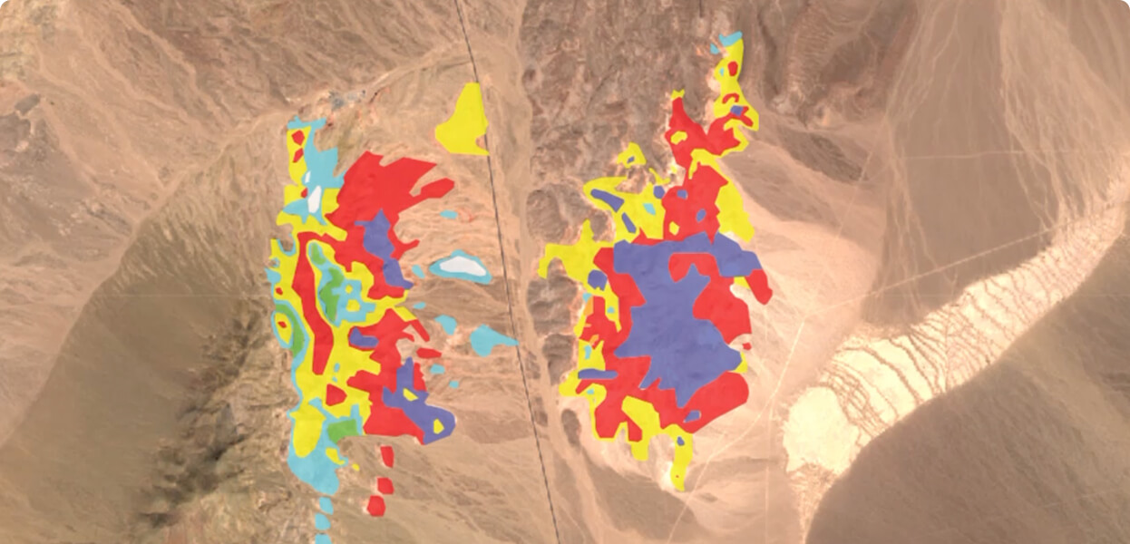
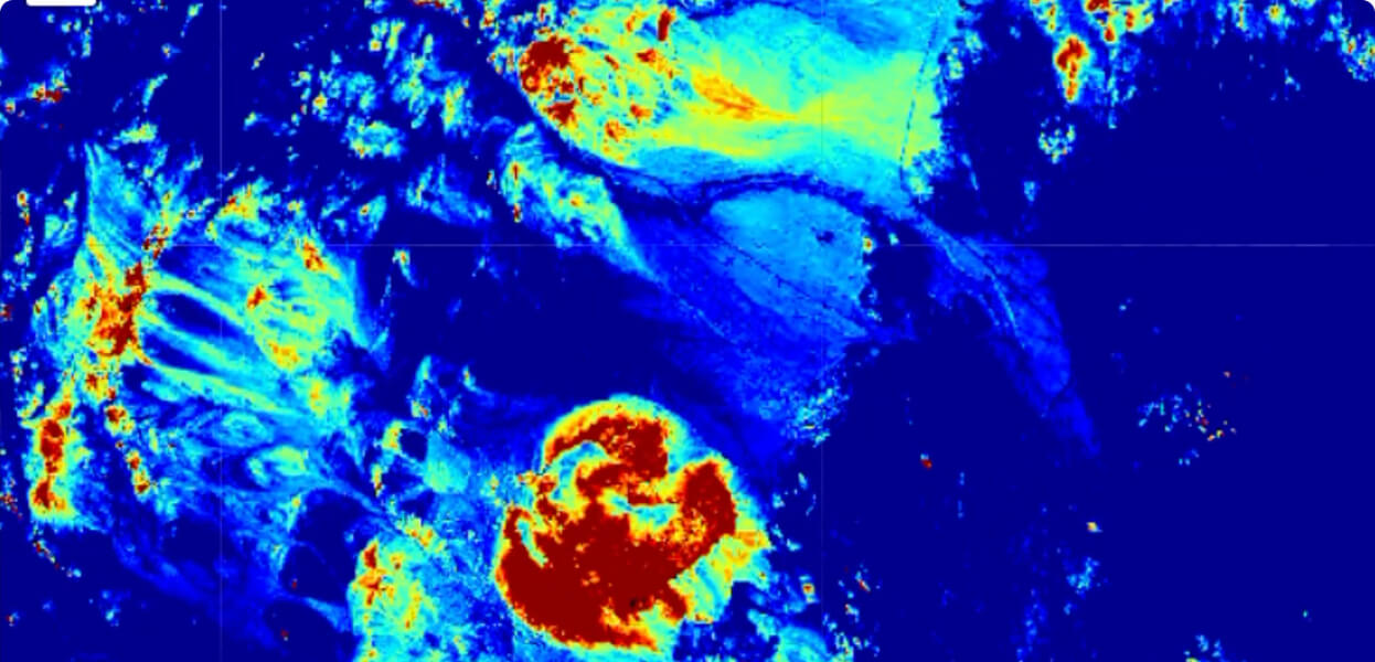
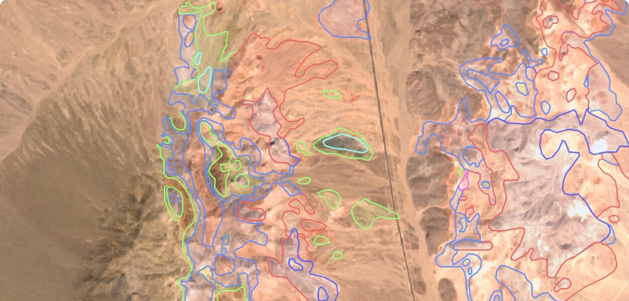
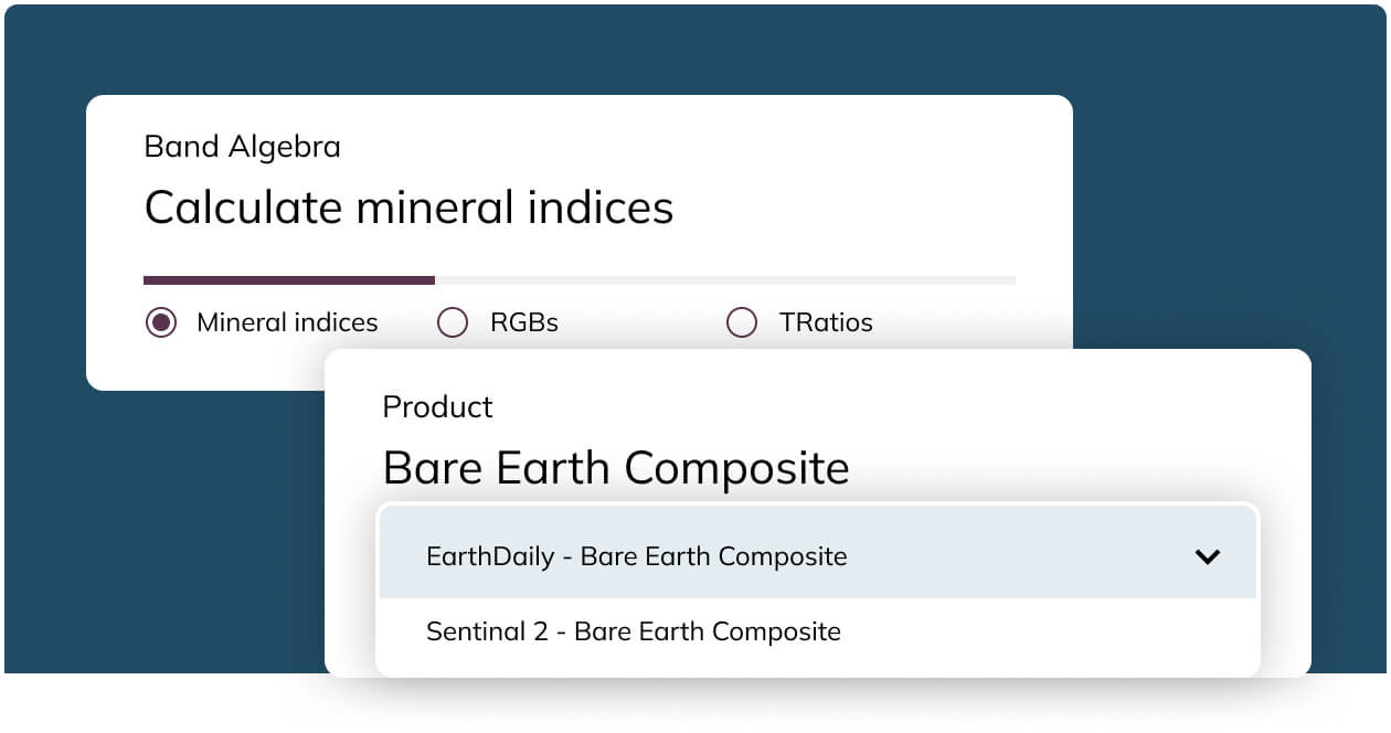
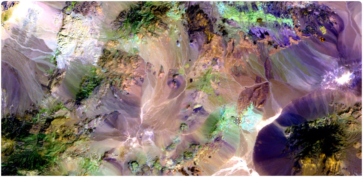
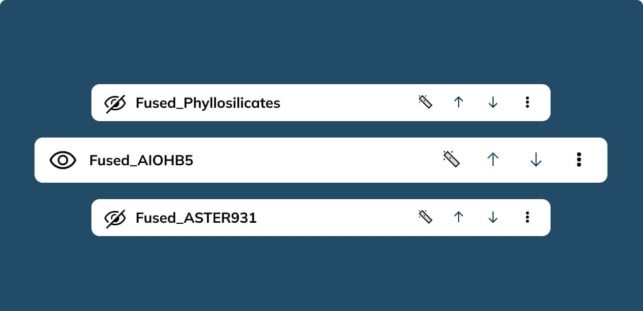
Lithological & Mineral Mapping:
Generate RGB composites, band ratios, and mineral indices for enhanced mineral detection.
.jpg?width=289&height=168&name=Data%20Use%20cases%20(1).jpg)