.jpg?width=289&height=168&name=Data%20Use%20cases%20(1).jpg)
EarthDaily Constellation
Image data subscriptions
Same constellation, same data, two ways to consume it.
Push every pixel into your pipeline, or pull exactly what you need, when you need it.
Two subscriptions, one simple choice
Same constellation, same data,
two ways to consume it.
Everywhere Everyday pushes everything in your AOI to cloud storage, every day.
Flex lets you pull exactly the scenes you need, when you need them.
Everywhere Everyday
For automated, algorithmic insight extraction at scale.
Every pixel, every day → S3 push or API pull.
Best When Machines Read the Data
Continuous ingestion into ML pipelines, change-detection models, and data lakes. The system delivers are eligible pixels in your AOI, daily.
Every pixel in your AOI, everyday.
Delivered to cloud storage or downloaded via API. Designed for algorithmic and automated extraction workflows that benefit from a complete, uninterrupted observation stream.
- Best For
- Algorithmic / automated extraction
- Delivery
- Push to AWS S3, STAC API access
- Cadence
- Every collected scene, every day
Flex
For analyst-led visual inspection & on-demand insight.
Download what you need, when you need it → API & web platform.
Best When Analysts Explore.
Download only what you need
Pick the area, the date, the product. Investigate events, compare scenes, and extract insight through search-driven discovery.
Pick the area, the date, the product.
Download on demand via API or web platform. Designed for analyst-led processes, visual inspection, event investigation, comparative analysis, without ingesting more than you’ll use.
- Best For
- Analyst-led inspection & insight tools
- Delivery
- STAC API · Web platform · Direct download
- Cadence
- On demand, scene-by-scene
Which one?
A 30-second decision.
Three questions tell you which subscription fits.
Choose Everywhere Everyday
Push every pixel into your pipeline, every day.
You need every observation, not just the ones you ask for.
You are running ML or change-detection models against the imagery stream.
You ingest into a data lake, cloud platform, or your own analytics stack.
Choose Flex
Analysts inspect, compare, and download what matters.
You target specific areas, events, or times of interest.
Analysts visually inspect imagery and extract insight scene by scene.
You want a web platform plus APIs, without standing up new ingestion infrastructure.
Built for pipelines
AI-ready, low-latency, API-native delivery.
Every image is radiometrically consistent, geometrically corrected, and ready for direct
integration into our customers' pipelines, no preprocessing tax.
Cloud-optimised GeoTIFF
Per band, ready for direct ingestion into analytics platforms.
STAC-compliant
Industry-standard catalogue integration, discovery without translation.
API-first
STAC API plus direct-to-cloud delivery to your storage of choice.
Under 12 hours
From acquisition to availability, fast enough for the next decision cycle.
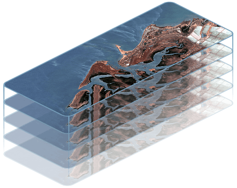
How the data arrives.
Imagery is delivered by scene, organised by swath. Clipped scenes can be reassembled
with later updates via the EarthDaily Python client.
.png "Data-AOI (1)")
- Delivery Format
- GeoTiff
- Swath Width
- 240 km
- Swath Length
- 120 km
- Swath Area
- 28,800 km²
- Scenes Per Swath
- 12
Customers receive the complete swath / satellite pass within their Subscription AOI. Clipped scenes can be brought together with later updates using EarthDaily’s Python client.
Everywhere
Everyday.
Push every pixel collected within your Subscription AOI to your cloud storage, every day, automatically.
What is it?
All daily-collected EarthDaily Constellation imagery products within your Subscription Area of Interest (SAOI) are accessible to download, automatically delivered to your cloud, every day.
Does EWED have a Download Quota?
No. Everywhere Everyday is built for customers who want every pixel collected within their Subscription AOI during the subscription period, there is no quota and no cap on volume within the AOI.
How do I access image products?
Everywhere Everyday is designed as a push to AWS S3 bucket. Imagery lands in your storage automatically, on schedule, and is available via STAC API for catalogue search and discovery.
How is it scoped?
Everywhere Everyday is scoped by the size of your Subscription Area of Interest. The minimum individual Subscription AOI size is 100 km². Volume considerations apply at scale.
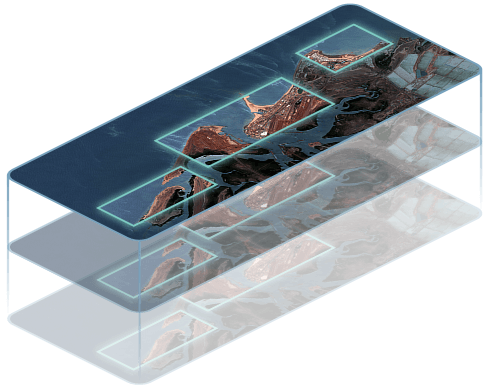
Flex.
Search, discover and download EarthDaily Constellation imagery on demand via API or web platform.
.jpg "Flex downloads only the scenes you select from within the subscription AOI, on demand (1)")
What is it?
Download any daily-collected EarthDaily imagery products within your Subscription Area of Interest, where and when you need them. Flex is built for analyst-led workflows where you pick the scenes that matter.
Does Flex have a Download Quota?
Yes. Flex subscriptions include an annual Download Quota, a pre-purchased volume of imagery you can pull from anywhere within your Subscription AOI over the subscription year.
How do I access image products?
Flex is an API- and platform-first subscription. Use the STAC API, EarthDaily’s Python client, or the web-based platform to search, discover, and download imagery directly.
How is it scoped?
Flex is scoped by both your Subscription AOI and your annual Download Quota. The minimum individual Subscription AOI size is 100 km², and the minimum individual image product download size is 100 km². There is no minimum or maximum requirement for the Download Quota, customers configure it to match their workload.
The acquisition model
No tasking.
And that is the point.
Every satellite collects everything in its 240 km swath on every pass, every day, automatically. You don't ask for an observation, it's already on its way.
No collection planning.
No need to schedule or prioritise. Every pixel in your AOI is collected by default.
Capture key events.
Floods, fires, emergency response. The imagery is already acquired before the request comes in.
Predictable scope.
Subscriptions deliver pixels only over the areas that you need. The boundary stays stable as missions evolve.
Consistent archive.
An always-growing time-series with consistent geometry and radiometry.
Get started
Talk to us about the subscription that fits your workflow.
We’ll size a Subscription AOI for your mission, walk you through delivery into your cloud, and help you decide whether Everywhere Everyday, Flex, or a mix is the right fit. Most customers start with a scoped pilot inside their existing analytics environment.