

.jpg?width=289&height=168&name=Data%20Use%20cases%20(1).jpg)
Spectral Diversity
22 calibrated bands spanning visible, shortwave infrared and thermal, so one pass answers questions about vegetation, moisture, minerals and heat.
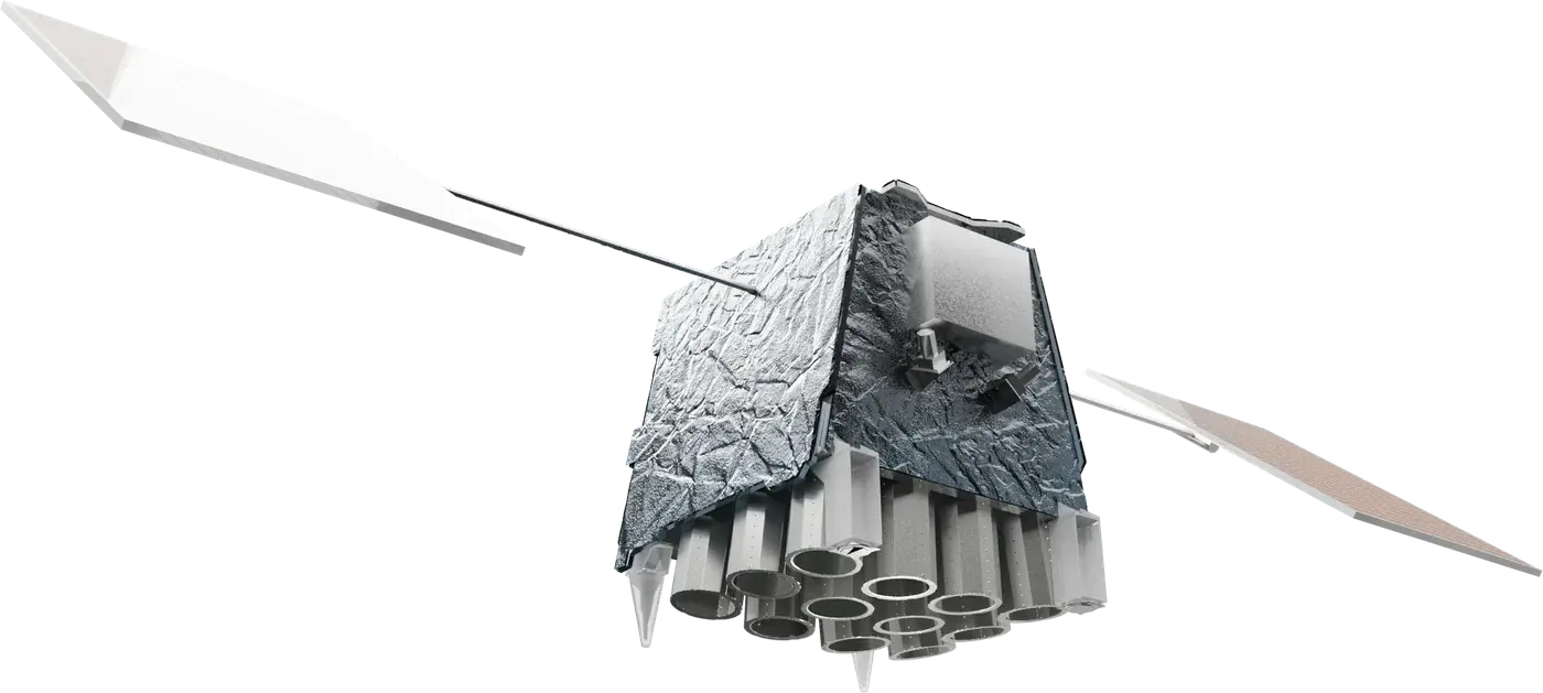
VNIR 5 m
SWIR 95 m
TIR 120 m
Visible and near infrared
Short blue light scatters off fine particles and penetrates clear water, so this band reads aerosols, haze and shallow coastal water.
Visible and near infrared
The blue channel of a true-colour picture. It separates water from land and carries detail in shallow water and atmospheric haze.
Visible and near infrared
Between blue and green, this band follows chlorophyll and suspended sediment in water, where algal blooms and turbidity show first.
Visible and near infrared
Healthy leaves reflect green, so this band peaks over vigorous vegetation and supplies the green channel of a true-colour picture.
Visible and near infrared
Yellow sits where leaves begin to yellow as they senesce, so it helps date crop maturity and separate soil from sparse cover.
Visible and near infrared
Chlorophyll absorbs red light strongly, so healthy canopy reads dark here. It is the red half of every vegetation index.
Visible and near infrared
The first step of the red edge, where reflectance climbs out of the chlorophyll trough. Its slope moves with leaf chlorophyll content.
Visible and near infrared
Midway up the red edge, this band is sensitive to canopy nitrogen and early stress before it is visible to the eye.
Visible and near infrared
The top of the red edge, where leaf structure takes over from pigment. It tracks leaf area and canopy density.
Visible and near infrared
Vegetation scatters near infrared strongly while water absorbs it, so this band carries canopy structure and biomass, and draws a hard line at the water's edge.
Visible and near infrared
Atmospheric water vapour absorbs here, so this band measures the moisture column above each pixel and is used to correct the others.
Shortwave infrared
A second water vapour absorption feature. Read against Water Vapour 1, it sharpens the atmospheric correction.
Shortwave infrared
Liquid water in leaves absorbs at this wavelength, so this band tracks canopy moisture and drought stress before it shows in the visible, and helps separate snow and ice from cloud.
Shortwave infrared
Strong water vapour absorption hides the ground at this wavelength, so only high, thin cirrus reflects. The band flags cloud the other bands cannot see.
Shortwave infrared
Sensitive to soil and leaf moisture and to minerals, this band separates burned ground, bare soil and snow.
Shortwave infrared
Methane absorbs in narrow shortwave lines. Read against a neighbouring band, this channel separates a plume from the ground beneath it. It is carried on board now and publishes at full operations.
Shortwave infrared
The reference channel for methane: close enough in wavelength to share the ground signal, outside the absorption line. It publishes at full operations.
Thermal infrared
Hot targets radiate strongly in the mid-wave infrared, so this band picks out active fire fronts and their intensity. It publishes at full operations.
Thermal infrared
The first of four thermal channels measuring emitted heat, for land surface temperature and evapotranspiration. It publishes at full operations.
Thermal infrared
A second thermal channel. Several thermal bands together separate surface temperature from emissivity. It publishes at full operations.
Thermal infrared
A third thermal channel, used with the others to correct for atmospheric water vapour in temperature retrievals. It publishes at full operations.
Thermal infrared
The longest-wave thermal channel, which completes the split-window set for surface temperature. It publishes at full operations.
Tile colour follows wavelength; the marker sits at the selected band's position on a logarithmic wavelength axis
reserved, publishes at full operations
| Band | Name | Detector | Centre | Bandwidth | Ground sample distance | What it measures |
|---|---|---|---|---|---|---|
| 1 Cst | Coastal | VNIR | 442.5 nm | to confirm | 5 m | Short blue light scatters off fine particles and penetrates clear water, so this band reads aerosols, haze and shallow coastal water. |
| 2 B | Blue | VNIR | 492 nm | to confirm | 5 m | The blue channel of a true-colour picture. It separates water from land and carries detail in shallow water and atmospheric haze. |
| 3 Aq | Aqua | VNIR | 530 nm | to confirm | 5 m | Between blue and green, this band follows chlorophyll and suspended sediment in water, where algal blooms and turbidity show first. |
| 4 G | Green | VNIR | 559.5 nm | to confirm | 5 m | Healthy leaves reflect green, so this band peaks over vigorous vegetation and supplies the green channel of a true-colour picture. |
| 5 Y | Yellow | VNIR | 605 nm | to confirm | 5 m | Yellow sits where leaves begin to yellow as they senesce, so it helps date crop maturity and separate soil from sparse cover. |
| 6 R | Red | VNIR | 664.5 nm | to confirm | 5 m | Chlorophyll absorbs red light strongly, so healthy canopy reads dark here. It is the red half of every vegetation index. |
| 7 Re1 | Red Edge 1 | VNIR | 703.8 nm | to confirm | 5 m | The first step of the red edge, where reflectance climbs out of the chlorophyll trough. Its slope moves with leaf chlorophyll content. |
| 8 Re2 | Red Edge 2 | VNIR | 740 nm | to confirm | 5 m | Midway up the red edge, this band is sensitive to canopy nitrogen and early stress before it is visible to the eye. |
| 9 Re3 | Red Edge 3 | VNIR | 781.5 nm | to confirm | 5 m | The top of the red edge, where leaf structure takes over from pigment. It tracks leaf area and canopy density. |
| 10 Nir | Near Infrared | VNIR | 864 nm | 36 nm | 5 m | Vegetation scatters near infrared strongly while water absorbs it, so this band carries canopy structure and biomass, and draws a hard line at the water's edge. |
| 11 Wv1 | Water Vapour 1 | VNIR | 912 nm | to confirm | 5 m | Atmospheric water vapour absorbs here, so this band measures the moisture column above each pixel and is used to correct the others. |
| 12 Wv2 | Water Vapour 2 | SWIR | 945 nm | to confirm | 95 m | A second water vapour absorption feature. Read against Water Vapour 1, it sharpens the atmospheric correction. |
| 13 Sw1 | SWIR 1 | SWIR | 1245 nm | to confirm | 95 m | Liquid water in leaves absorbs at this wavelength, so this band tracks canopy moisture and drought stress before it shows in the visible, and helps separate snow and ice from cloud. |
| 14 Cir | Cirrus | SWIR | 1375 nm | to confirm | 95 m | Strong water vapour absorption hides the ground at this wavelength, so only high, thin cirrus reflects. The band flags cloud the other bands cannot see. |
| 15 Sw2 | SWIR 2 | SWIR | 1610 nm | to confirm | 95 m | Sensitive to soil and leaf moisture and to minerals, this band separates burned ground, bare soil and snow. |
| 16 Ch1 | Methane 1 | SWIR | reserved | reserved | 95 m | Methane absorbs in narrow shortwave lines. Read against a neighbouring band, this channel separates a plume from the ground beneath it. It is carried on board now and publishes at full operations. |
| 17 Ch2 | Methane 2 | SWIR | reserved | reserved | 95 m | The reference channel for methane: close enough in wavelength to share the ground signal, outside the absorption line. It publishes at full operations. |
| 18 Fir | Wildfire | TIR | reserved | reserved | 120 m | Hot targets radiate strongly in the mid-wave infrared, so this band picks out active fire fronts and their intensity. It publishes at full operations. |
| 19 Th1 | Thermal 1 | TIR | reserved | reserved | 120 m | The first of four thermal channels measuring emitted heat, for land surface temperature and evapotranspiration. It publishes at full operations. |
| 20 Th2 | Thermal 2 | TIR | reserved | reserved | 120 m | A second thermal channel. Several thermal bands together separate surface temperature from emissivity. It publishes at full operations. |
| 21 Th3 | Thermal 3 | TIR | reserved | reserved | 120 m | A third thermal channel, used with the others to correct for atmospheric water vapour in temperature retrievals. It publishes at full operations. |
| 22 Th4 | Thermal 4 | TIR | reserved | reserved | 120 m | The longest-wave thermal channel, which completes the split-window set for surface temperature. It publishes at full operations. |
Signal scales with collecting area, so it falls with the square of pixel size
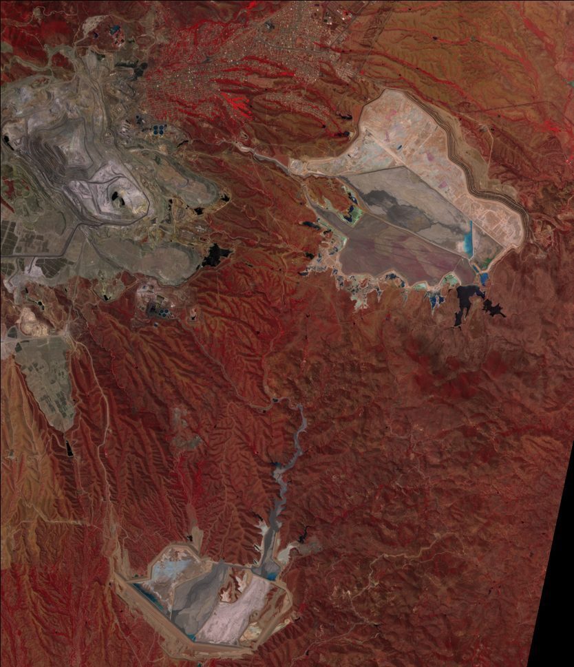
EarthDaily imagery: Cananea, Mexico. Near-infrared false colour.
Relative light collected per pixel 100%
Noise floor Low
5 m is where EarthDaily's visible and near-infrared bands sit: fine enough to resolve a field, a vessel or a construction site, with a full photon budget behind every pixel.
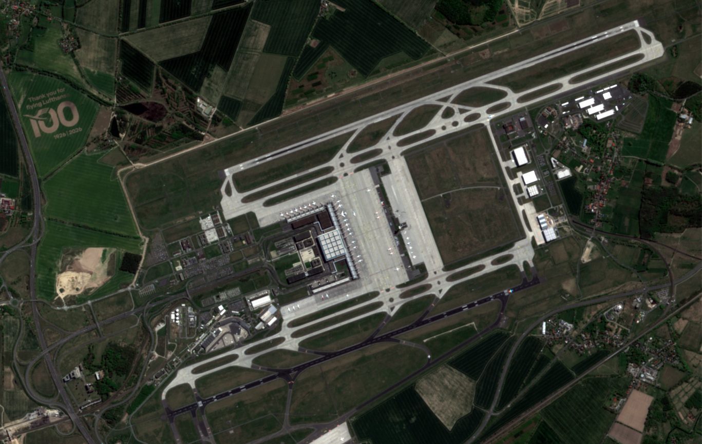
Nadir. Ground point holds its pixel.
EarthDaily imagery: Berlin, Germany.
Straight down. The footprint is square, buildings sit on their own footprint, and pixels register to the same ground position on every pass.
Footprint 240 km, undistorted
Tilted. The footprint stretches, tall features lean away from the sensor, and the same ground point lands on different pixels from pass to pass.
Footprint stretched, features leaning
Both strips drawn to the same ground scale
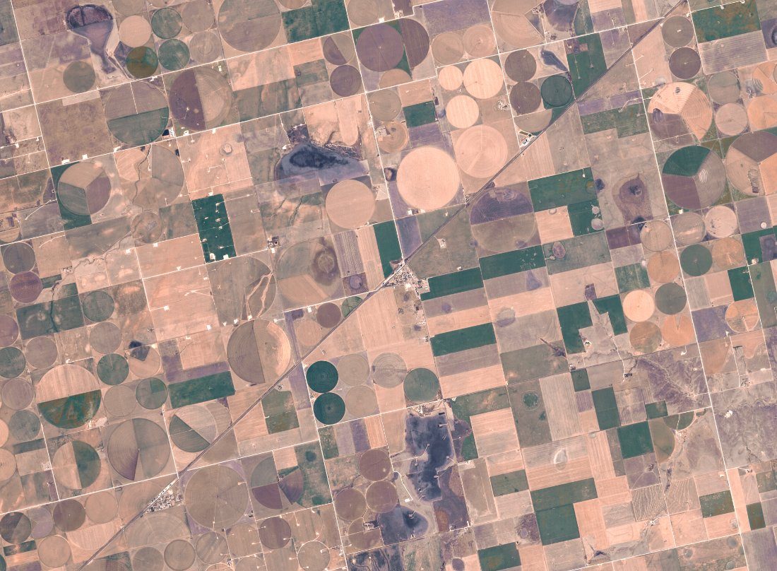
EarthDaily imagery: centre pivot cropland, North America.
Ground width per pass, drawn to scale on a 0 to 360 km ruler: EarthDaily, 240 km; Tasked strip, 20 km.
240 km
Swath width
Identical for the VNIR, SWIR and TIR bands.
92%
Landmass daily
Average systematic coverage with nine satellites, excluding Antarctica.
9 + 1
Satellites
Nine operational, one in-orbit spare.
0
Tasking requests
Landmass and coastal waters to 100 km offshore are collected by plan.