Primary: Top-of-Atmosphere Data for Teams That Demand Full Processing Control
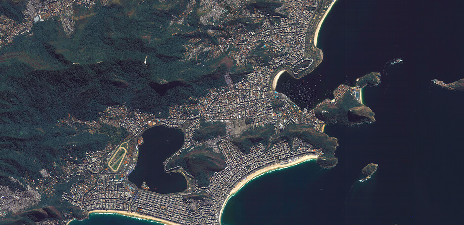
Primary delivers top-of-atmosphere satellite imagery built for organizations with robust remote sensing teams who require complete control over their processing pipelines. With 11 spectral bands, precise geometric and radiometric correction, and L1 calibration, Primary provides the foundational data that powers custom atmospheric correction, algorithm development, and specialized analytical workflows.
The Complete Foundation for Custom Remote Sensing
Purpose-built for advanced remote sensing operations, Primary provides research institutions, government agencies, defense organizations, and analytics companies with the unprocessed spectral fidelity needed to implement proprietary processing chains. Maximum bands, precise calibration, complete control.
Tailored Spectral Access Primary provides all 11 constellation bands, including the Coastal band at 443nm, for analysts who need complete spectral access to run their own atmospheric correction or build specialized indices beyond standard land applications.
Top-of-Atmosphere Calibration L1 processing preserves top-of-atmosphere radiance values with precise radiometric calibration. Your team applies atmospheric correction algorithms matched to your specific applications, sensors, and environmental conditions. No black-box processing decisions imposed on your data.
Built on the EarthDaily Constellation Powered by the revolutionary 10-satellite EarthDaily Constellation, Primary delivers market-leading signal-to-noise ratios and geometric precision. Daily global coverage with consistent acquisition geometry. Ten years of imaging continuity for long-term research programs and operational monitoring.
Tailored Spectral Information: All 11 bands including Coastal (443nm) for atmospheric characterization, aquatic remote sensing, and specialized vegetation indices—the full sensor output without band selection decisions made for you.
Precise Calibration Foundation: Rigorous geometric and radiometric correction ensures reliable, repeatable measurements across the constellation—essential for time-series analysis, change detection, and quantitative remote sensing.
Algorithm Development Ready: Consistent, well-characterized data supports development and validation of new remote sensing algorithms, machine learning models, and automated detection systems.
Two subscriptions, one simple choice Same constellation, same data, two ways to consume it.
Everywhere Everyday pushes everything in your AOI to cloud storage, every day. Flex lets you pull exactly the scenes you need, when you need them.
Choose Everywhere Everyday
Push every pixel into your pipeline, every day.
You need every observation, not just the ones you ask for.
You are running ML or change-detection models against the imagery stream.
You ingest into a data lake, cloud platform, or your own analytics stack.
Choose Flex
Analysts inspect, compare, and download what matters.
You target specific areas, events, or times of interest.
Analysts visually inspect imagery and extract insight scene by scene.
You want a web platform plus APIs, without standing up new ingestion infrastructure.
Core Capabilities From Sensor to Science-Ready Delivery
Primary data undergoes rigorous calibration while preserving the top-of-atmosphere measurements your processing chains require.
Radiometric Calibration Precise sensor-level calibration converts raw digital numbers to calibrated radiance values. Cross-constellation calibration ensures consistent radiometric response regardless of which satellite captures the imagery.
Geometric Correction Accurate orthorectification using precision ephemeris and terrain models delivers reliable geographic positioning. Geometric accuracy supports multi-temporal analysis and integration with other geospatial datasets.
Band Co-registration Precise alignment across all 11 spectral bands ensures accurate multi-band analysis, index calculation, and spectral unmixing applications.
Seamless Integration with Processing Infrastructure
Standard Data Formats: GeoTIFF delivery works with GIS platforms, remote sensing toolchains, and custom analytics pipelines
STAC-Compliant Catalog: SpatioTemporal Asset Catalog implementation enables standardized discovery and access across operational systems
Cloud-Native Access: Cloud Optimized GeoTIFFs stream directly into processing environments for rapid analysis
API Integration: RESTful endpoints and a Python client library support automated ingestion into your processing workflows.
Coverage Area: Global land, coastal, and maritime regions
Revisit Frequency: Daily at consistent local solar time
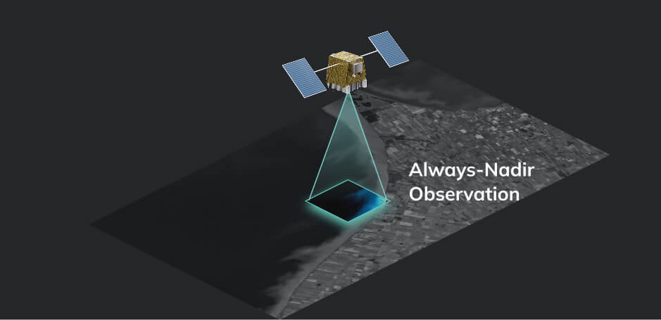
Viewing Geometry: Nadir (consistent look angle across constellation)
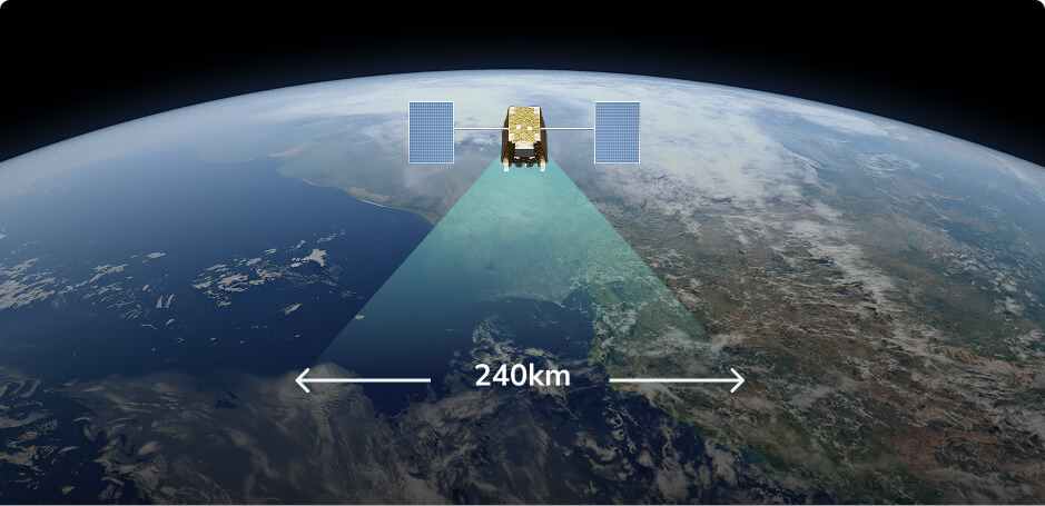
Swath Width: 240 km per satellite pass
Archive: Expanding historical archive for time-series analysis
Spectral Bands
Visible
Coastal
Blue
Aqua
Green
Yellow
Near Infrared
Red
Red Edge 1
Red Edge 2
Red Edge 3
Near Infrared
Shortwave Infrared
Water Vapour 1
Water Vapour 2
SWIR 1
Cirrus
SWIR 2
Methane 1
Methane 2
Thermal Infrared
Wildfire
TIR 1
TIR 2
TIR 3
TIR 4
Primary Features & Capabilities Precise Calibration. Complete Control.
11-Band Multispectral Imaging:
Visible and near-infrared coverage from the Coastal band (443 nm), including three red edge bands
16-Bit Radiometric Depth:
Efficient data architecture with precise calibration for quantitative remote sensing applications
L1 Processing Level:
Radiometrically and geometrically corrected top-of-atmosphere data, ready for your own atmospheric correction and processing pipelines
Cloud Mask Included:
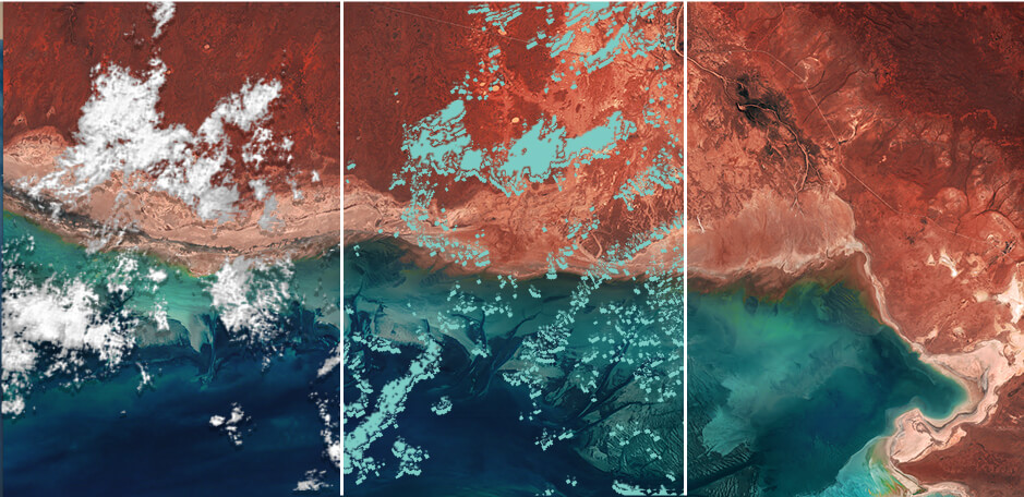
Quality layer identifies cloud-contaminated areas to maximize usable coverage and automate data filtering
Consistent Acquisition Geometry:
Fixed local solar time and nadir viewing angle across acquisitions enables reliable temporal analysis and change detection.
Wide-Area Swath
240 km swath width provides efficient coverage of large land, coastal, and maritime regions
FAQs
What is Primary?
Primary is EarthDaily's top-of-atmosphere satellite data product, delivering all 11 spectral bands from the EarthDaily Constellation with precise radiometric and geometric calibration. It is built for organizations that require complete control over their own processing pipelines, from atmospheric correction through to final analysis.
Why does Primary include the Coastal band?
The Coastal band at 443nm is the primary input for atmospheric characterization, aerosol retrieval, and aquatic remote sensing. Primary retains the full 11-band dataset so teams can run their own correction workflows and build specialized aquatic and atmospheric models without constraints imposed by upstream processing decisions.
What processing level is Primary data?
Primary provides L1 calibrated data, radiometrically and geometrically corrected top-of-atmosphere radiance. This preserves original sensor measurements while ensuring precise calibration, giving your team full control to apply atmospheric correction optimized for your specific applications.
What calibration information is provided?
Primary includes complete radiometric calibration coefficients, spectral response functions, and geometric correction parameters in the metadata, supporting quantitative analysis and custom algorithm development.
How does Primary support atmospheric correction development?
Top-of-atmosphere data combined with the Coastal band gives teams the inputs needed to develop, validate, and refine their own atmospheric correction algorithms. Consistent cross-constellation calibration provides a reliable foundation for testing and iteration.
Is historical data available?
Yes. Primary includes access to the expanding EarthDaily archive with consistent calibration, enabling historical analysis for both research and operational applications.
How is Primary data delivered?
Primary is delivered through cloud-native infrastructure via API access, supporting GeoTIFF and Cloud Optimized GeoTIFF formats with STAC-compliant cataloging and Python client library integration.
Access Top-of-Atmosphere Data with Full Processing Control
Power your custom processing with calibrated, top-of-atmosphere satellite data. Explore how Primary delivers the spectral fidelity and precise calibration your processing chains demand:
Access sample data through EarthPlatform to evaluate quality and integration
Explore spectral coverage across your application's critical wavelengths
Test API integration with the earthdaily-python-client and your existing workflows
Configure coverage tailored to your areas of operational interest


.jpg?width=289&height=168&name=Data%20Use%20cases%20(1).jpg)