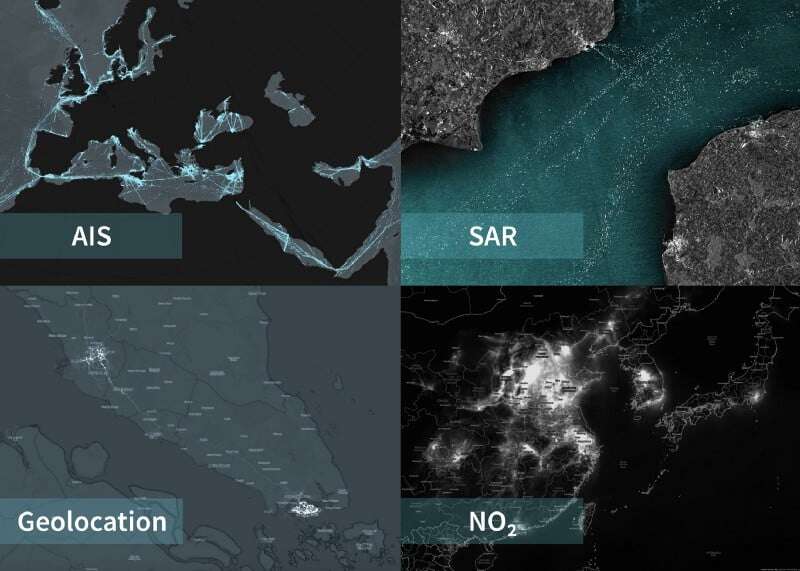
.jpg?width=289&height=168&name=Data%20Use%20cases%20(1).jpg)

Predicting Vegetation Indices Using Radar Imagery By Terry Conlon — Ph.D. Student in the Sustainable...
Predicting Vegetation Indices Using Radar Imagery By Terry Conlon — Ph.D. Student in the Sustainable...
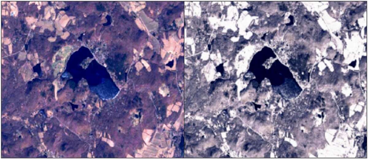
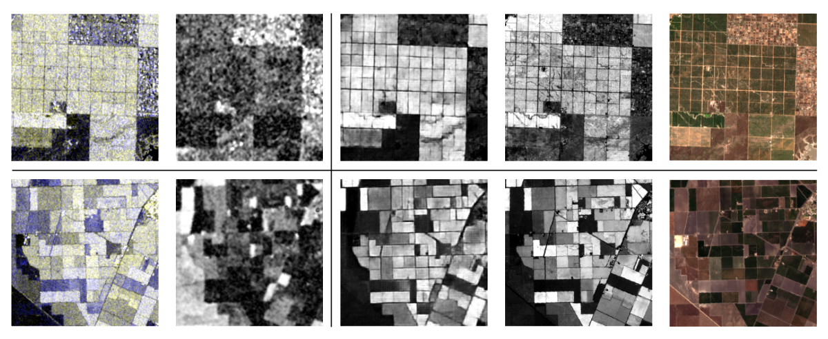
Generating realistic but synthetic images to test automated change detection algorithms By Christoph...
Descartes Labs opens up our second round of applications for free platform API access to individuals...
We will recover, but how will we know when? Updated with aggregated mobility data from Friday, June ...
Geospatial data and modeling tools in one package At Descartes Labs, we’ve been working at scale for...
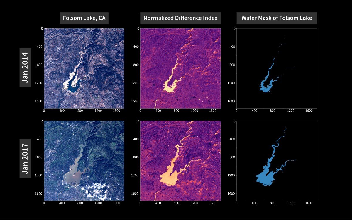
Creating statistical models of reservoir storage and hydropower generation using the Descartes Labs ...
For a fun piece to chew on during the Thanksgiving holiday, National Geographic asked Descartes Labs...
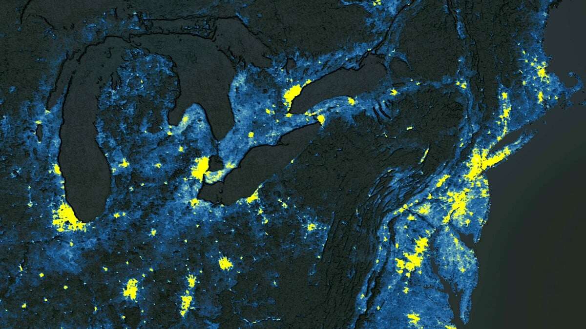
The Descartes Labs Platform supercharges the development of an urban heat island layer across 14,000...
Descartes Labs aims to improve science around the world with free Platform API access for individual...
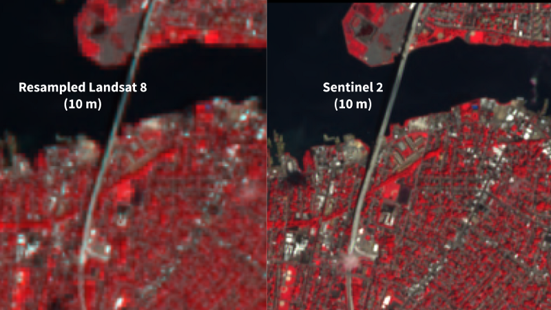
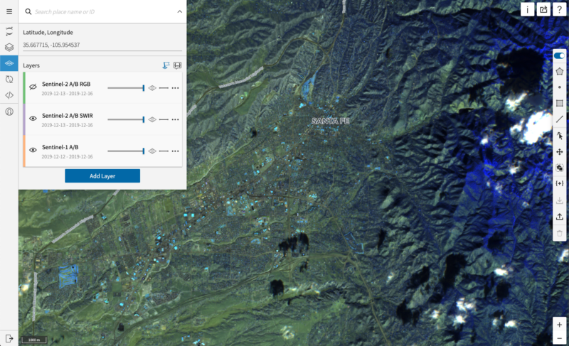
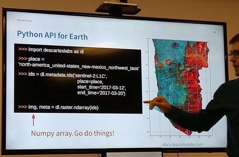
If you’ve ever gone online to find your favorite spot on a map and, upon zooming in, you were left d...
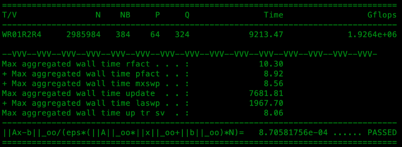
Descartes Labs builds one of the world’s TOP500 fastest supercomputers and the first system on the l...

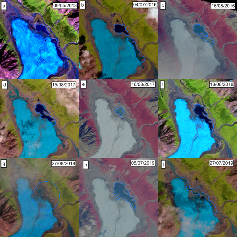
In February of 2015, after years of delays (including seven that saw the project literally sitting i...