.jpg?width=289&height=168&name=Data%20Use%20cases%20(1).jpg)

Over the past week, we’ve watched in horror as wildfires tore across Northern California. With a dee...
Over the past week, we’ve watched in horror as wildfires tore across Northern California. With a dee...
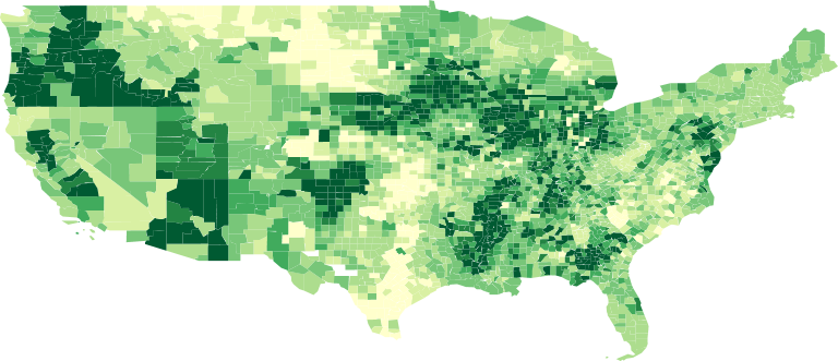
A choropleth map is a “thematic map in which areas are shaded or patterned in proportion to the meas...
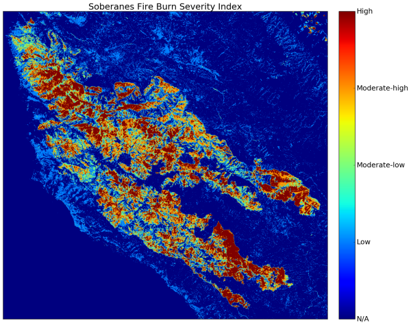
In the wake of yet another season of significant wildfire activity across the US and in particular C...
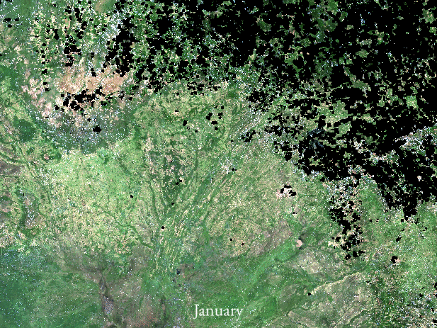
There are at the very least six separate global land cover mapping efforts. The European Space Agenc...
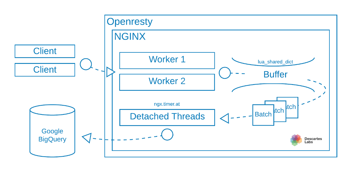
Here at Descartes Labs, we have been using the microservice architecture in building out our platfor...
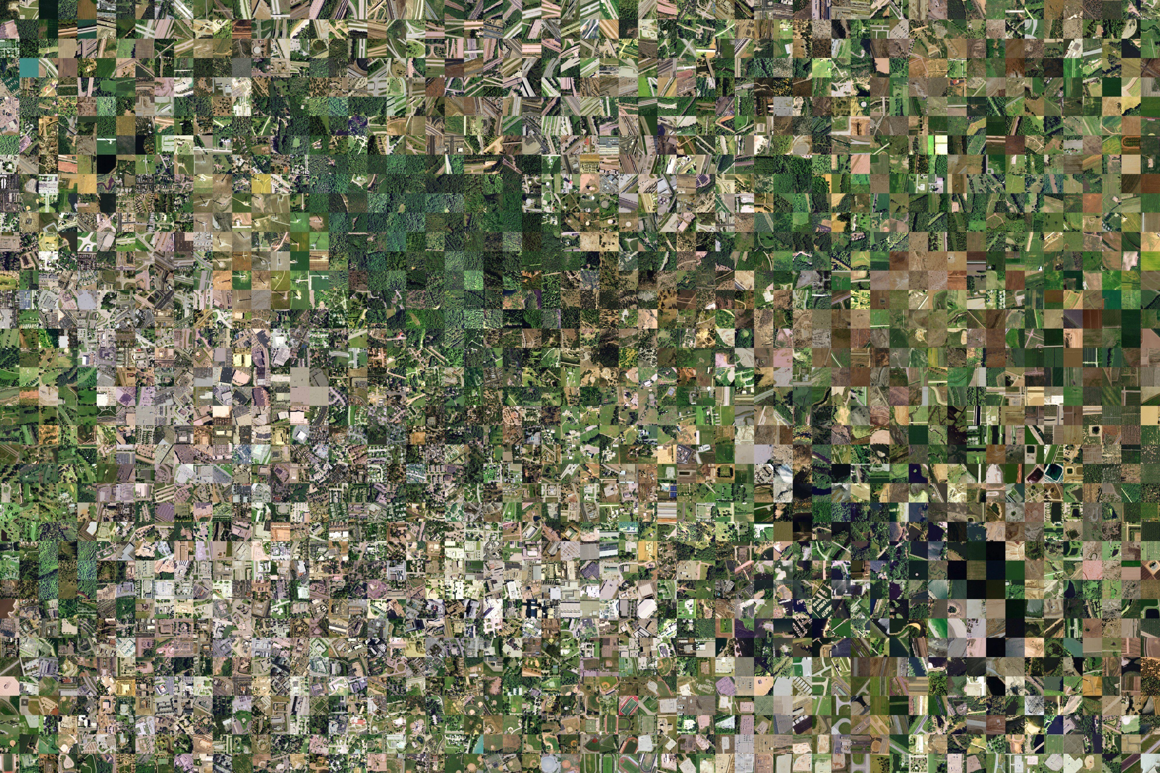
Last summer a group of artists and coders created Terrapattern, a ground-breaking demonstration of v...
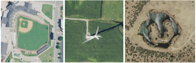
Today, we’re unveiling a technology demonstration of machine learning at global scale, which we call...
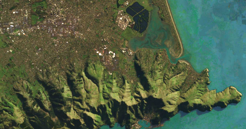
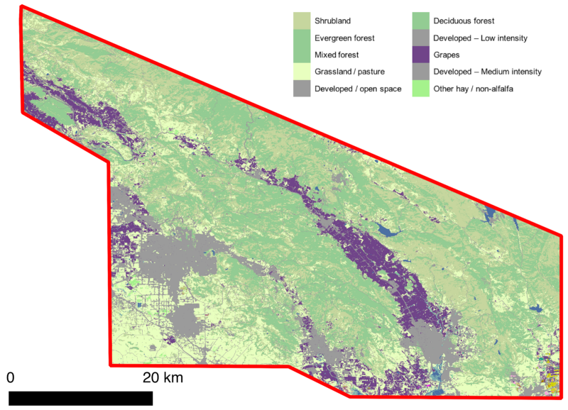
Today we’re excited to share three new satellite imagery-based maps of the earth, made here at Desca...