.jpg?width=289&height=168&name=Data%20Use%20cases%20(1).jpg)

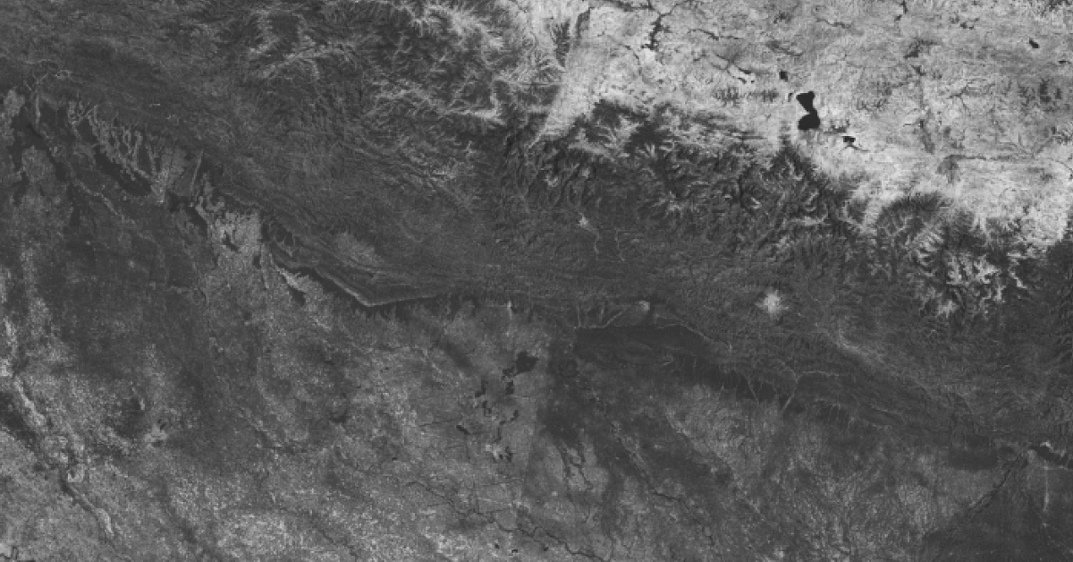
This is Part 4 of a technical series focusing on Descartes Labs’ global SAR processing capabilities....
This is Part 4 of a technical series focusing on Descartes Labs’ global SAR processing capabilities....
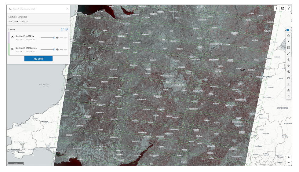
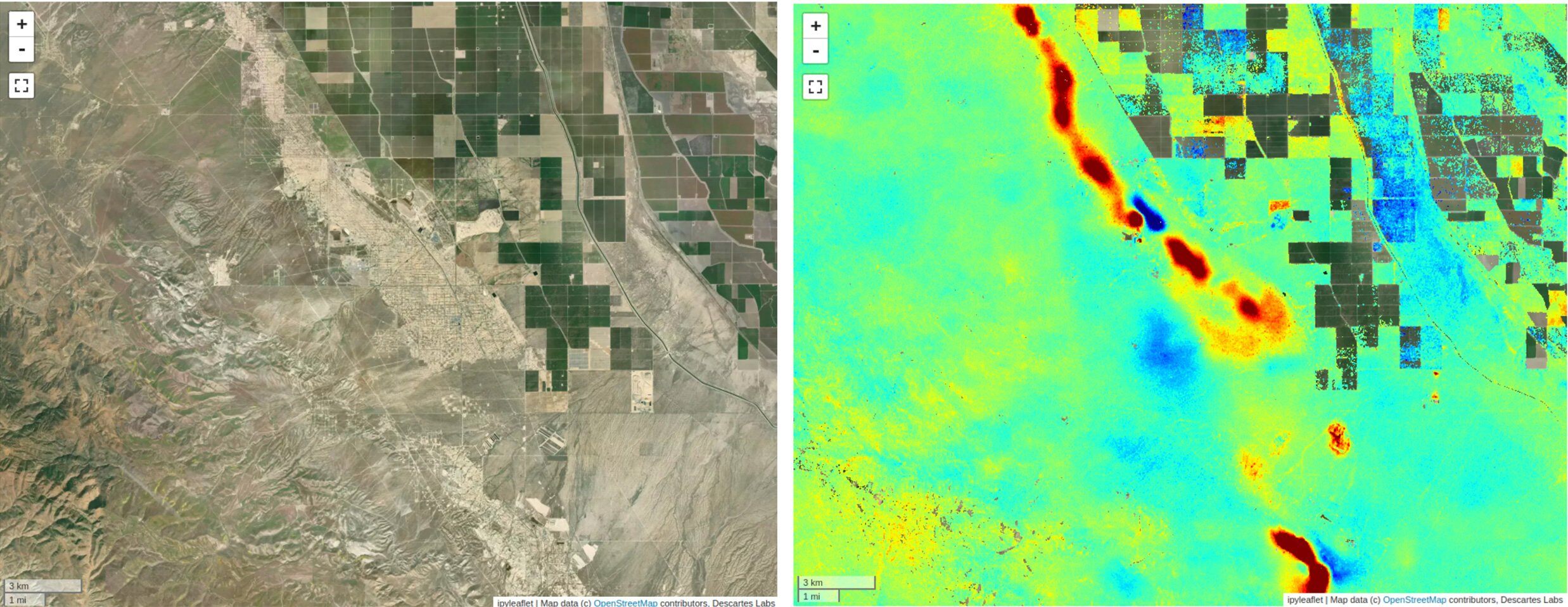
This is Part 3 of a technical series focusing on Descartes Labs’ global SAR processing capabilities....
This is Part 2 of a technical series focusing on Descartes Labs’ global SAR processing capabilities....
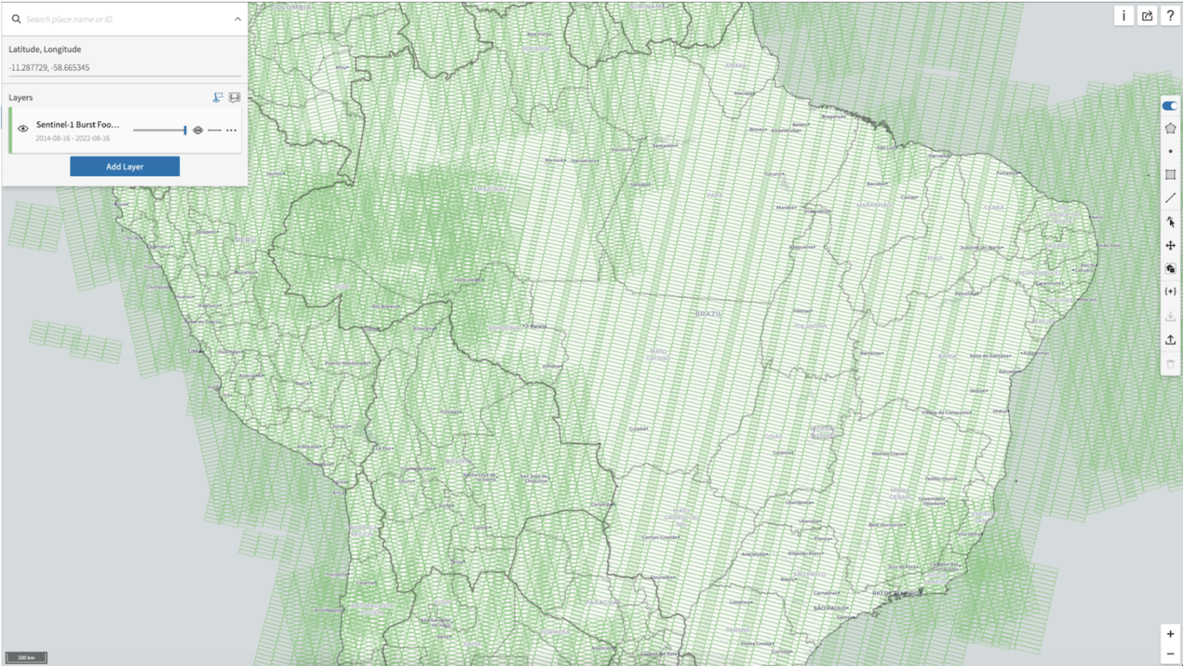
Welcome to Part 1 of a technical series focusing on Descartes Labs’ global SAR processing capabiliti...
Welcome to the first post in a technical series highlighting the capabilities at Descartes Labs (DL)...
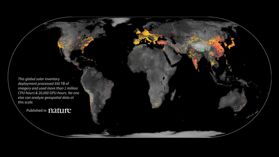
Access the original article in Nature and explore the full dataset on ResourceWatch from WRI.
Understanding the different types of data used in geospatial modeling is essential for those learnin...
At Descartes Labs, we often dive deep into the technical aspects of geospatial intelligence, the rig...
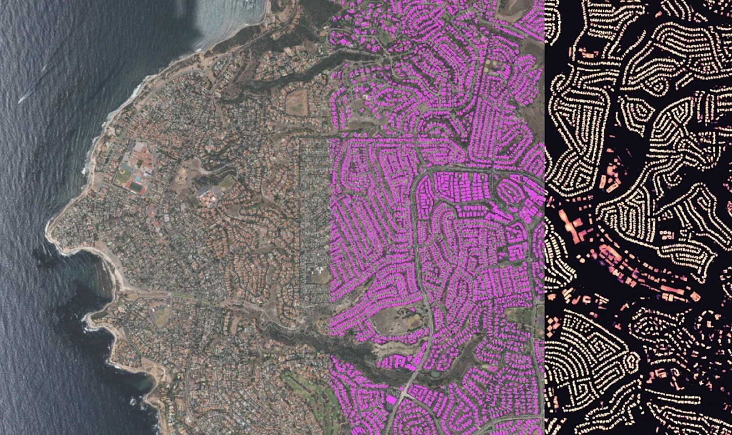
Introduction In this blog, we will show how to go from zero data to thousands of annotated satellite...
Today, we’re excited to announce a new partnership with Satellogic that brings sub-meter, high-frequ...
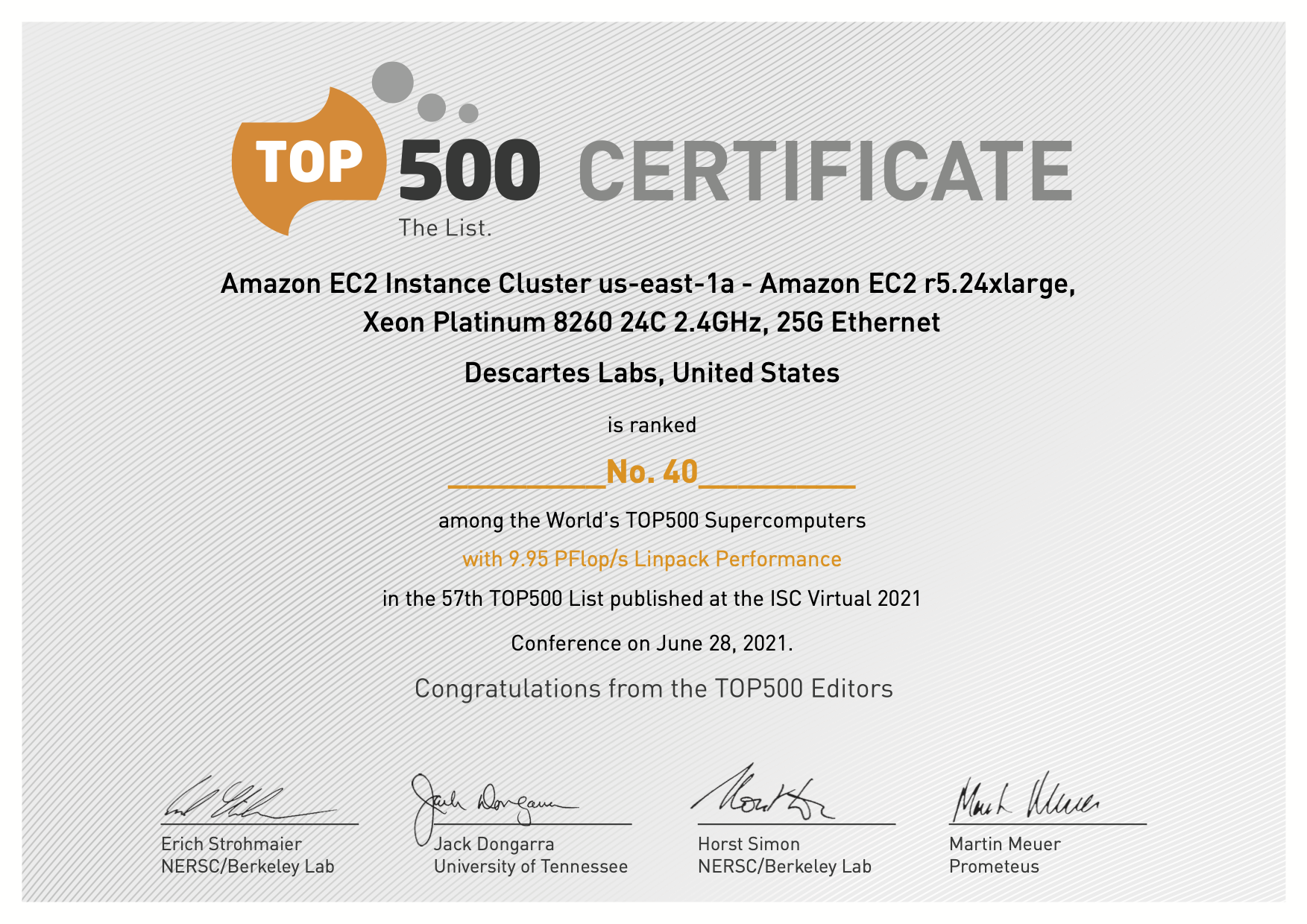
SANTA FE--(Newswire.com)--Jun. 28, 2021-- Descartes Labs, Inc. today announced a new cloud supercomp...