Climate Change
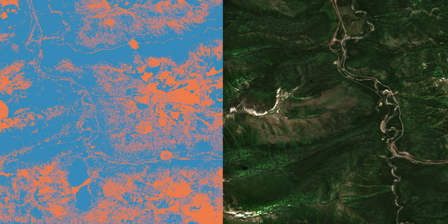
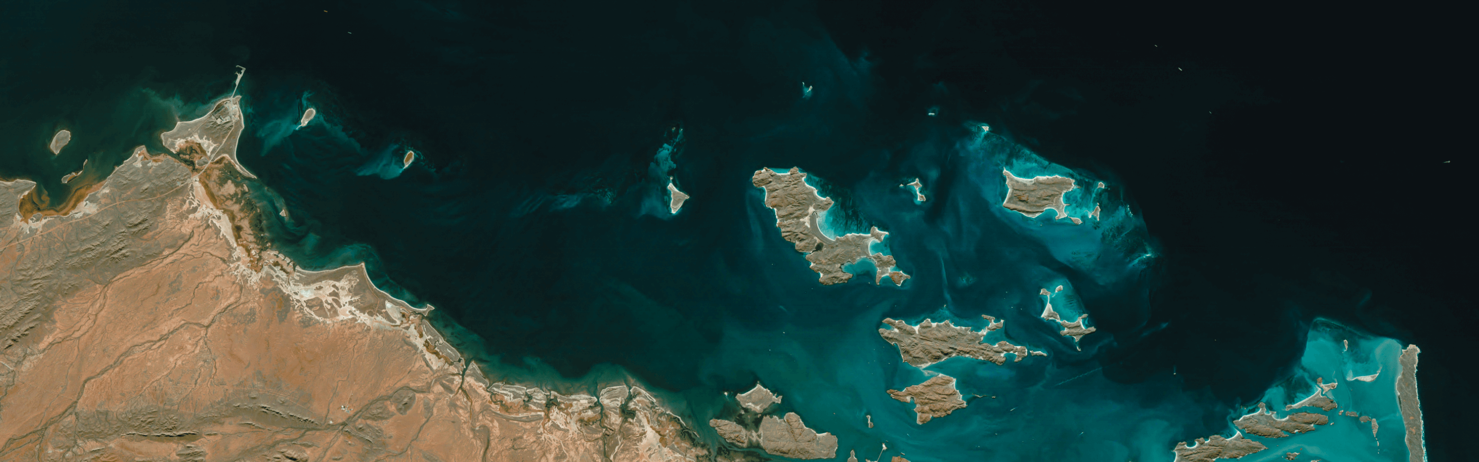
Earth observation data can empower governments and corporations to better manage operations and risks associated with extreme weather events and changes in climate conditions, particularly by monitoring and measuring impacts of droughts, floods, hurricanes, and landslides.

All these efforts, from modelling to prediction, advisory to mitigation, require timely, accurate measurements. Upon the launch of EarthDaily Constellation, we will be ready to take change detection to the next level with Earth Observation data that boasts the best quality, the broadest coverage, and the highest revisit frequency.
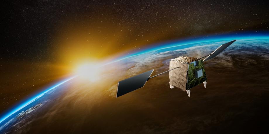
Experience the EarthDaily Constellation
What does the world’s most advanced change detection system look like?
The unprecedented insights unlocked by our constellation will enable our customers to make informed decisions with the magnitude of accuracy and efficiency unseen before.
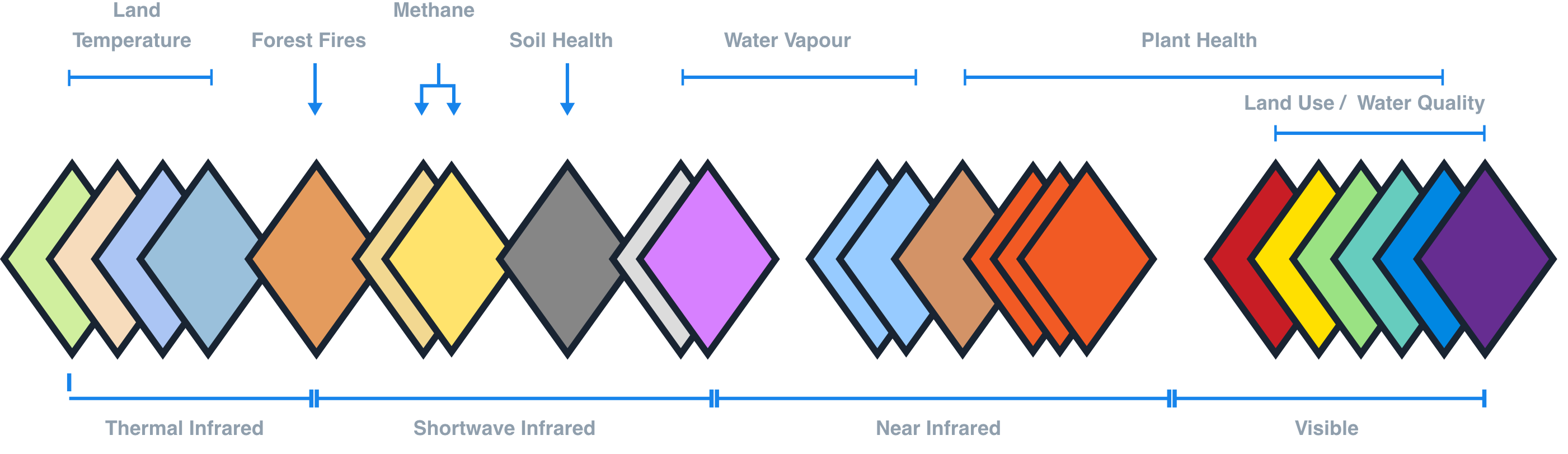
22 Spectral Bands
Tailored to give you the best Analysis Ready Data
EarthDaily’s unique data source allows us to solve the following challenges:
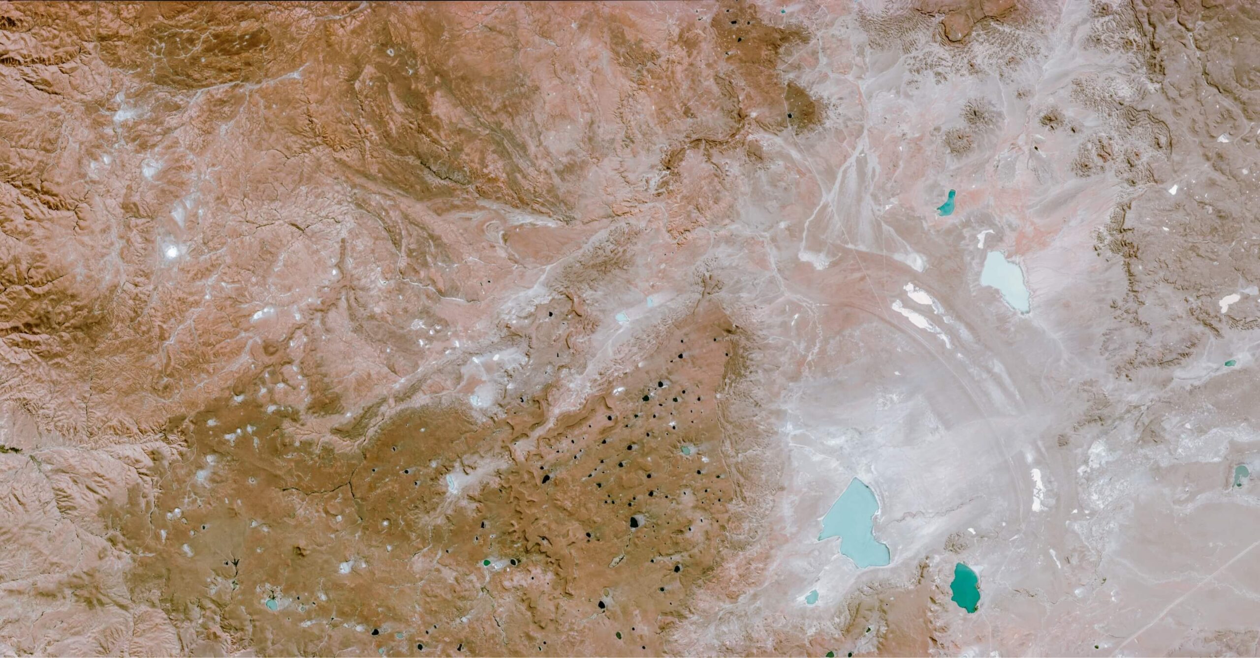
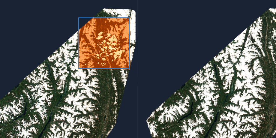
Drought response
Climate change has caused droughts to become longer and more severe. Our satellite data will help identify crucial drought indicators in vegetation health, soil moisture and river and reservoir water levels. Such impact analysis plays a vital role in detecting vulnerable areas, assessing risks, and curbing further damage.
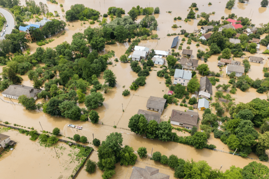
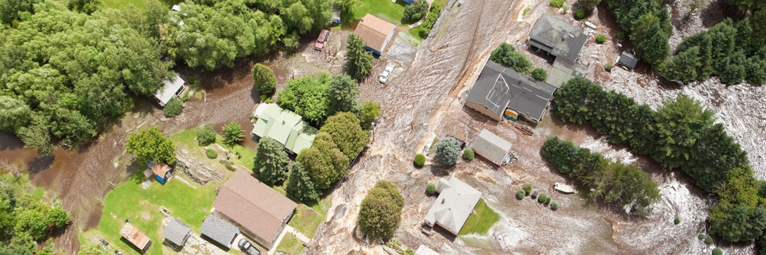
Flood mapping
Floods have become a major threat to crops (agriculture), water quality (natural resources), aquatic ecosystems, roads (infrastructure) and soil erosion due to their increasing frequency and magnitude. All countries, especially those developing, are able to alleviate the impacts of floods with our analytics-ready satellite data.
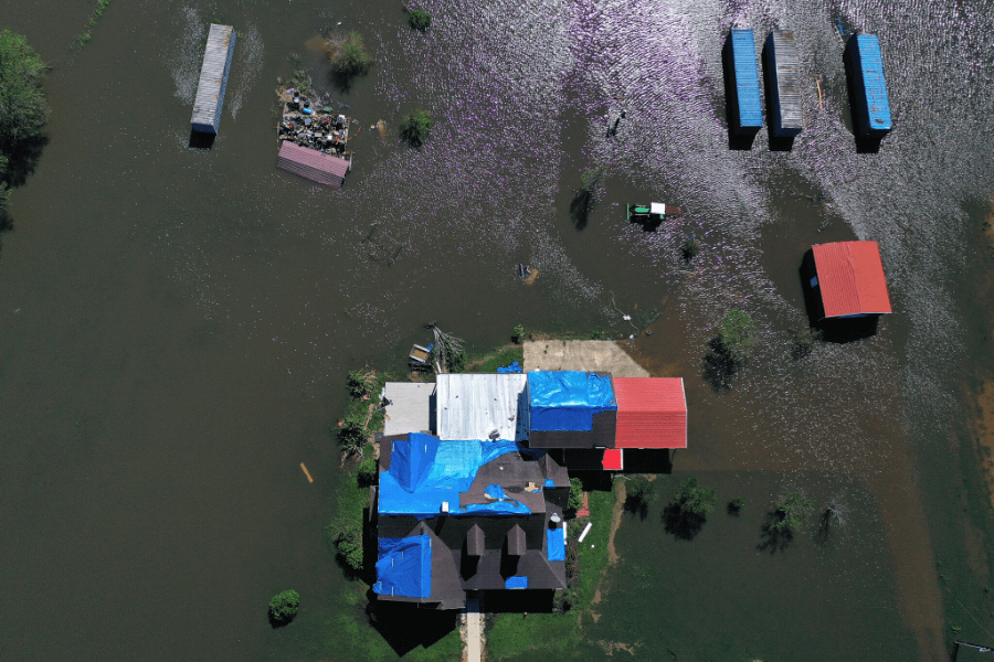
Hurricane impact
Insights derived from our satellite data can help build models to automatically identify whether a given region is to contain damage and even to what extent, including the number of buildings and the condition of the roads. Such assessment is critical to emergency managers and first responders.
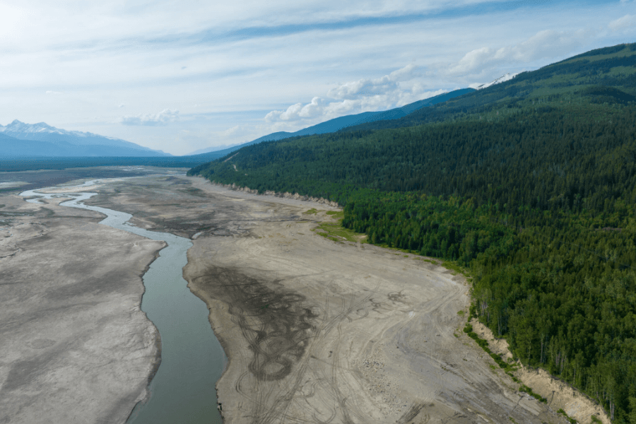
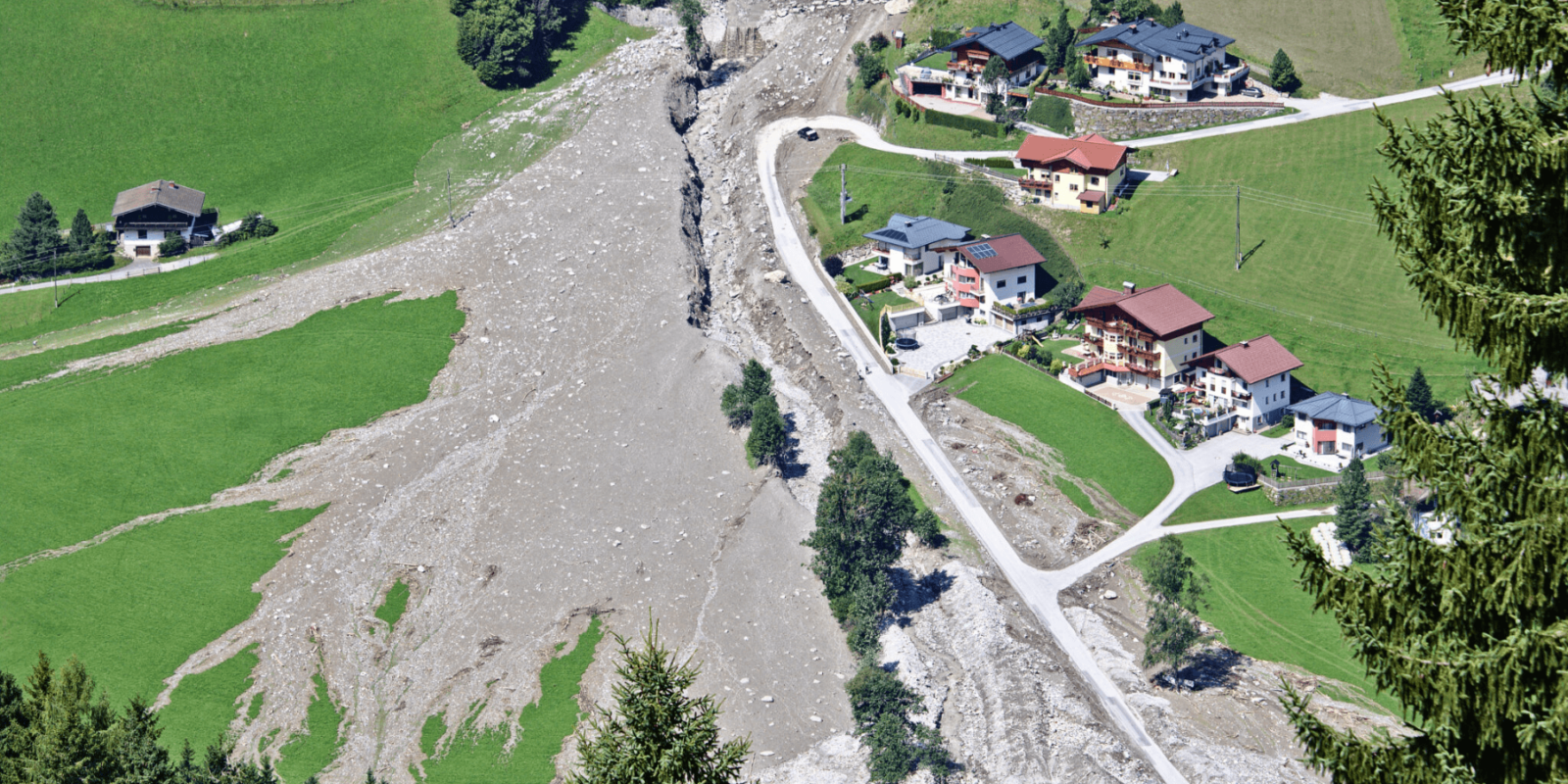
Landslide and debris flows
Intense rain can trigger landslides that merge into debris flows filling neighboring communities with mud and rocks. Data from our satellites can help assess the extent of the impact as the debris flows can potentially end up blocking coastal roads or damming entire rivers, resulting in various infrastructure related hazards.
Foundational Partner Program
EarthDaily is on a mission to bring the world’s most advanced change detection system to market, providing high accuracy broad coverage earth observation data that helps unlock valuable insights far beyond what is economically feasible or technically possible with currently available commercial EO offerings. We are building a global network of foundational partners that are committed to working with EarthDaily in pioneering our next-generation earth observation technology to build innovative and valuable solutions for their customers.
- The global average temperature has increased by 1.1°C since the pre-industrial era, and is projected to increase by 1.5°C within the next two decades.
- 700+ million of the population will be at-risk of being displaced as a result of drought by 2030.
Products & Services
EarthDaily is on a mission to empower the entire Space and Earth Observation industry with the most meaningful data and insights,
much needed for decision-making, quantifying, and managing risk across all sectors and industries.
Not all data is created equal. Don’t settle for anything less than what EarthDaily Analytics offers: accuracy, quality and coverage. Join us on the mission to solve the biggest challenges in climate change.
Making a difference starts here.