Forestry, Natural Resource Management
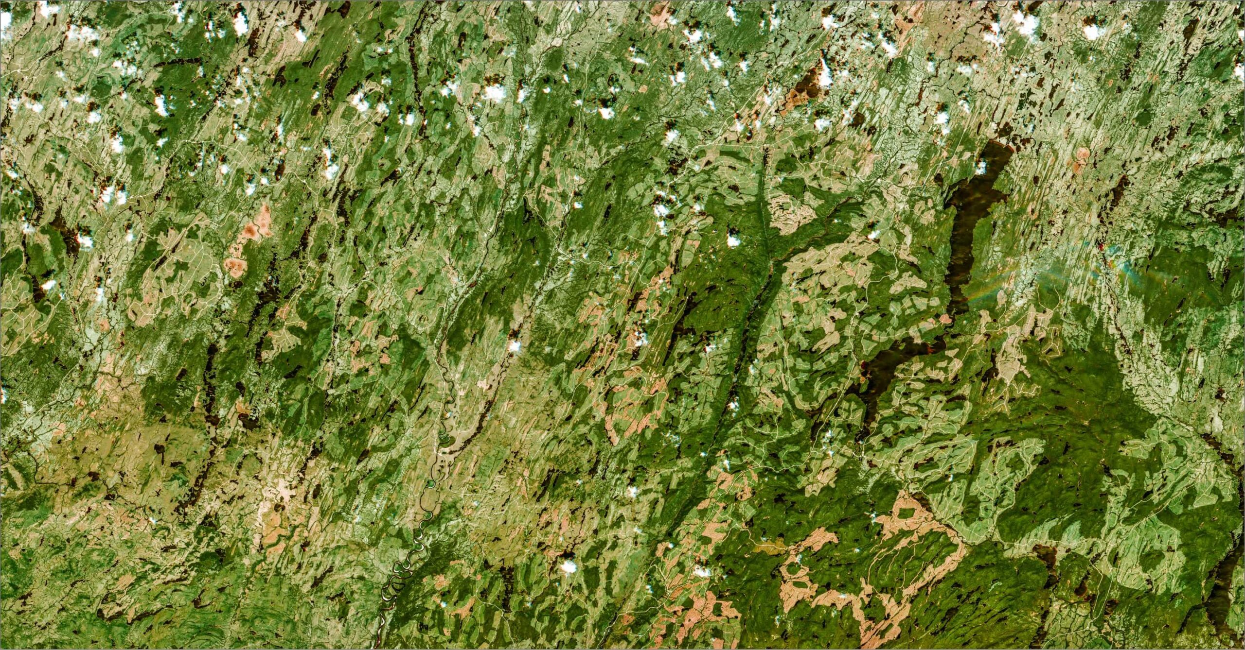
Natural resource management professionals are facing major challenges regarding forestry health monitoring, water optimization and wildfire impact assessment. Our highly advanced data tools enable financial and operational risk mitigation by detecting, confronting and preventing harmful changes anywhere on our planet at any given moment.


All these efforts, from modelling to prediction, advisory to mitigation, require timely, accurate measurements. Upon the launch of EarthDaily Constellation, we will be ready to take change detection to the next level with Earth Observation data that boasts the best quality, the broadest coverage, and the highest revisit frequency.
Experience the EarthDaily Constellation
What does the world’s most advanced change detection system look like?
The unprecedented insights unlocked by our constellation will enable our customers to make informed decisions with the magnitude of accuracy and efficiency unseen before.
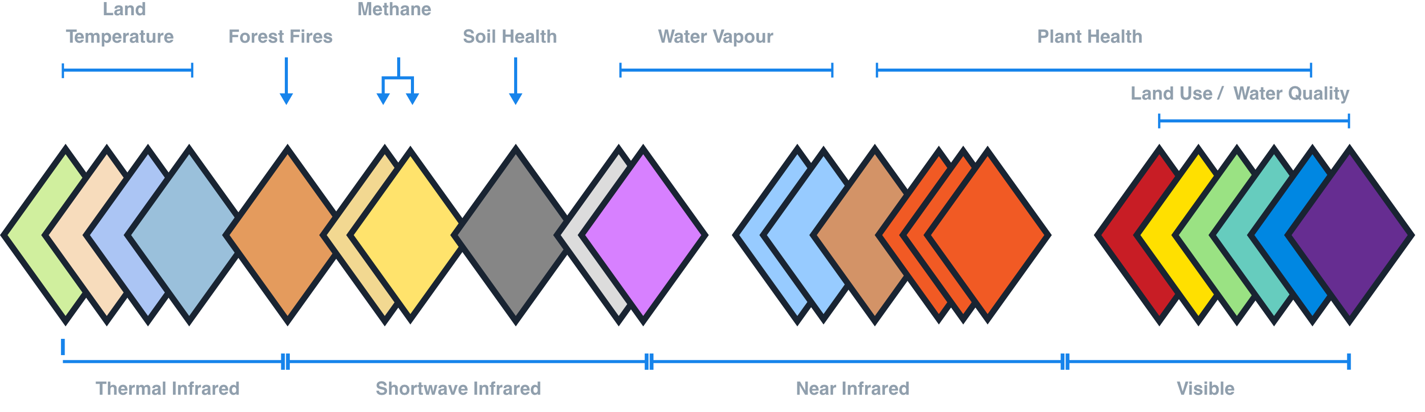
22 Spectral Bands
Tailored to give you the best Analysis Ready Data
EarthDaily’s unique data source allows us to solve the following challenges:
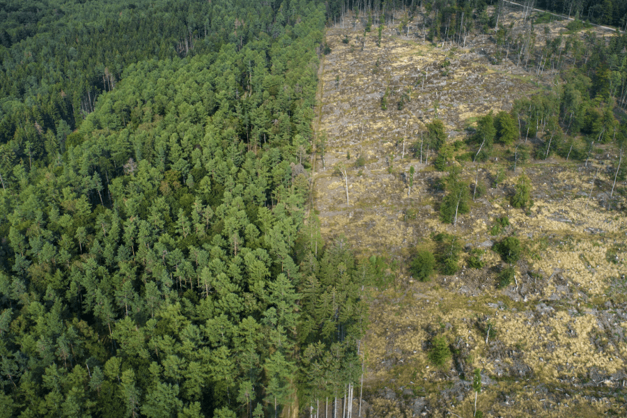
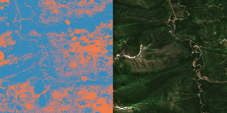
Forest Productivity and Resilience
Diversity, composition, structure and regeneration are all at-risk areas in forest management. It is in the interests of both the public and private sectors, ecologically and commercially, to be able to develop and deploy best practices. Analysis Ready Mosaics will also help identify patterns shaping the forests.
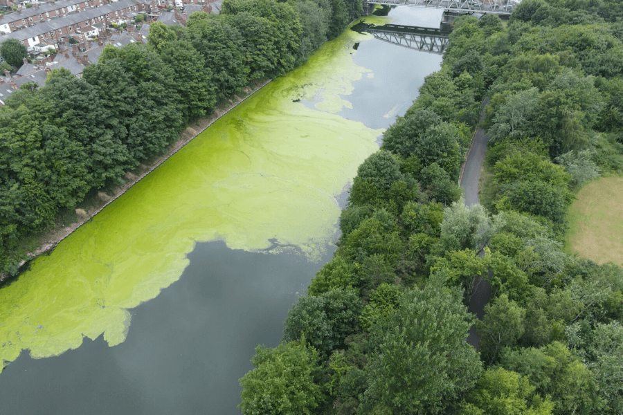
Water Security, Health and Optimization
The health of our lakes, reservoirs and associated watersheds embodies complex behaviours that combine weather patterns, water networks, topography, and land composition. Our satellite data will help gain understanding of the interconnection and build resilience against the effects of both floods and droughts.

Negative Emissions Technologies
Specific types of vegetation, e.g., cattails, have the ability to effectively remove contaminants like phosphorus which can mitigate pollution and runoff that leads to lake eutrophication. With timed harvesting, the acquired ecological biomasses can be converted into clean energy and inputs.
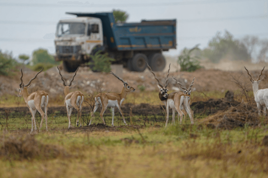
Biodiversity, Wildlife and Habitat Protection
As unprecedented biodiversity loss is worsening across the planet today, governments are creating policies and strategies to protect and restore diversity of life and natural habitats, from restoring wetlands to protecting habitats through frequent, broad-scale analysis.
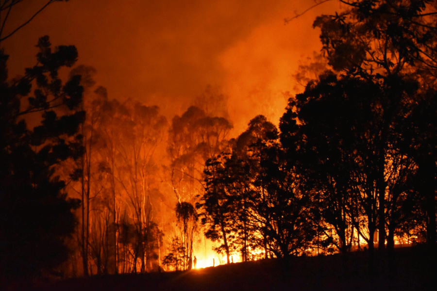
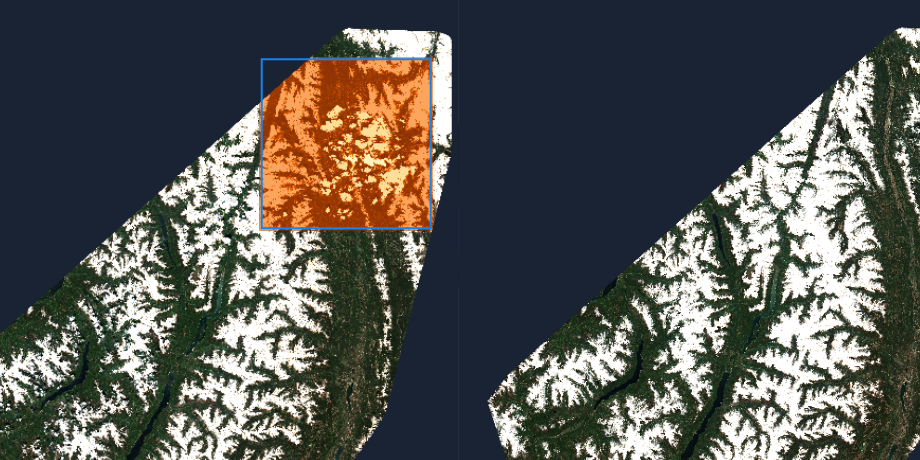
Wildfire Prediction and Analysis
Assessments such as air/land temperature, moisture content, and burn/ignition probability, available from our satellite imagery, will strengthen risk forecasts to protect public health and financial interests. Cloud-free data from our satellites will also help determine the precise extent of a wildfire.
Foundational Partner Program
EarthDaily is on a mission to bring the world’s most advanced change detection system to market, providing high accuracy broad coverage earth observation data that helps unlock valuable insights far beyond what is economically feasible or technically possible with currently available commercial EO offerings. We are building a global network of foundational partners that are committed to working with EarthDaily in pioneering our next-generation earth observation technology to build innovative and valuable solutions for their customers.
- Loss of tropical forests equivalent to more than 30 soccer fields worth of trees every minute.
- 7,667 fires recorded in California (2022), totaling approximately 363,939 acres across the State.
- Current extinction rates are 1,000 times higher than natural background rates of extinction, and future rates are likely to be 10,000 times higher.
Products & Services
EarthDaily is on a mission to empower the entire Space and Earth Observation industry with the most meaningful data and insights,
much needed for decision-making, quantifying, and managing risk across all sectors and industries.


Not all data is created equal. Don’t settle for anything less than what EarthDaily Analytics offers: accuracy, quality and coverage. Join us on the mission to solve the biggest challenges in Forestry and Natural Resource Management.
Making a difference starts here.