

EarthDaily Adds Wildfire Intelligence for Australian Insurer's Post-Catastrophe Response
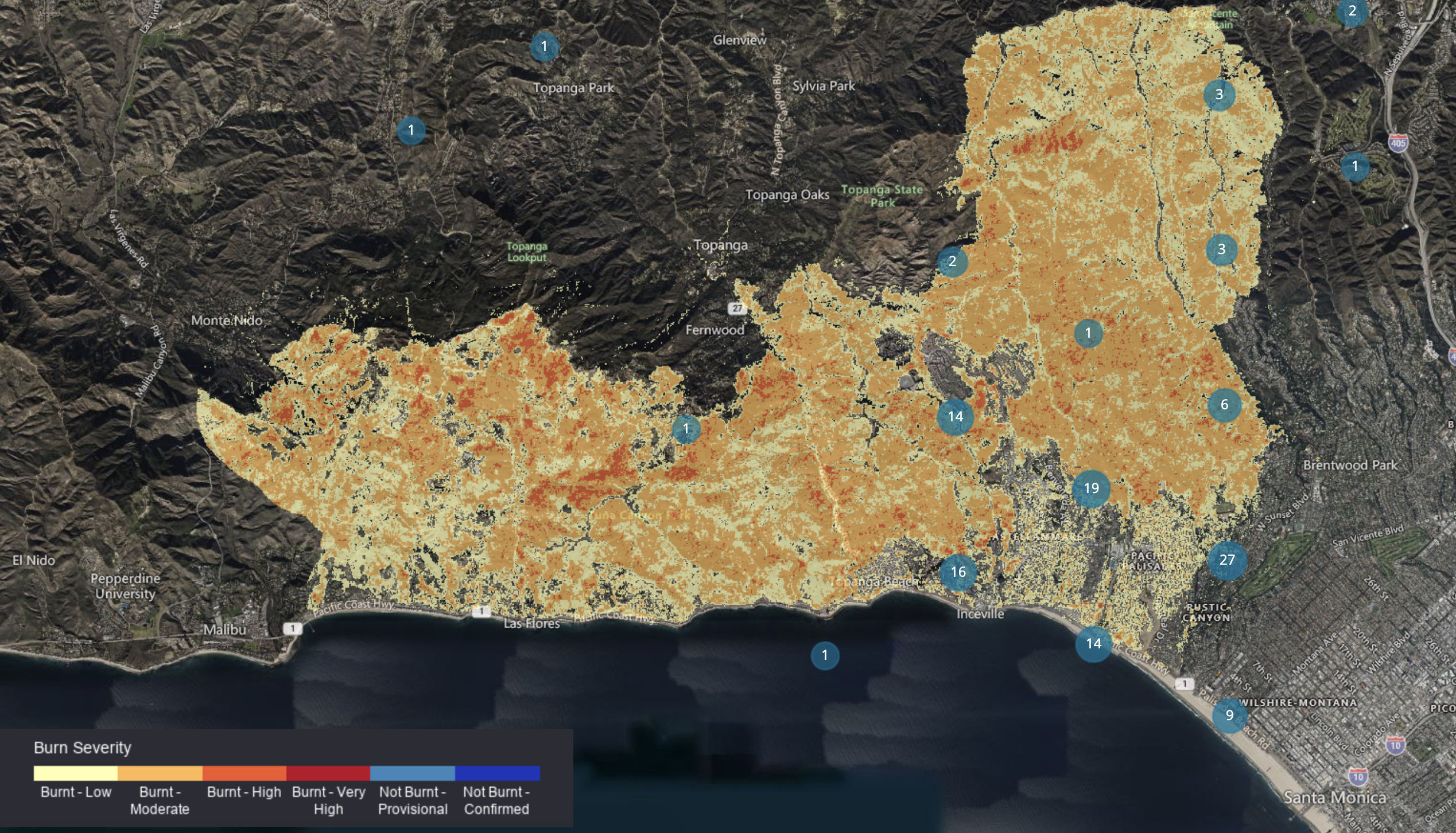
Burn Severity and Perimeter Data will be aligned to the insurer's portfolio following wildfire events to support post-catastrophe claims triage and resource deployment.
EarthDaily is introducing its Burn Severity and Perimeter Data to a major Australian insurer, marking the first EarthDaily-built data product added to the existing customer relationship.
Following a wildfire event, the Burn Severity and Perimeter data will be aligned to the insurer's portfolio and used for post-catastrophe event response, primarily claims triage and resource deployment. While EarthDaily’s wildfire and forestry products have gained traction in North America, this deployment marks an exciting geographic expansion as the first application in Australia.
"Last season's bushfires near Alexandra and Wabba in Victoria showed how long insurers can wait for a clear picture of damage, which is why one of our long-standing customers, a leading Australian insurer, chose to be the first to put our Burn Severity and Perimeter product to work," said Margaret Williams, Director of Product Management, EarthDaily. "In the early days of a fire, carriers often rely on rough perimeters and anecdotal reports, which slows claims, complicates reserving, and delays help for policyholders in immediate need. Giving insurers an early and evolving view of the event footprint lets them move faster and more confidently."
Supporting Post-Catastrophe Response
In the days after a wildfire, insurers face a familiar problem: they need to know which policies are affected and how badly, but ground access to burned areas is often limited or unsafe, and early information is incomplete. That uncertainty slows the first critical steps of the claims process.
Burn Severity and Perimeter Data provides two complementary views of an event: the geographic extent of the fire and the severity of burning within it. EarthDaily processes satellite imagery throughout an event using time-series analysis, so perimeter and severity maps can be produced while a fire is still active rather than weeks after containment.
Matched to an insurer's portfolio, these outputs give claims teams an early, objective basis for action. They can identify which insured properties fall inside or near the fire footprint, prioritise those in the most severely burned areas, direct assessors where they are needed most and contact affected policyholders sooner.
The insurer is applying Burn Severity and Perimeter Data across its wildfire claims response, analysing fire events to inform triage and the deployment of assessors and response resources. The deployment marks the first use of the product in Australia and lays the foundation for its wider rollout to the Australian insurance market.
About the Author
