.jpg?width=289&height=168&name=Data%20Use%20cases%20(1).jpg)
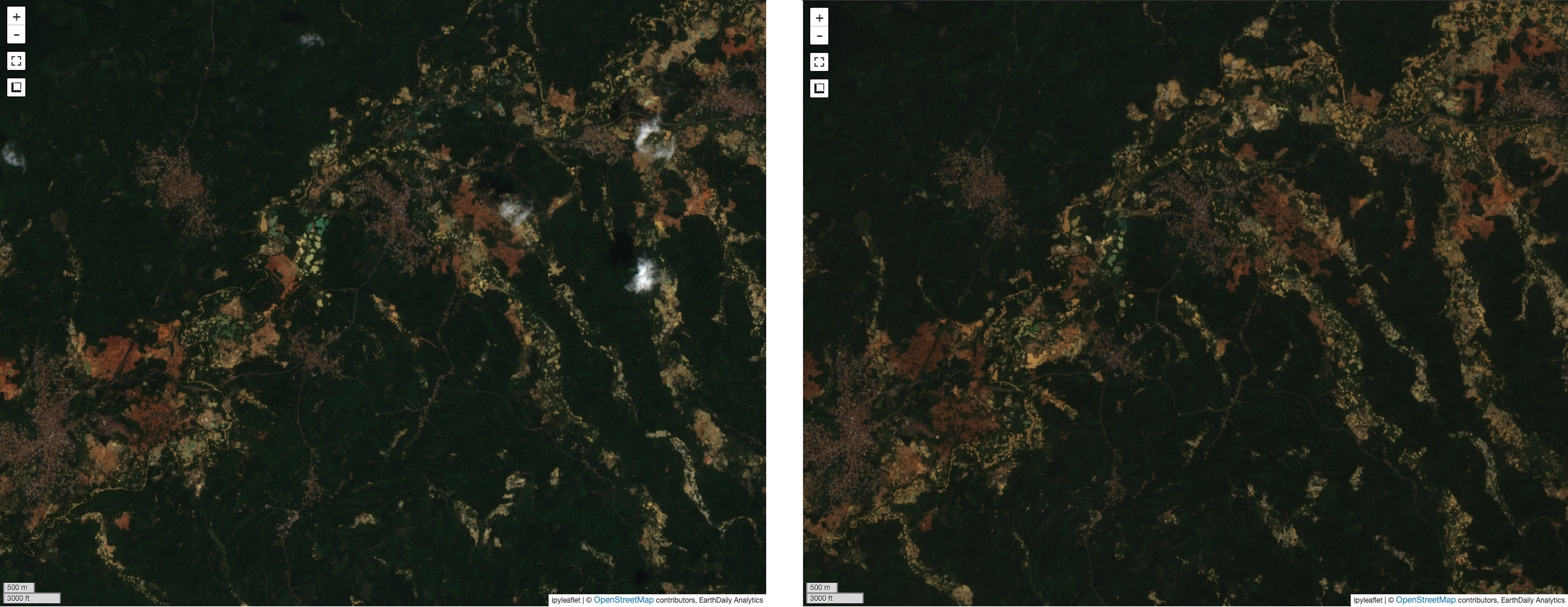
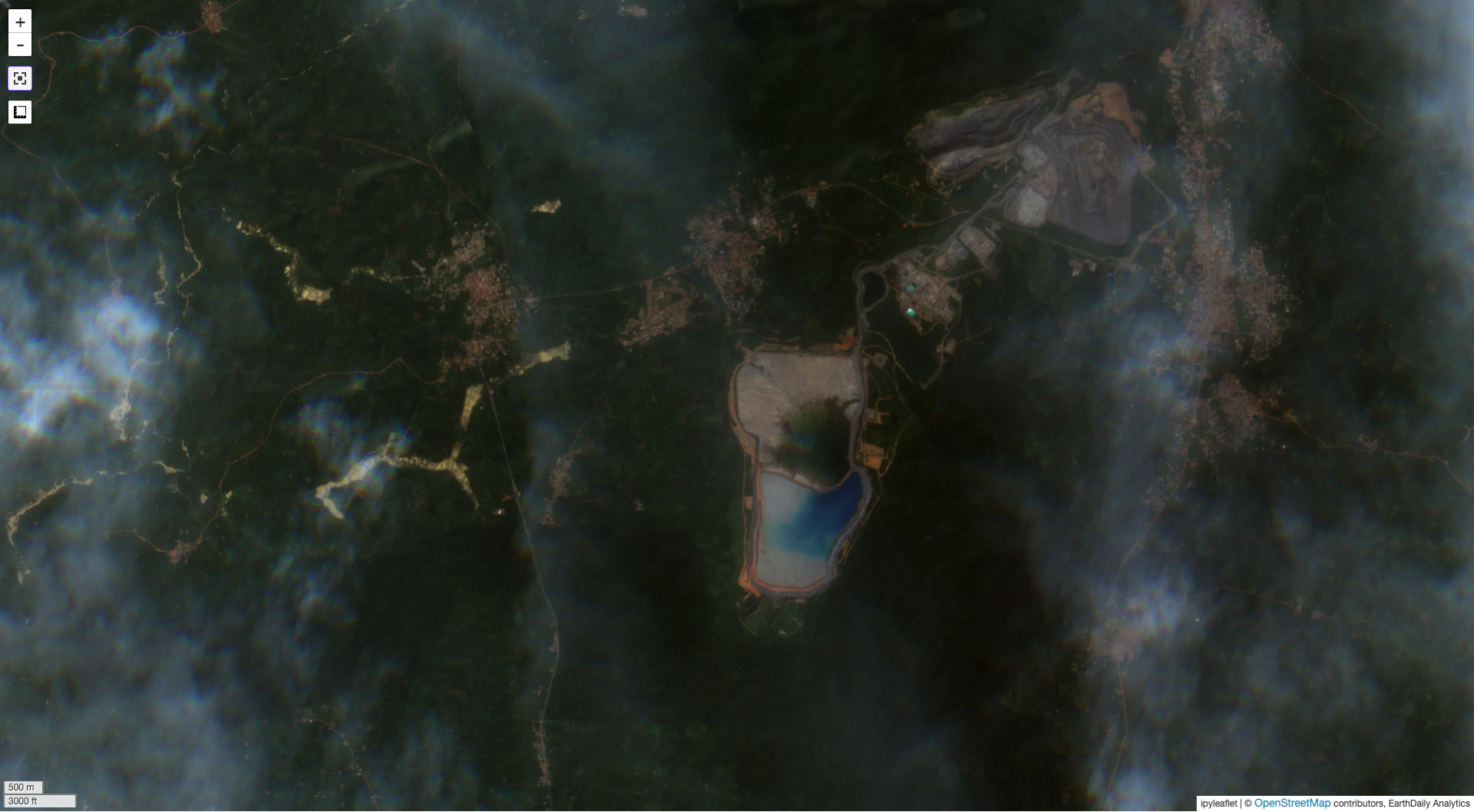
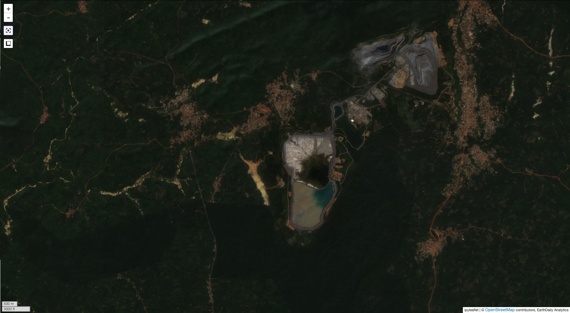
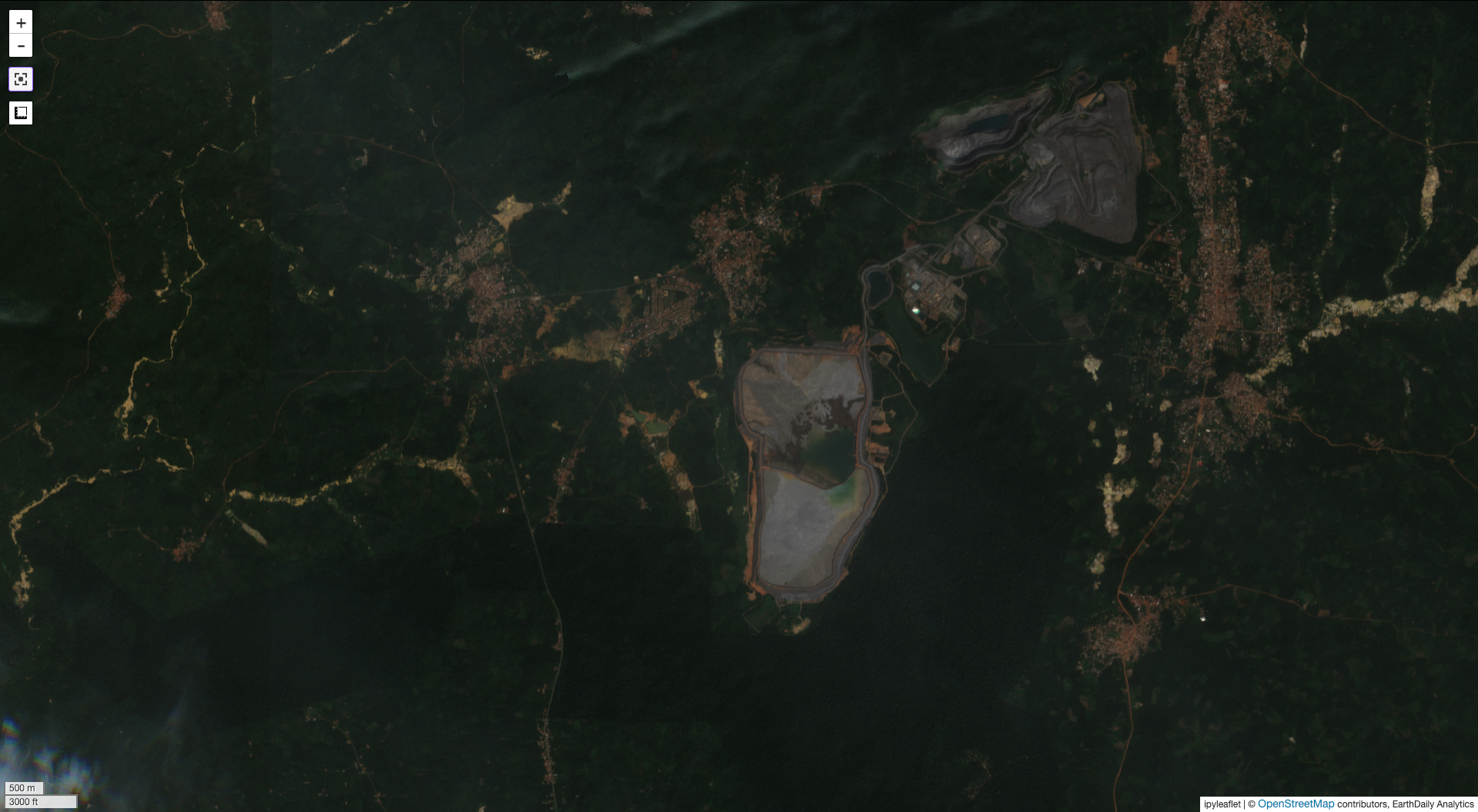
ASM activity visibility in Sentinel-2 imagery collected on November 11, 2024 (left) and December 16, 2025 (right). Source: EarthDaily analysis.
ASM is often understood after the fact, through scattered reports, site visits, and visible disturbance. Better monitoring helps build the missing record: what changed, where it changed, and whether the pattern is growing over time.
In the first section of this series, we established what ASM is, how it differs across formal, informal, and illegal contexts, and what different stakeholders need from ASM intelligence. The series now turns to the intelligence base itself: the monitoring required to support oversight, prioritization, engagement, and reform in ways that reflect the regulatory context in which activity is occurring.
Across formal, informal, and illegal ASM contexts, the common gap is that decisions are made with outdated, partial, or anecdotal information. Whether the objective is oversight, engagement, planning, or enforcement, decision-makers frequently lack consistent evidence on where activity is occurring and whether it is growing and intensifying over time.
Effective ASM monitoring therefore requires an ‘always on’ solution which triggers a shift from episodic observation to objective, continuous, and scalable visibility.
From Episodic Observation to Objective Visibility
The sheer scale of ASM makes it difficult to monitor through ground reporting alone. The World Bank estimates that ASM directly employs 45 million people across more than 80 countries. ASM monitoring capability will likely vary by country, reflecting different levels of data-capture maturity. National borders and jurisdictional boundaries can further reduce monitoring effectiveness by creating blind spots where ASM activity, environmental impacts, and mineral supply chains cross jurisdictions. These transboundary gaps can weaken decision-making by fragmenting enforcement, obscuring attribution of environmental impacts, and limiting accurate supply-chain accounting.
Establishing a full intelligence picture from pieces of disparate and multi-model data can significantly limit the ability to make data driven decisions. Spatially and temporally consistent monitoring data, when integrated with various types and sources of ASM related data decisions makers currently work with, can significantly enhance the ASM intelligence base. Key features of a spatially and temporally consistence monitoring system include:
Regional-Scale Coverage: Regional-scale coverage helps show how activity is distributed across large and diverse areas. For formal ASM, this can support oversight across multiple licensed sites. For informal ASM, it can help establish a more complete activity baseline to measure changes against. For illegal ASM, it can help identify where activity is expanding toward protected areas, licensed tenements, or critical infrastructure.
- Repeatable Time-Series Observation: ASM decisions depend on change. Repeatable time-series observation turns scattered signs of surface activity into a clearer record of ASM behavior, especially when ASM changes quickly or unevenly. One area may intensify while another slows and activity may pause during one season and restart in another.
- All-Weather Capability: Many ASM areas are hard to monitor regularly. Inclement weather, terrain, distance and safety can all be limiting factors. Monitoring needs to keep working across seasons and conditions, so decision-makers do not miss the moment when ASM activity starts to grow, shift, or move into a higher-risk area.
- Quantifiable and Auditable Change Metrics: Governments, operators, investors, and communities need evidence they can check against earlier activity and use with confidence. This also connects to broader responsible sourcing and due diligence expectations, including OECD guidance for mineral supply chains in conflict-affected and high-risk areas. That evidence may be used in different ways. A regulator may use it to plan and justify inspections and to demonstrate the effectiveness of ASM policy reforms. A mining operator may use it to better understand health, safety and environment related risk of an exploration concession where ASM is encroaching. An investor may use it to see whether exposure is being monitored properly. A community may use it to understand what is changing nearby.
- Separating Signal from Noise: Although this blog series is focused on ASM, it is important to note that not every surface disturbance is ASM activity. Monitoring has to separate persistent activity from temporary disturbance or disturbance occurring within non-ASM contexts, such as agriculture or infrastructure development. It needs to distinguish signals that matter from changes that may reflect seasonal effects, unrelated land use, short-term access, or noise in the data.
This is where repeatability and consistency are essential. A single datapoint can raise a question whereas continued observation helps determine whether that question points to an emerging pattern, a stable condition, or a false positive. For ASM monitoring, the objective is not only to detect surface activity, but to work with decision-makers to interpret the surface activity within the context of ASM.
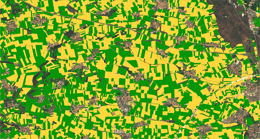
 Tanda, Côte d’Ivoire. Deforestation signals from mixed agriculture and ASM land use. Source: EarthDaily analysis
Context that Supports Interpretation
Detecting change is the first step, but it is context that helps decision-makers understand what that change might mean. For example, the expansion of a large-scale open-pit mine inside an approved mining licence, and close to established processing infrastructure, may indicate formal and authorised activity. A cluster of small pits within a designated ASM area may similarly suggest formalised artisanal and small-scale mining. But similar pits inside a protected area, near a concession boundary, or along a river corridor may point to informal, unauthorised, or potentially illegal activity. Context does not prove legality on its own, but it helps turn raw detection into useful intelligence for prioritising follow-up, enforcement, or further investigation.
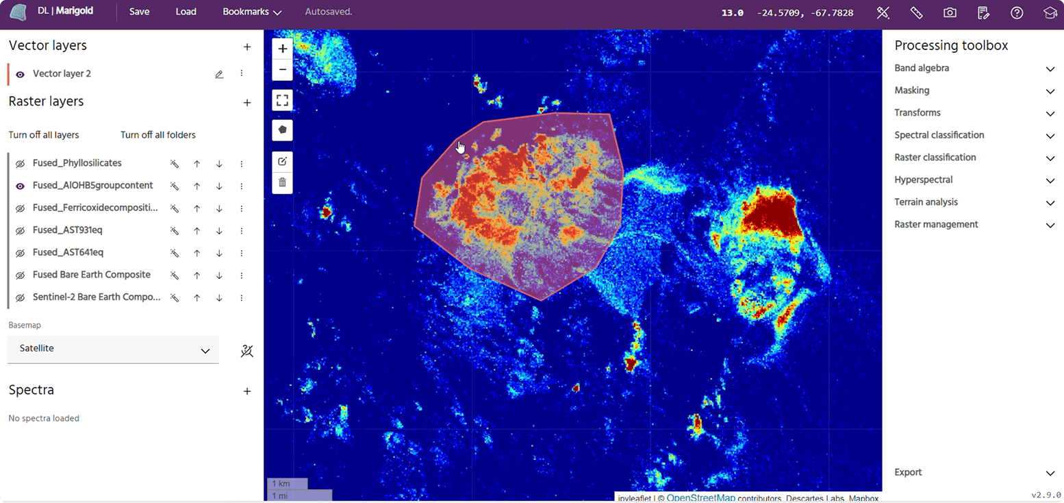
The progression of ASM activity to the west and east of the Akyen Gold Mine located within the Birim North District of Ghana's Eastern Region between December 2023 and December 2025. ASM activity encroaches up to the Akyen Gold Mine’s south eastern boundary. Source: EarthDaily analysis
In the next article we will looks at the role of earth observation and analytics in a comprehensive ASM monitoring system.
About the Author