.jpg?width=289&height=168&name=Data%20Use%20cases%20(1).jpg)
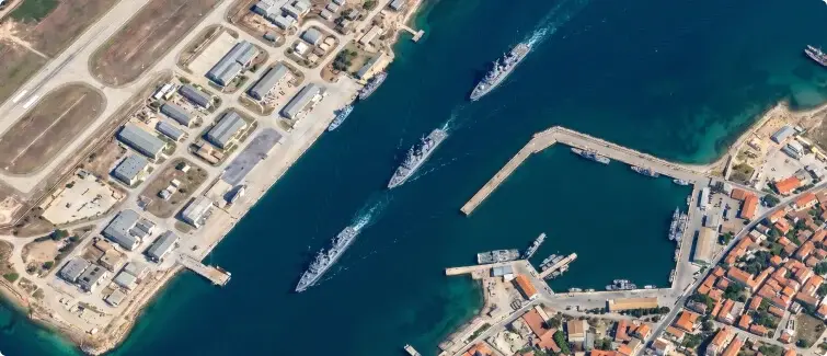
Daily, consistent Earth observation helps agencies detect vessel activity, follow changes at ports and coastlines, and direct surveillance assets where closer attention is needed.
In August, two subsea communications cables off the coast of Perth developed faults in close succession inside a protected cable zone. Australian authorities are assessing the incident, and no cause has been established. But it has renewed attention on a persistent maritime security challenge: maintaining a reliable record of activity across vast and difficult-to-observe waters.
Vessel tracking forms part of that record, but AIS only shows what vessels transmit. Signals disappear for many reasons, including equipment problems, operating conditions and legitimate security concerns. They can also be deliberately disabled or manipulated. Once a vessel stops reporting its position, an important part of the operating picture disappears with it.
AIS, coastal radar, patrol vessels, aircraft and satellite systems each provide part of that picture. The challenge is maintaining visibility across an environment too large and dynamic to monitor only after a vessel or location has attracted attention.
The Limits of Selective Surveillance
Maritime surveillance has traditionally depended on deciding where to look. A patrol aircraft follows a designated flight path. A ship-based sensor sees its immediate surroundings. Coastal radar provides frequent observations within its geographic range. High-resolution satellites can examine a specific vessel, facility or location when tasked to do so.
These systems are highly effective when an agency already knows which vessel or area requires attention. The more difficult challenge is identifying significant activity beyond the locations already being watched.
AIS provides a broad and valuable record of commercial vessel movement, but it is a cooperative system. Not every vessel is required to carry a transponder, transmissions can be interrupted, and AIS information can be deliberately disabled or manipulated. Even a legitimate transmission gap can leave analysts without the information needed to distinguish routine movement from activity that warrants closer investigation.
An unusual anchorage, an unexpected concentration of vessels or a shift in activity around a port may become meaningful only when compared with what normally happens in that location. An isolated image can show what was present at one moment. It cannot, by itself, explain whether that observation represents a significant departure from previous activity.
Maritime domain awareness therefore depends on more than detecting known targets. It requires enough persistent visibility to recognize where the next target may emerge.
Building the Missing Context
Earth observation provides a persistent layer between broad tracking systems and highly targeted surveillance assets. By maintaining visibility across large maritime regions, it can identify potential changes and direct specialized assets toward locations requiring further assessment.
Doing that reliably requires more than frequent imagery. Automated systems must be able to compare observations collected on different days without mistaking changes in acquisition conditions for changes on the water.
.webp?width=841&height=376&name=Defence-Maritime-Awareness-fisheries%20(1).webp)
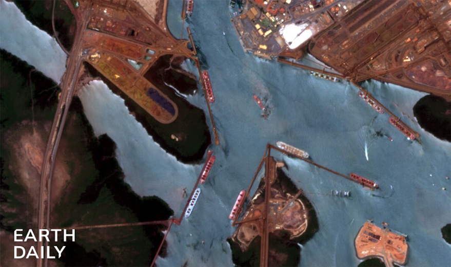
EarthDaily's maritime capability combines daily 5-meter coverage with consistent viewing geometry and calibrated spectral data. Precise orbit control maintains a consistent overpass time and viewing geometry, creating a more stable baseline for automated analysis. When the observations remain comparable, analytics can more reliably separate potential vessels, infrastructure developments and environmental events from sensor-related variation.
This supports several maritime missions:
- Vessel detection and classification: Satellite observations can reveal vessels across open ocean and coastal waters without depending exclusively on cooperative transmissions. Wake patterns, displacement and other visual characteristics can support assessment of vessel type and size.
- Port and infrastructure monitoring: New construction, expanded facilities and modifications to ports or naval installations become visible through comparison with an established baseline.
- Environmental monitoring: Oil spills, sediment plumes, algal blooms and other forms of pollution leave different spectral signatures. Following those signatures across repeat observations can help response teams assess the affected area and how it is moving.
- Coastal change analysis: Erosion, land reclamation and shoreline modification often develop gradually. A consistent record makes those changes easier to track and assess over time.
Weather, cloud cover and local conditions will continue to affect what any individual optical observation can reveal. That is why persistent optical monitoring is most valuable as part of a layered system that also incorporates AIS, radar and other intelligence sources.
From Detection to Direction
The shift from selective to persistent monitoring changes the role of satellite data. Under a tasking-led model, an agency identifies a concern and then collects information about it. Persistent monitoring reverses that sequence. Broad-area observation establishes what is happening across the operating environment, while automated analysis identifies changes that may justify closer attention.
This is particularly valuable across large exclusive economic zones, strategic waterways and remote coastal regions where maintaining a continuous physical presence is neither practical nor affordable.
A potential dark vessel can be compared with available AIS records. An unexpected change at a port can trigger further analysis or higher-resolution collection. A suspected oil slick can be assessed against subsequent observations to understand its direction of travel and proximity to vulnerable coastline.
The first observation does not need to provide every answer. Its operational value may lie in revealing that there is a question to investigate and directing limited surveillance capacity toward it.
Data for Different Missions
.webp?width=1252&height=410&name=Defence-Maritime-Awareness-choke-point%20(1).webp)
Different missions require different levels of processing, spectral depth and control. EarthDaily provides three data configurations built on the same constellation and geometric foundation:
- AiRD provides AI-ready data engineered for automated analytics and change detection. Consistent acquisition conditions help models distinguish meaningful change from sensor artifacts.
- Maritime offers a streamlined four-band, 8-bit configuration designed for rapid processing across very large areas, including vessel detection and behavioral analysis at scale.
- Science provides ten-band top-of-atmosphere data with Level 1 calibration, including a coastal band for atmospheric characterization. It is designed for teams operating proprietary processing pipelines that require greater spectral information and control.
The choice depends on the mission. Some organizations need data ready for automated analysis across millions of square kilometers. Others need greater control over how measurements are processed and interpreted. Both depend on observations that remain consistent enough to support reliable comparison over time.
Maritime agencies will always need to prioritize their surveillance assets. Persistent, wide-area observation provides the context to make those decisions earlier and direct limited capacity toward the activity most likely to require investigation.
It cannot eliminate every maritime blind spot, but it can make those gaps smaller, shorter and easier to investigate.
Find out which EarthDaily data product fits your maritime mission.
About the Author