.jpg?width=289&height=168&name=Data%20Use%20cases%20(1).jpg)
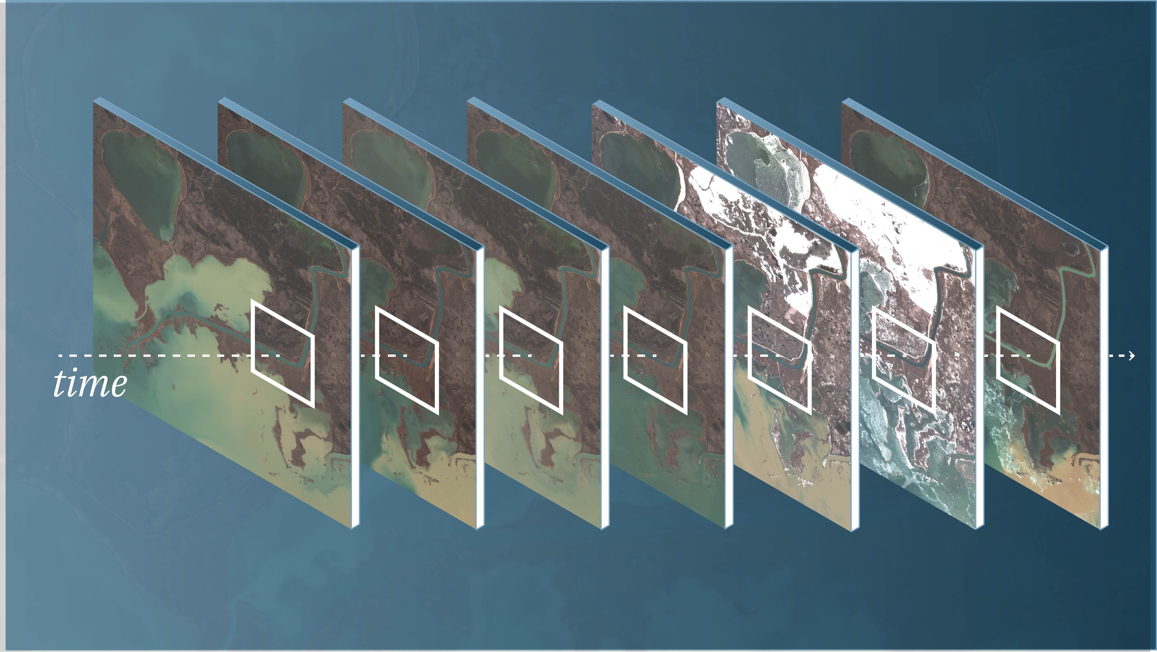
Science-grade Earth observation data provides the foundation for trusted measurement over time, enabling users to compare change across dates, regions, and systems with known accuracy, uncertainty, and consistency.
In the Earth observation industry, the term “science-grade” is often used as a synonym for “high quality.” In reality, it is a specific technical status. While most satellite imagery is processed for visual interpretation, making it clear and easy for the human eye to read, those products are not always designed for precise measurement.
As the volume of imagery has increased, the need for consistent, analysis-ready data has become more apparent. For scientists, policymakers, and researchers, the data has to hold up over time. It must be stable, comparable, and physically meaningful.
This is commonly referred to as science-grade Earth observation data.
What Does ‘Science-grade’ Actually Mean?
There is no single, dictionary-style definition used by agencies like NASA. Instead, the concept is defined through standards.
NASA organizes its Earth observation data through processing levels, calibration practices, and validation frameworks. Data suitable for scientific use is typically:
- Calibrated into physical units
- Geolocated with high precision
- Validated against independent measurements
- Accompanied by known uncertainty
In practice, “science-grade” refers to data that meets these conditions and can be used for quantitative analysis and long-term monitoring.
At its core: Science-grade EO data is data that can be used to measure change over time with known accuracy and uncertainty.

How NASA Defines Usable Earth Science Data
Rather than using marketing terms, NASA classifies data based on how it is processed.
- Level 0 – Raw instrument data
- Level 1 – Calibrated and geolocated measurements
- Level 2 – Derived geophysical variables (e.g., reflectance, temperature)
- Level 3/4 – Gridded or modeled datasets
By the time data reaches Level 1 and above, pixel values represent measurable properties of the Earth, not just raw sensor output.
While Level 1 provides calibrated measurements, Level 2 products derive geophysical variables such as surface reflectance and are widely used for analysis. This is typically the threshold where data becomes suitable for quantitative scientific use.
NASA defines its Standard Data Products as internally consistent, well-calibrated records of Earth’s geophysical properties, suitable for scientific research and applications. The requirement is consistency over time. Measurements have to align across datasets.
The Three Pillars of Science-Grade Data
Across NASA and broader Earth science practices, science-grade data is generally understood to rest on three core foundations
- Calibration: from signal to measurement: Satellite sensors record raw digital signals. Calibration converts these signals into physical quantities such as radiance or surface reflectance. Over time, instruments degrade due to radiation and thermal stress. Calibration models correct for these effects and maintain measurement stability.
These calibrations are traceable to physical reference standards, keeping measurements comparable across instruments and over time.
Why it matters: A measurement taken today has to align with one taken years earlier. Without calibration, apparent change can reflect sensor drift rather than real-world conditions. - Validation: proving the data is correct: Validation connects the measurement to independent observations. NASA missions use continuous Calibration and Validation (Cal/Val), comparing satellite data with ground stations, ocean buoys, and airborne campaigns.
Uncertainty is measured and documented, not assumed away.
Why it matters: Users know how much to trust a measurement and where its limits are. - Metadata and context: capturing the full observation: Every satellite measurement is influenced by external conditions such as viewing geometry, atmospheric state, and solar angle. Science-grade datasets record these factors as metadata so they can be corrected consistently.
This allows those effects to be corrected rather than carried into the measurement.
Why it matters: Without this context, observations taken at different times or locations are not directly comparable.
NASA and the USGS maintain the integrity of the Landsat archive through the EROS Calibration/Validation Center of Excellence (ECCOE). This team is responsible for the continuous radiometric and geometric adjustments that ensure the 'gold standard' of data quality is upheld across decades of observations.

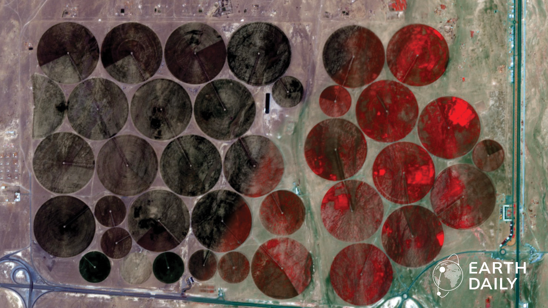
Why Consistency Matters More than Resolution
A single high-resolution image can show detail. It cannot reliably show change. Science-grade data is designed for time-series analysis. It must remain stable across:
- Days, seasons, and years
- Different geographic regions
- Multiple satellites and sensors
If measurements vary due to external conditions rather than real-world change, analysis breaks down. Missions like Landsat and Sentinel-2 maintain measurement consistency over time. Cross-calibration allows data from different satellites to be combined into a continuous record, supporting long-term environmental and climate analysis.
Analysis Ready Data and Operational Use
Many of the principles that define science-grade data have been formalized by the Committee on Earth Observation Satellites through the concept of Analysis Ready Data (ARD).
ARD ensures that Earth observation data is radiometrically consistent, geometrically aligned, and preprocessed for time-series analysis. In practical terms, it reduces the amount of correction and preparation required before data can be used.
These same characteristics underpin what is commonly referred to as science-grade data. Across NASA and CEOS frameworks, such data consistently includes:
- Physical meaning: Pixel values correspond to real-world quantities (e.g., reflectance, temperature)
- Radiometric accuracy and stability: Measurements remain consistent over time
- Geometric precision: Accurate geolocation enables pixel-level comparison
- Calibration and validation (Cal/Val): Measurements are tested against known references
- Quantified uncertainty: Error margins are documented and understood
- Cross-time and cross-sensor consistency: Data can be compared reliably across dates and platforms
This is what keeps measurements consistent and comparable over time.
From Observation to Measurement
Science-grade data is the difference between a snapshot and a measurement. A single image can show what the Earth looks like at a moment in time. But understanding how systems evolve – whether glaciers, forests, or agricultural landscapes—requires consistency over time.
The Earth observation industry is producing more data than ever before. But more data does not automatically lead to better understanding.
What matters is whether that data can be trusted – across time, across systems, and across decisions.
Science-grade Earth observation data provides that foundation. It allows us to move from observing the planet to measuring how it is changing, with the confidence to act on those measurements.
About the Author