.jpg?width=289&height=168&name=Data%20Use%20cases%20(1).jpg)
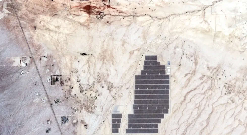
Solar power infrastructure in Imperial Valley, California, captured by the EarthDaily Constellation in June 2026
As Earth observation moves from specialist analysis toward the enterprise infrastructure stack, it must behave more like the internet: a service businesses simply expect to work. That requires measurements from orbit to be reliable, repeatable and ready for everyday decisions.
Space-derived capabilities are moving from specialized services into the basic infrastructure of business. That is one of the central implications of a new Goldman Sachs Global Institute report, which compares the emerging space stack to the internet and predicts that the distinction between orbital and terrestrial infrastructure will continue to dissolve.
The comparison sets a high bar for the space sector. Internet infrastructure became foundational because providers absorbed its technical complexity and made connectivity straightforward for businesses to adopt. Earth observation providers face the same task: managing calibration, processing, quality control and delivery before the information reaches the customer’s workflow.
The scale of the gap is visible in a 2026 World Economic Forum and Deloitte analysis. It estimates that Earth observation already contributes $440 billion to global GDP, while a further $263 billion in annual value remains unrealized. The analysis attributes $84 billion of that opportunity to data acquisition, $117 billion to processing and $62 billion to deployment.
These figures measure economic value created across industries, rather than projected revenue for Earth observation companies. Processing represents the largest share of the unrealized opportunity, placing the industry’s central challenge in the middle of the value chain: turning raw observations into trusted products that can be used consistently and at scale.
The Largest Gap Sits Between Collection and Use
Earth observation capabilities have expanded rapidly. More satellites, sensor types and commercial data sources are making it possible to observe larger areas more frequently and in greater detail.
The value of those observations depends on what happens after collection. Raw data must be calibrated, processed, interpreted and delivered in a form that answers an operational question. An organization monitoring crop conditions across a growing region or physical risk across an insurance portfolio needs a coherent measurement record that can support repeated comparison.
Acquisition, processing and deployment are closely linked. A gap in coverage limits what can be analyzed. Inconsistent processing weakens comparison across time. An output that cannot enter an existing system may never reach the person responsible for acting on it.
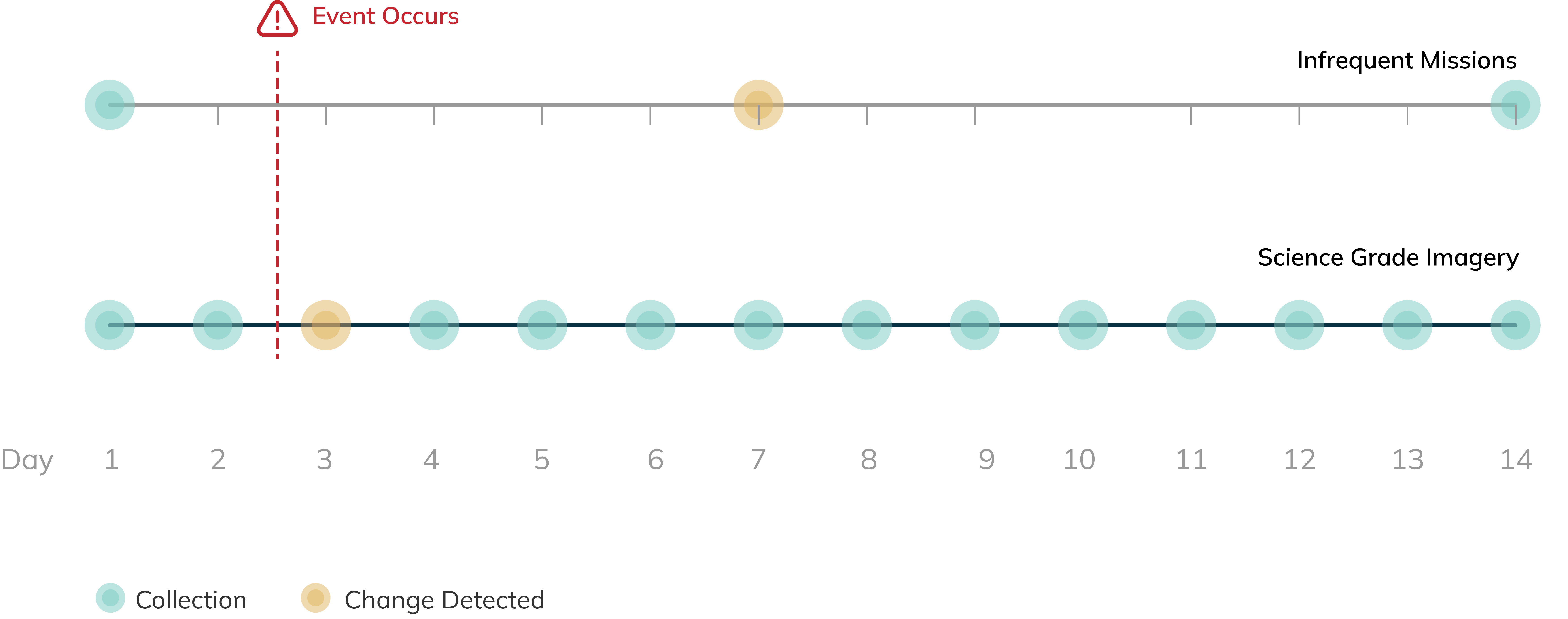
Timeline comparing change detection from infrequent missions with daily science-grade imagery over 14 days
The $117 billion processing opportunity identified by the World Economic Forum and Deloitte captures the scale of this middle layer. Processing is where observations become products that can be trusted and used repeatedly. It is also where differences in calibration, alignment, temporal consistency and quality control determine whether the resulting information is ready for operational use.
Earth Observation Has to Behave Like Infrastructure
Infrastructure carries an expectation of dependable performance. Organizations build operations around services they expect to be available, stable and capable of working at the full scale of the problem.
For Earth observation, broad and repeated coverage establishes the record needed to identify where conditions are changing. Consistency allows that change to be interpreted with confidence. Measurements collected by different satellites, instruments or spectral bands must remain calibrated, geometrically aligned and comparable over time.
The same standard applies to automated analytics and AI models. These systems process the variation present in their inputs, including variation introduced by atmospheric conditions, viewing geometry, sensor behavior or processing choices. A consistent data foundation helps separate real change on Earth from differences created within the observation system.
Infrastructure-grade EO also requires predictable delivery, documented quality controls and traceable provenance. Users need to know how a measurement was produced, which source data contributed to it and whether an update to the processing chain could affect the result.
Together, these qualities allow organizations to compare conditions across seasons, regions and assets without reconstructing the analysis around every new collection. They turn Earth observation from an occasional technical exercise into a continuing operational capability.
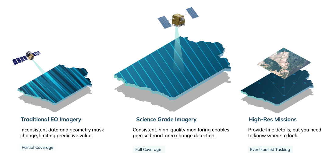
Comparison of traditional EO imagery, science-grade imagery and targeted high-resolution missions
Infrastructure Reaches Users Through Their Workflows
Most organizations using Earth observation are not space companies. They are agricultural businesses, insurers, utilities, mining operators, transportation networks and government agencies. Their interest begins with the decision the data can support.
The result may reach them as a crop-condition indicator, an updated risk assessment, a change alert or an input to a forecasting model. The satellite system remains fundamental, but the user interacts with information delivered through an existing platform or operational workflow.
This is where deployment becomes critical. Earth observation products must connect with enterprise software, analytical environments and sector-specific decision systems. As industrial workflows increasingly rely on AI and automation, AI-ready data becomes a basic requirement: machine-readable, interoperable and consistent enough to support models and downstream processes at operational scale. It must also arrive within the timelines governing field operations, underwriting, asset management, emergency response and strategic planning.
When those connections are in place, organizations can progress from isolated projects covering selected locations to repeatable monitoring across their full areas of responsibility. Remote-sensing expertise remains essential within the system, while users receive information in a form suited to the decisions they already make.
Economic Value Is Created on Earth
The projected $703 billion opportunity is ultimately a measure of what terrestrial industries can do with Earth observation. The value appears when better information improves productivity, reduces losses or changes how resources are allocated.
In agriculture, that may mean identifying developing crop stress across an entire production region. In insurance, it may mean understanding how physical exposure is changing across a portfolio. For infrastructure operators and governments, it may mean detecting consequential change early enough to investigate, prioritize and respond.
Each application depends on a chain extending from the sensor to the decision. Collection establishes what can be observed. Processing determines whether the measurement can be trusted. Deployment places it where action can follow.
As that chain becomes more reliable, Earth observation becomes part of the operational foundation on which industries work. For most organizations, the second space age will take the form of dependable measurements inside ordinary decisions. That is how space infrastructure becomes Earth infrastructure and how the remaining economic opportunity moves into everyday use.
The EarthDaily Constellation is designed around this infrastructure model. Daily 5-meter observations, consistent viewing conditions, calibrated measurements and analysis-ready processing are built into the system to create a dependable record across locations and over time. That foundation enables Earth observation to connect more readily with the operational workflows where decisions are already being made.
About the Author